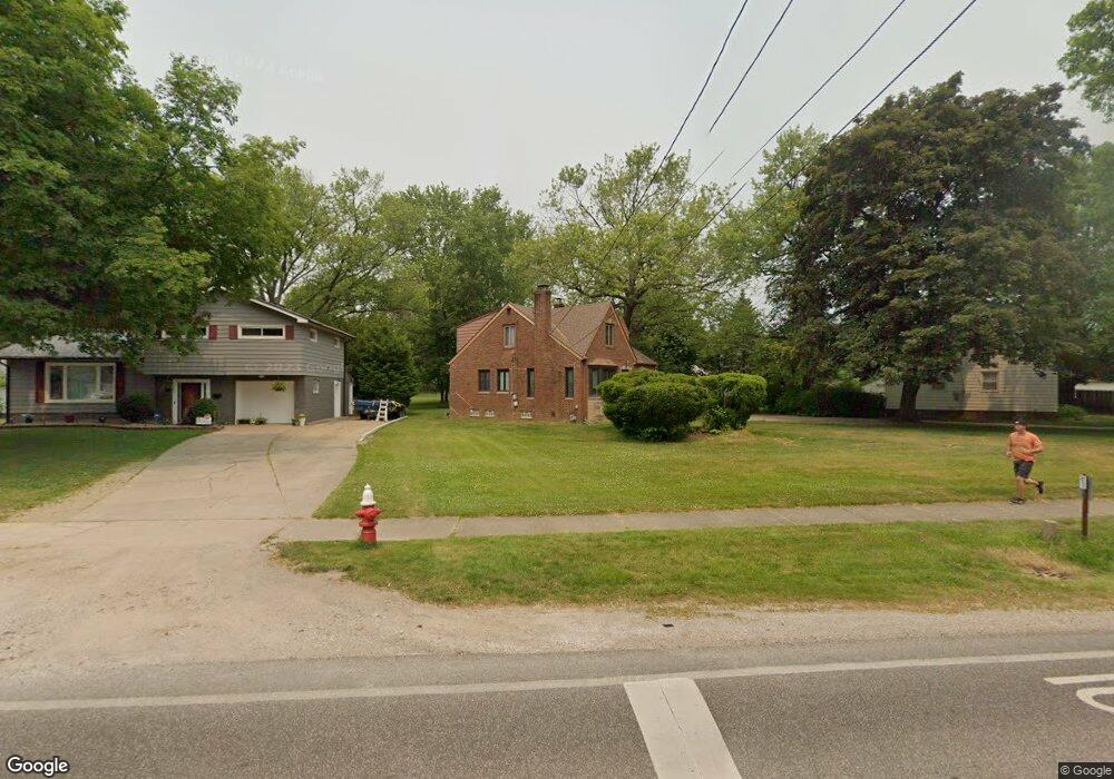
21440 Mastick Rd Cleveland, OH 44126
Estimated Value: $237,000 - $323,000
3
Beds
2
Baths
946
Sq Ft
$291/Sq Ft
Est. Value
About This Home
This home is located at 21440 Mastick Rd, Cleveland, OH 44126 and is currently estimated at $274,922, approximately $290 per square foot. 21440 Mastick Rd is a home located in Cuyahoga County with nearby schools including Gilles-Sweet Elementary School, Lewis F Mayer Middle School, and Fairview High School.
Ownership History
Date
Name
Owned For
Owner Type
Purchase Details
Closed on
Oct 24, 2001
Sold by
Gobel Eldon L
Bought by
Gobel Eldon L and Gobel Kathleen E
Current Estimated Value
Purchase Details
Closed on
Sep 9, 1988
Sold by
Phillips Herman
Bought by
Gobel Eldon L
Purchase Details
Closed on
Sep 30, 1987
Sold by
Frank Gorman
Bought by
Phillips Herman
Purchase Details
Closed on
Aug 4, 1981
Sold by
Gorman Frank
Bought by
Frank Gorman
Purchase Details
Closed on
Feb 25, 1977
Sold by
Young Florence
Bought by
Gorman Frank
Purchase Details
Closed on
Jan 1, 1975
Bought by
Young Florence
Create a Home Valuation Report for This Property
The Home Valuation Report is an in-depth analysis detailing your home's value as well as a comparison with similar homes in the area
Home Values in the Area
Average Home Value in this Area
Purchase History
| Date | Buyer | Sale Price | Title Company |
|---|---|---|---|
| Gobel Eldon L | -- | -- | |
| Gobel Eldon L | $79,000 | -- | |
| Phillips Herman | -- | -- | |
| Frank Gorman | -- | -- | |
| Gorman Frank | -- | -- | |
| Young Florence | -- | -- |
Source: Public Records
Tax History Compared to Growth
Tax History
| Year | Tax Paid | Tax Assessment Tax Assessment Total Assessment is a certain percentage of the fair market value that is determined by local assessors to be the total taxable value of land and additions on the property. | Land | Improvement |
|---|---|---|---|---|
| 2024 | $6,133 | $89,250 | $19,285 | $69,965 |
| 2023 | $5,376 | $66,820 | $12,950 | $53,870 |
| 2022 | $5,242 | $66,820 | $12,950 | $53,870 |
| 2021 | $5,354 | $66,820 | $12,950 | $53,870 |
| 2020 | $4,923 | $53,870 | $10,430 | $43,440 |
| 2019 | $4,377 | $153,900 | $29,800 | $124,100 |
| 2018 | $4,053 | $53,870 | $10,430 | $43,440 |
| 2017 | $3,904 | $44,280 | $10,540 | $33,740 |
| 2016 | $3,878 | $44,280 | $10,540 | $33,740 |
| 2015 | $3,733 | $44,280 | $10,540 | $33,740 |
| 2014 | $3,733 | $42,980 | $10,220 | $32,760 |
Source: Public Records
Map
Nearby Homes
- 5951 Rockport Ln
- 20930 Mastick Rd
- 22247 Mastick Rd
- 22534 Bard Ave
- 22503 Sandy Ln
- 22506 Sharon Ln
- 22537 Lenox Dr
- 22045 Morton Ave
- 4627 W 223rd St
- 4464 W 224th St
- 22934 Mastick Rd Unit 102
- 21437 Hillsdale Ave
- 4710 Grayton Rd
- 21763 Hillsdale Ave
- 4720 Grayton Rd
- 4514 Orchard Rd
- 22895 Mastick Rd
- 4309 W 222nd St
- 4401 Fairview Park
- 22968 Maple Ridge Rd Unit 103
- 21460 Mastick Rd
- 21400 Mastick Rd
- 21455 Kings Hwy
- 21380 Mastick Rd
- 21516 Mastick Rd
- 21461 Mastick Rd
- 21477 Mastick Rd
- 21445 Kings Hwy
- 21445 Mastick Rd
- 21435 Kings Hwy
- 21429 Mastick Rd
- 21536 Mastick Rd
- 21495 Mastick Rd
- 21350 Mastick Rd
- 21465 Kings Hwy
- 21425 Kings Hwy
- 21415 Mastick Rd
- 21515 Mastick Rd
- 21399 Mastick Rd
- 21450 Riviera Dr