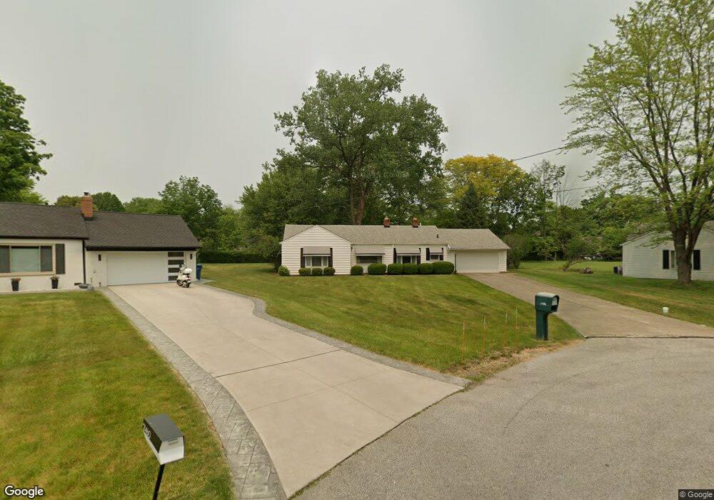
21450 Riviera Dr Cleveland, OH 44126
Estimated Value: $249,825 - $283,000
2
Beds
1
Bath
1,338
Sq Ft
$201/Sq Ft
Est. Value
About This Home
This home is located at 21450 Riviera Dr, Cleveland, OH 44126 and is currently estimated at $269,206, approximately $201 per square foot. 21450 Riviera Dr is a home located in Cuyahoga County with nearby schools including Gilles-Sweet Elementary School, Lewis F Mayer Middle School, and Fairview High School.
Ownership History
Date
Name
Owned For
Owner Type
Purchase Details
Closed on
Oct 16, 2012
Sold by
Dugan William J
Bought by
Dugan William J
Current Estimated Value
Purchase Details
Closed on
Apr 19, 1994
Sold by
Hunka Gary B
Bought by
Dugan William J
Purchase Details
Closed on
Aug 11, 1988
Sold by
Sims Alberta A
Bought by
Hunka Gary B
Purchase Details
Closed on
Sep 16, 1987
Sold by
Drakage James G
Bought by
Sims Alberta A
Purchase Details
Closed on
Nov 28, 1975
Sold by
Harrington Eloise
Bought by
Drakage James G
Purchase Details
Closed on
Jan 1, 1975
Bought by
Harrington Eloise
Create a Home Valuation Report for This Property
The Home Valuation Report is an in-depth analysis detailing your home's value as well as a comparison with similar homes in the area
Home Values in the Area
Average Home Value in this Area
Purchase History
| Date | Buyer | Sale Price | Title Company |
|---|---|---|---|
| Dugan William J | -- | Attorney | |
| Dugan William J | $100,000 | -- | |
| Hunka Gary B | $82,500 | -- | |
| Sims Alberta A | $75,000 | -- | |
| Drakage James G | $34,000 | -- | |
| Harrington Eloise | -- | -- |
Source: Public Records
Tax History Compared to Growth
Tax History
| Year | Tax Paid | Tax Assessment Tax Assessment Total Assessment is a certain percentage of the fair market value that is determined by local assessors to be the total taxable value of land and additions on the property. | Land | Improvement |
|---|---|---|---|---|
| 2024 | $5,268 | $76,300 | $18,410 | $57,890 |
| 2023 | $4,919 | $60,970 | $13,020 | $47,950 |
| 2022 | $4,797 | $60,970 | $13,020 | $47,950 |
| 2021 | $4,896 | $60,970 | $13,020 | $47,950 |
| 2020 | $4,505 | $49,180 | $10,500 | $38,680 |
| 2019 | $4,007 | $140,500 | $30,000 | $110,500 |
| 2018 | $2,006 | $49,180 | $10,500 | $38,680 |
| 2017 | $3,793 | $42,980 | $10,640 | $32,340 |
| 2016 | $3,768 | $42,980 | $10,640 | $32,340 |
| 2015 | $3,624 | $42,980 | $10,640 | $32,340 |
| 2014 | $3,624 | $41,730 | $10,330 | $31,400 |
Source: Public Records
Map
Nearby Homes
- 20930 Mastick Rd
- 5951 Rockport Ln
- 22247 Mastick Rd
- 22534 Bard Ave
- 22503 Sandy Ln
- 22506 Sharon Ln
- 22045 Morton Ave
- 4710 Grayton Rd
- 4720 Grayton Rd
- 4627 W 223rd St
- 21437 Hillsdale Ave
- 4464 W 224th St
- 22934 Mastick Rd Unit 102
- 21763 Hillsdale Ave
- 22895 Mastick Rd
- 4514 Orchard Rd
- 4309 W 222nd St
- 19631 Thornridge Ave
- 4401 Fairview Park
- 22968 Maple Ridge Rd Unit 103
- 21460 Riviera Dr
- 21440 Riviera Dr
- 21461 Mastick Rd
- 21445 Mastick Rd
- 21484 Riviera Dr
- 21429 Mastick Rd
- 21477 Mastick Rd
- 21495 Mastick Rd
- 21415 Mastick Rd
- 21435 Riviera Dr
- 21506 Riviera Dr
- 21445 Riviera Dr
- 21515 Mastick Rd
- 21455 Riviera Dr
- 21399 Mastick Rd
- 21526 Riviera Dr
- 21531 Mastick Rd
- 21475 Riviera Dr
- 21460 Mastick Rd
- 21387 Mastick Rd