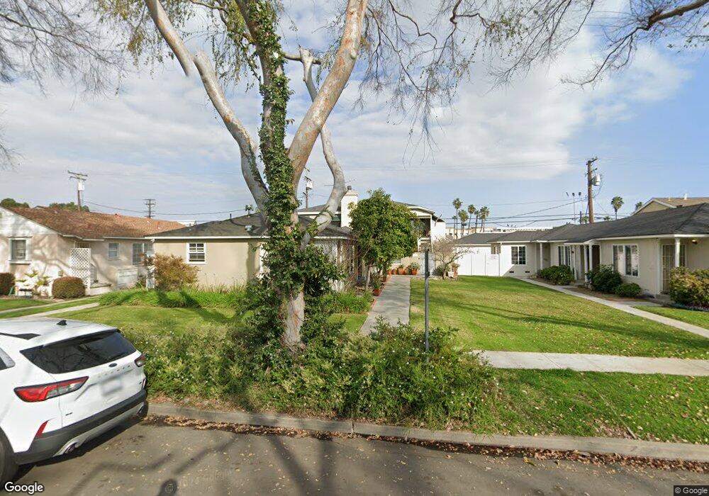
2146 Montair Ave Long Beach, CA 90815
Los Altos South NeighborhoodEstimated Value: $1,284,000 - $1,683,000
5
Beds
5
Baths
3,178
Sq Ft
$479/Sq Ft
Est. Value
About This Home
This home is located at 2146 Montair Ave, Long Beach, CA 90815 and is currently estimated at $1,521,667, approximately $478 per square foot. 2146 Montair Ave is a home located in Los Angeles County with nearby schools including Bixby Elementary School, Stanford Middle School, and Woodrow Wilson High School.
Ownership History
Date
Name
Owned For
Owner Type
Purchase Details
Closed on
Oct 2, 2008
Sold by
Stok James W
Bought by
Stok James W and James W Stok Living Trust
Current Estimated Value
Purchase Details
Closed on
Oct 3, 2007
Sold by
Stok James W and Stok Joseph
Bought by
Stok James W
Purchase Details
Closed on
Dec 10, 2001
Sold by
Stok Joseph and Stok Virginia
Bought by
Stok James W and Stok Joseph
Home Financials for this Owner
Home Financials are based on the most recent Mortgage that was taken out on this home.
Original Mortgage
$260,000
Interest Rate
6%
Create a Home Valuation Report for This Property
The Home Valuation Report is an in-depth analysis detailing your home's value as well as a comparison with similar homes in the area
Home Values in the Area
Average Home Value in this Area
Purchase History
| Date | Buyer | Sale Price | Title Company |
|---|---|---|---|
| Stok James W | -- | None Available | |
| Stok James W | -- | None Available | |
| Stok James W | -- | Fidelity Title |
Source: Public Records
Mortgage History
| Date | Status | Borrower | Loan Amount |
|---|---|---|---|
| Closed | Stok James W | $260,000 |
Source: Public Records
Tax History Compared to Growth
Tax History
| Year | Tax Paid | Tax Assessment Tax Assessment Total Assessment is a certain percentage of the fair market value that is determined by local assessors to be the total taxable value of land and additions on the property. | Land | Improvement |
|---|---|---|---|---|
| 2025 | $5,083 | $343,400 | $87,069 | $256,331 |
| 2024 | $5,083 | $336,667 | $85,362 | $251,305 |
| 2023 | $4,906 | $330,067 | $83,689 | $246,378 |
| 2022 | $4,621 | $323,597 | $82,049 | $241,548 |
| 2021 | $4,506 | $317,253 | $80,441 | $236,812 |
| 2020 | $4,491 | $314,001 | $79,617 | $234,384 |
| 2019 | $4,438 | $307,845 | $78,056 | $229,789 |
| 2018 | $4,252 | $301,810 | $76,526 | $225,284 |
| 2016 | $3,900 | $290,092 | $73,555 | $216,537 |
| 2015 | $3,756 | $285,736 | $72,451 | $213,285 |
| 2014 | $3,749 | $280,140 | $71,032 | $209,108 |
Source: Public Records
Map
Nearby Homes
- 5449 E Fairbrook St
- 2158 Rutgers Ave
- 1949 Chatwin Ave
- 2381 N Bellflower Blvd
- 1881 Tulane Ave
- 2430 Marber Ave
- 5025 E Los Coyotes Diagonal
- 2236 Albury Ave
- 5200 E Atherton St Unit 108
- 5275 E 25th St
- 5681 E Vernon St
- 2038 San Vicente Ave
- 4841 E Los Coyotes Diagonal
- 2351 Argonne Ave
- 2276 Fanwood Ave
- 1430 La Perla Ave
- 2631 Radnor Ave
- 1849 Fanwood Ave
- 1425 La Perla Ave
- 2680 Chatwin Ave
- 2152 Montair Ave
- 2140 Montair Ave
- 2158 Montair Ave
- 2134 Montair Ave
- 2153 Montair Ave
- 2147 Montair Ave
- 2164 Montair Ave
- 2128 Montair Ave
- 2157 Montair Ave
- 2141 Montair Ave
- 2163 Montair Ave
- 2135 Montair Ave
- 2122 Montair Ave
- 2169 Montair Ave
- 2131 Montair Ave
- 2154 Stearnlee Ave
- 2148 Stearnlee Ave
- 2160 Stearnlee Ave
- 5470 E Stearns St
- 2142 Stearnlee Ave