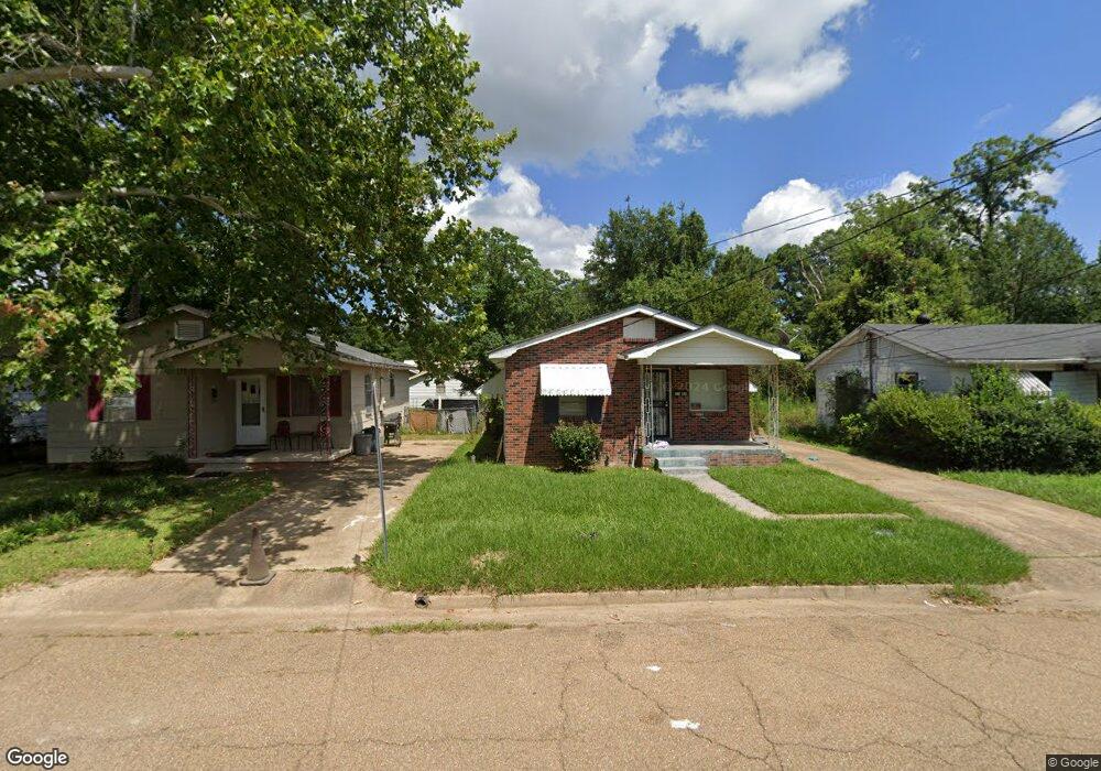
2146 Powers Ave Jackson, MS 39213
North Jackson NeighborhoodEstimated Value: $45,000 - $53,000
3
Beds
2
Baths
1,472
Sq Ft
$33/Sq Ft
Est. Value
About This Home
This home is located at 2146 Powers Ave, Jackson, MS 39213 and is currently estimated at $48,004, approximately $32 per square foot. 2146 Powers Ave is a home located in Hinds County with nearby schools including Johnson Elementary School, Lanier High School, and Amazing Christian School.
Ownership History
Date
Name
Owned For
Owner Type
Purchase Details
Closed on
Jul 22, 2016
Sold by
W L Hughes Properties Iii Llc
Bought by
Hughes Willie L
Current Estimated Value
Purchase Details
Closed on
Jul 21, 2015
Sold by
Hughes Willie and Hughes Willie
Bought by
W L Hughes Properties Iii Llc
Purchase Details
Closed on
Jun 8, 2010
Sold by
Secretary Of Housing And Urban Developme
Bought by
Hughes Willie and Hughes Willie
Create a Home Valuation Report for This Property
The Home Valuation Report is an in-depth analysis detailing your home's value as well as a comparison with similar homes in the area
Home Values in the Area
Average Home Value in this Area
Purchase History
| Date | Buyer | Sale Price | Title Company |
|---|---|---|---|
| Hughes Willie L | -- | Attorney | |
| W L Hughes Properties Iii Llc | -- | None Available | |
| Hughes Willie | -- | -- |
Source: Public Records
Tax History
| Year | Tax Paid | Tax Assessment Tax Assessment Total Assessment is a certain percentage of the fair market value that is determined by local assessors to be the total taxable value of land and additions on the property. | Land | Improvement |
|---|---|---|---|---|
| 2025 | $734 | $3,789 | $675 | $3,114 |
| 2024 | $734 | $3,798 | $675 | $3,123 |
| 2023 | $734 | $3,798 | $675 | $3,123 |
| 2022 | $731 | $3,798 | $675 | $3,123 |
| 2021 | $731 | $3,798 | $675 | $3,123 |
| 2020 | $709 | $3,708 | $675 | $3,033 |
| 2019 | $710 | $3,708 | $675 | $3,033 |
| 2018 | $702 | $3,708 | $675 | $3,033 |
| 2017 | $684 | $3,708 | $675 | $3,033 |
| 2016 | $684 | $3,708 | $675 | $3,033 |
| 2015 | $667 | $3,726 | $675 | $3,051 |
| 2014 | $666 | $3,726 | $675 | $3,051 |
Source: Public Records
Map
Nearby Homes
- 2122 Mobile Ave
- 2307 Mobile Ave
- 870 Crawford St
- 1056 Randall St
- 333 Bon Air St
- 933 Randall St
- 2221 Woodlawn St Unit 23
- 2804 Overstreet Ave Unit 6
- 2012 Woodlawn St Unit 14
- 450 Derrick St
- 1612 W Capitol St
- 1427 Fernwood Dr Unit AB
- 156 S Denver St
- 1346 Fernwood Dr
- 1655 Saint Charles St
- 122 Glenmary St
- 238 S Denver St
- 207 Huron St
- 3329 Hollywood Ave
- 1442 Wood St
- 2150 Powers Ave
- 2142 Powers Ave
- 2154 Powers Ave
- 2138 Powers Ave
- 2158 Powers Ave
- 2134 Powers Ave
- 2147 Morton Ave
- 2143 Morton Ave
- 2153 Morton Ave
- 2157 Morton Ave Unit 59
- 2139 Morton Ave
- 2147 Powers Ave
- 2143 Powers Ave
- 2130 Powers Ave
- 2151 Powers Ave Unit 53
- 2135 Morton Ave
- 2139 Powers Ave
- 2155 Powers Ave Unit 57
- 2166 Powers Ave
- 2161 Morton Ave
Your Personal Tour Guide
Ask me questions while you tour the home.