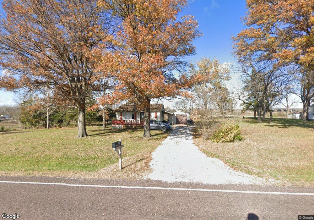
21484 Dempsey Rd Leavenworth, KS 66048
Estimated Value: $194,699 - $299,000
1
Bed
1
Bath
725
Sq Ft
$321/Sq Ft
Est. Value
About This Home
This home is located at 21484 Dempsey Rd, Leavenworth, KS 66048 and is currently estimated at $232,925, approximately $321 per square foot. 21484 Dempsey Rd is a home located in Leavenworth County with nearby schools including Tonganoxie Elementary School, Tonganoxie Middle School, and Tonganoxie High School.
Ownership History
Date
Name
Owned For
Owner Type
Purchase Details
Closed on
Apr 20, 2021
Sold by
Kesinger Edward L and Kesinger Sylvia A
Bought by
Compton Matthew A
Current Estimated Value
Home Financials for this Owner
Home Financials are based on the most recent Mortgage that was taken out on this home.
Original Mortgage
$155,400
Outstanding Balance
$140,307
Interest Rate
3%
Mortgage Type
VA
Estimated Equity
$92,618
Purchase Details
Closed on
Oct 28, 2011
Sold by
Kathleen Powers
Bought by
Kesinger Edward L and Kesinger Sylvia A
Home Financials for this Owner
Home Financials are based on the most recent Mortgage that was taken out on this home.
Original Mortgage
$48,675
Interest Rate
4.13%
Mortgage Type
New Conventional
Create a Home Valuation Report for This Property
The Home Valuation Report is an in-depth analysis detailing your home's value as well as a comparison with similar homes in the area
Home Values in the Area
Average Home Value in this Area
Purchase History
| Date | Buyer | Sale Price | Title Company |
|---|---|---|---|
| Compton Matthew A | $152,292 | Kansas Secured Title | |
| Kesinger Edward L | $60,843 | -- |
Source: Public Records
Mortgage History
| Date | Status | Borrower | Loan Amount |
|---|---|---|---|
| Open | Compton Matthew A | $155,400 | |
| Previous Owner | Kesinger Edward L | $48,675 |
Source: Public Records
Tax History Compared to Growth
Tax History
| Year | Tax Paid | Tax Assessment Tax Assessment Total Assessment is a certain percentage of the fair market value that is determined by local assessors to be the total taxable value of land and additions on the property. | Land | Improvement |
|---|---|---|---|---|
| 2025 | $2,262 | $21,446 | $5,284 | $16,162 |
| 2024 | $2,233 | $20,622 | $5,049 | $15,573 |
| 2023 | $2,233 | $20,021 | $5,022 | $14,999 |
| 2022 | $1,961 | $17,435 | $4,253 | $13,182 |
| 2021 | $1,213 | $10,608 | $3,103 | $7,505 |
| 2020 | $1,110 | $9,684 | $2,974 | $6,710 |
| 2019 | $987 | $8,802 | $2,399 | $6,403 |
| 2018 | $926 | $8,265 | $2,399 | $5,866 |
| 2017 | $878 | $7,797 | $2,399 | $5,398 |
| 2016 | $879 | $7,797 | $2,360 | $5,437 |
| 2015 | $842 | $7,475 | $2,360 | $5,115 |
| 2014 | $824 | $7,475 | $2,360 | $5,115 |
Source: Public Records
Map
Nearby Homes
- Lot 5 219th St
- 21610 Fairmmont Rd
- 21610 Fairmont Rd
- 0 219th St
- 0 Kissinger Rd
- Lot 3 Kissinger Rd
- Lot 2 Kissinger Rd
- Lot 1 Kissinger Rd
- 22416 Mcintyre Rd
- 20723 Kissinger Rd
- Lot 1 235th St
- 23338 Kissinger Rd
- Lot 9 Ackerland Rd
- Lot 4 Ackerland Rd
- 21423 227th St
- Lot 17 235th St
- Lot 10 235th St
- Lot 12 235th St
- Lot 25 235th St
- Lot 5 235th St
- 21452 Dempsey Rd
- 21542 Dempsey Rd
- 21400 Dempsey Rd
- 21326 Dempsey Rd
- 21670 Dempsey Rd
- 21311 Dempsey Rd
- 21278 Dempsey Rd
- 21728 Dempsey Rd
- 21235 Dempsey Rd
- 21208 Dempsey Rd
- 21760 Dempsey Rd
- 21204 Dempsey Rd
- 21185 Smiley Ave
- 21800 Dempsey Rd
- 23613 212th St
- 21185 Lowe Ave
- 23673 212th St
- 23868 219th St
- 21140 Dempsey Rd
- 23626 212th St