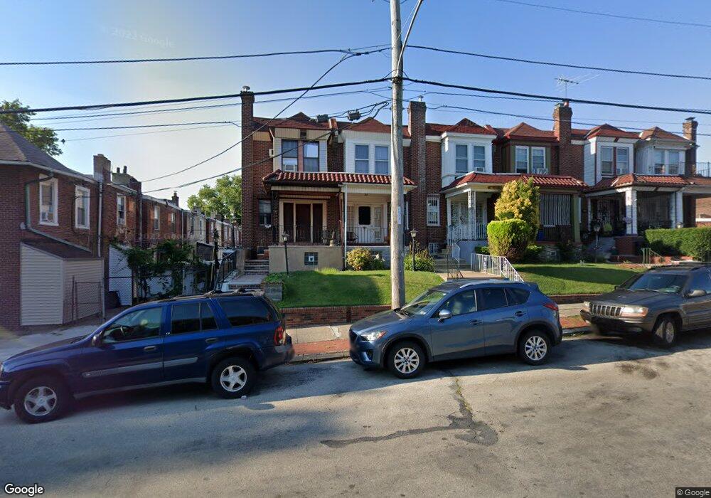
2149 65th Ave Philadelphia, PA 19138
East Germantown NeighborhoodEstimated Value: $158,466 - $218,000
3
Beds
1
Bath
1,302
Sq Ft
$143/Sq Ft
Est. Value
About This Home
This home is located at 2149 65th Ave, Philadelphia, PA 19138 and is currently estimated at $185,617, approximately $142 per square foot. 2149 65th Ave is a home located in Philadelphia County with nearby schools including Martin Luther King High School, West Oak Lane Charter School, and Mastery Charter School - Francis D. Pastorius Elemen.
Ownership History
Date
Name
Owned For
Owner Type
Purchase Details
Closed on
Mar 29, 2004
Sold by
Baptiste Suzanne Jean
Bought by
Mcneil Jamie
Current Estimated Value
Home Financials for this Owner
Home Financials are based on the most recent Mortgage that was taken out on this home.
Original Mortgage
$55,626
Outstanding Balance
$25,994
Interest Rate
5.56%
Mortgage Type
FHA
Estimated Equity
$159,623
Purchase Details
Closed on
Aug 17, 1978
Bought by
Charles Kirkland
Create a Home Valuation Report for This Property
The Home Valuation Report is an in-depth analysis detailing your home's value as well as a comparison with similar homes in the area
Home Values in the Area
Average Home Value in this Area
Purchase History
| Date | Buyer | Sale Price | Title Company |
|---|---|---|---|
| Mcneil Jamie | $56,500 | Lawyers Title Ins | |
| Charles Kirkland | $18,000 | -- |
Source: Public Records
Mortgage History
| Date | Status | Borrower | Loan Amount |
|---|---|---|---|
| Open | Mcneil Jamie | $55,626 |
Source: Public Records
Tax History Compared to Growth
Tax History
| Year | Tax Paid | Tax Assessment Tax Assessment Total Assessment is a certain percentage of the fair market value that is determined by local assessors to be the total taxable value of land and additions on the property. | Land | Improvement |
|---|---|---|---|---|
| 2025 | $1,662 | $154,300 | $30,860 | $123,440 |
| 2024 | $1,662 | $154,300 | $30,860 | $123,440 |
| 2023 | $1,662 | $118,700 | $23,740 | $94,960 |
| 2022 | $517 | $73,700 | $23,740 | $49,960 |
| 2021 | $1,146 | $0 | $0 | $0 |
| 2020 | $1,146 | $0 | $0 | $0 |
| 2019 | $1,197 | $0 | $0 | $0 |
| 2018 | $1,387 | $0 | $0 | $0 |
| 2017 | $1,387 | $0 | $0 | $0 |
| 2016 | $967 | $0 | $0 | $0 |
| 2015 | $926 | $0 | $0 | $0 |
| 2014 | -- | $99,100 | $6,913 | $92,187 |
| 2012 | -- | $11,808 | $2,143 | $9,665 |
Source: Public Records
Map
Nearby Homes
- 5725 Crittenden St
- 6531 N Beechwood St
- 2152 Stenton Ave
- 5827 Crittenden St
- 2125 Stenton Ave
- 5829 Crittenden St
- 1344 Narragansett St
- 2115 Stenton Ave
- 5831 Crittenden St
- 2105 Stenton Ave
- 2120 66th Ave
- 5839 Crittenden St
- 6329 N Beechwood St
- 5843 Crittenden St
- 1226 E Chelten Ave
- 6421 N 21st St
- 5852 Crittenden St
- 6534 N Lambert St
- 6603 N 21st St
- 6308 N Norwood St
- 2147 65th Ave
- 2151 65th Ave
- 2145 65th Ave
- 2143 65th Ave
- 2141 65th Ave
- 6503 Wister St
- 6507 Wister St
- 6514 N Beechwood St
- 6501 Wister St
- 6509 Wister St
- 6505 Wister St
- 6511 Wister St
- 6513 Wister St
- 6516 N Beechwood St
- 6515 Wister St
- 6517 Wister St
- 6519 Wister St
- 6520 N Beechwood St
- 6522 N Beechwood St
- 6508 Wyncote Ave