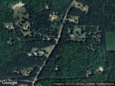
2149 Banning Rd Whitesburg, GA 30185
Estimated Value: $515,000 - $622,769
3
Beds
4
Baths
2,438
Sq Ft
$240/Sq Ft
Est. Value
About This Home
This home is located at 2149 Banning Rd, Whitesburg, GA 30185 and is currently estimated at $583,923, approximately $239 per square foot. 2149 Banning Rd is a home located in Carroll County with nearby schools including Whitesburg Elementary School, Central Middle School, and Central High School.
Ownership History
Date
Name
Owned For
Owner Type
Purchase Details
Closed on
Jul 20, 2022
Sold by
Horrex Peter Lewis
Bought by
Horrex Kevin Matthew and Hoover Sara Marie
Current Estimated Value
Purchase Details
Closed on
Dec 27, 1996
Sold by
Horrex Pester and Horrex Dawn
Bought by
Horrex Peter and Horrex Dawn
Purchase Details
Closed on
Aug 10, 1987
Bought by
Horrex Pester and Horrex Dawn
Create a Home Valuation Report for This Property
The Home Valuation Report is an in-depth analysis detailing your home's value as well as a comparison with similar homes in the area
Home Values in the Area
Average Home Value in this Area
Purchase History
| Date | Buyer | Sale Price | Title Company |
|---|---|---|---|
| Horrex Kevin Matthew | -- | -- | |
| Horrex Peter | -- | -- | |
| Horrex Pester | -- | -- |
Source: Public Records
Mortgage History
| Date | Status | Borrower | Loan Amount |
|---|---|---|---|
| Previous Owner | Horrex Peter Lewis | $106,500 | |
| Previous Owner | Horrex Peter Lewis | $30,000 | |
| Previous Owner | Horrex Peter Lewis | $25,000 |
Source: Public Records
Tax History Compared to Growth
Tax History
| Year | Tax Paid | Tax Assessment Tax Assessment Total Assessment is a certain percentage of the fair market value that is determined by local assessors to be the total taxable value of land and additions on the property. | Land | Improvement |
|---|---|---|---|---|
| 2024 | $4,108 | $227,689 | $71,239 | $156,450 |
| 2023 | $4,108 | $199,914 | $56,992 | $142,922 |
| 2022 | $3,262 | $158,340 | $43,619 | $114,721 |
| 2021 | $2,889 | $133,069 | $34,895 | $98,174 |
| 2020 | $2,693 | $122,052 | $31,722 | $90,330 |
| 2019 | $2,591 | $115,522 | $31,722 | $83,800 |
| 2018 | $2,422 | $104,591 | $29,647 | $74,944 |
| 2017 | $2,428 | $104,591 | $29,647 | $74,944 |
| 2016 | $2,429 | $104,591 | $29,647 | $74,944 |
| 2015 | $2,059 | $77,632 | $23,380 | $54,253 |
| 2014 | $2,068 | $77,633 | $23,380 | $54,253 |
Source: Public Records
Map
Nearby Homes
- 2700 Banning Rd
- 1795 Hutcheson Ferry Rd
- 177 W Lake Blvd
- 157 W Lake Blvd
- 161 W Lake Blvd
- 133 W Lake Blvd
- 165 W Lake Blvd
- 169 W Lake Blvd
- 125 Toccoa Rd
- 840 Old Driver Rd
- 0 Cross Plains Hulett Rd Unit 10466890
- 0 Cross Plains Hulett Rd Unit 10466889
- 0 Cross Plains Hulett Rd Unit 10466887
- 0 Cross Plains Hulett Rd Unit 10400946
- 615 Woodruff Rd
- 0 Horsley Dr Unit 139456
- 2149 Banning Rd
- 2175 Banning Rd
- 2065 Banning Rd
- 2115 Banning Rd
- 2207 Banning Rd
- 2035 Banning Rd
- 2265 Banning Rd
- 2124 Banning Rd
- 2246 Banning Rd
- 2180 Banning Rd
- 2090 Banning Rd
- 2828 Jones Mill Rd
- 2288 Banning Rd
- 2343 Banning Rd Unit Tract 6
- 2330 Banning Rd Unit Tract 7
- 2164 Banning Rd
- 2040 Banning Rd
- 2066 Banning Rd
- 2166 Banning Rd
- 3024 Jones Mill Rd
