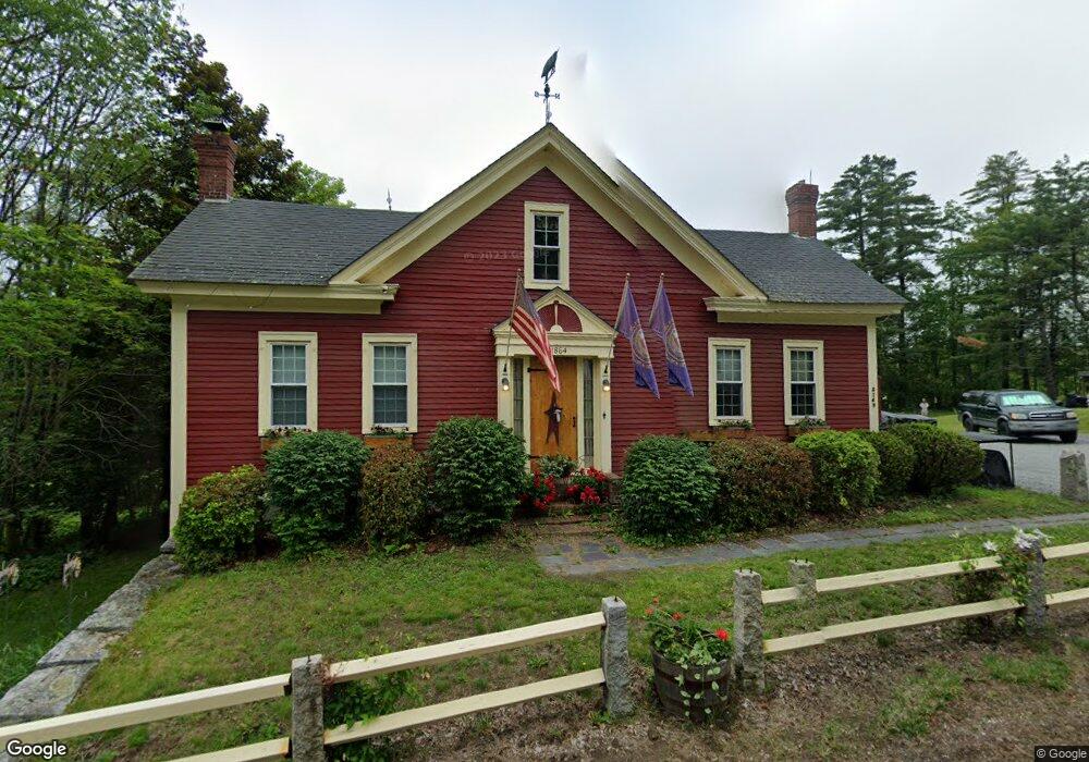
2149 State Route 114 Bradford, NH 03221
Estimated Value: $486,000 - $768,000
4
Beds
3
Baths
3,212
Sq Ft
$184/Sq Ft
Est. Value
About This Home
This home is located at 2149 State Route 114, Bradford, NH 03221 and is currently estimated at $591,149, approximately $184 per square foot. 2149 State Route 114 is a home located in Merrimack County with nearby schools including Kearsarge Regional Elementary School at Bradford, Kearsarge Regional Middle School, and Kearsarge Regional High School.
Ownership History
Date
Name
Owned For
Owner Type
Purchase Details
Closed on
Mar 24, 2008
Sold by
Blanchard Timothy G and Marcisso Lynn M
Bought by
Blanchard Timothy G
Current Estimated Value
Home Financials for this Owner
Home Financials are based on the most recent Mortgage that was taken out on this home.
Original Mortgage
$150,000
Interest Rate
5.75%
Mortgage Type
Purchase Money Mortgage
Create a Home Valuation Report for This Property
The Home Valuation Report is an in-depth analysis detailing your home's value as well as a comparison with similar homes in the area
Home Values in the Area
Average Home Value in this Area
Purchase History
| Date | Buyer | Sale Price | Title Company |
|---|---|---|---|
| Blanchard Timothy G | $50,000 | -- |
Source: Public Records
Mortgage History
| Date | Status | Borrower | Loan Amount |
|---|---|---|---|
| Open | Blanchard Timothy G | $157,500 | |
| Closed | Blanchard Timothy G | $150,000 |
Source: Public Records
Tax History Compared to Growth
Tax History
| Year | Tax Paid | Tax Assessment Tax Assessment Total Assessment is a certain percentage of the fair market value that is determined by local assessors to be the total taxable value of land and additions on the property. | Land | Improvement |
|---|---|---|---|---|
| 2024 | $8,799 | $559,400 | $158,000 | $401,400 |
| 2023 | $8,529 | $306,800 | $70,000 | $236,800 |
| 2022 | $7,518 | $304,500 | $70,000 | $234,500 |
| 2021 | $7,281 | $304,500 | $70,000 | $234,500 |
| 2020 | $7,265 | $304,500 | $70,000 | $234,500 |
| 2019 | $5,691 | $203,900 | $43,000 | $160,900 |
| 2018 | $5,406 | $200,600 | $43,000 | $157,600 |
| 2017 | $5,296 | $200,600 | $43,000 | $157,600 |
| 2016 | $4 | $200,600 | $43,000 | $157,600 |
| 2015 | $5,408 | $200,600 | $43,000 | $157,600 |
| 2014 | $4,833 | $207,700 | $66,300 | $141,400 |
| 2013 | $4,657 | $207,700 | $66,300 | $141,400 |
Source: Public Records
Map
Nearby Homes
- 5 Greenhouse Ln
- 55 Water St
- 0 Bagley Hill Rd
- 45 Crittenden Rd
- 257 Jackson Rd
- 44 Pleasant View Rd
- 71 Melvin Rd
- 108 Circle View Dr
- 00 Fairgrounds Rd Unit 5
- 64 Rowe Mountain Rd
- 17 Jolly Farm Rd
- 000 Route 114 Unit 168
- 2024 Route 114
- 2400 Route 114
- 337 Rowe Mountain Rd
- 200 South Rd
- 26 Butman Rd
- 375 West Rd
- 10 Dodge Hill Rd
- 99 Newell Rd
- 2154 State Route 114
- 2161 State Route 114
- 2158 State Route 114
- 2115 State Route 114
- 162 E Main St
- 2 Old Warner Rd
- 166 E Main St
- 170 E Main St
- 12 Old Warner Rd
- 150 E Main St
- 0 Old Warner Rd Unit 94 / 96 4822084
- 0 Old Warner Rd Unit 4510132
- 161 E Main St
- 2172 State Route 114
- 144 E Main St
- 2118 State Route 114
- 149 E Main St
- 2174 State Route 114
- 145 E Main St
- 18 Old Warner Rd