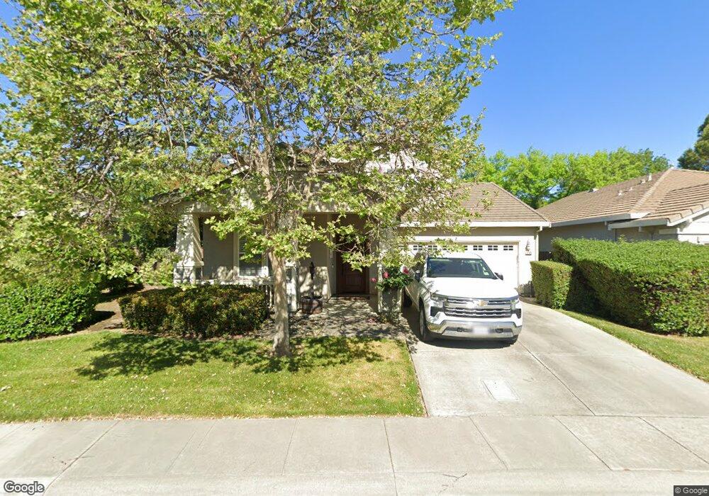
2149 Whistler Ct Davis, CA 95618
North Davis NeighborhoodEstimated Value: $958,000 - $1,327,000
5
Beds
3
Baths
2,655
Sq Ft
$440/Sq Ft
Est. Value
About This Home
This home is located at 2149 Whistler Ct, Davis, CA 95618 and is currently estimated at $1,168,681, approximately $440 per square foot. 2149 Whistler Ct is a home located in Yolo County with nearby schools including Birch Lane Elementary School, Oliver Wendell Holmes Junior High School, and Davis Senior High School.
Ownership History
Date
Name
Owned For
Owner Type
Purchase Details
Closed on
Apr 19, 2019
Sold by
Looney Keith and Looney Stacy J
Bought by
The Looney Family Trust
Current Estimated Value
Purchase Details
Closed on
Jun 26, 1999
Sold by
Morrison Homes Inc
Bought by
Looney Keith and Looney Stacy J
Home Financials for this Owner
Home Financials are based on the most recent Mortgage that was taken out on this home.
Original Mortgage
$220,000
Outstanding Balance
$57,063
Interest Rate
6.62%
Estimated Equity
$1,111,618
Create a Home Valuation Report for This Property
The Home Valuation Report is an in-depth analysis detailing your home's value as well as a comparison with similar homes in the area
Home Values in the Area
Average Home Value in this Area
Purchase History
| Date | Buyer | Sale Price | Title Company |
|---|---|---|---|
| The Looney Family Trust | -- | None Available | |
| Looney Keith | $296,000 | First American Title Ins Co |
Source: Public Records
Mortgage History
| Date | Status | Borrower | Loan Amount |
|---|---|---|---|
| Open | Looney Keith | $220,000 |
Source: Public Records
Tax History Compared to Growth
Tax History
| Year | Tax Paid | Tax Assessment Tax Assessment Total Assessment is a certain percentage of the fair market value that is determined by local assessors to be the total taxable value of land and additions on the property. | Land | Improvement |
|---|---|---|---|---|
| 2025 | $7,954 | $520,502 | $118,334 | $402,168 |
| 2023 | $7,954 | $500,292 | $113,740 | $386,552 |
| 2022 | $7,660 | $490,483 | $111,510 | $378,973 |
| 2021 | $7,503 | $480,867 | $109,324 | $371,543 |
| 2020 | $7,376 | $475,938 | $108,204 | $367,734 |
| 2019 | $7,068 | $466,607 | $106,083 | $360,524 |
| 2018 | $6,661 | $457,458 | $104,003 | $353,455 |
| 2017 | $6,557 | $448,489 | $101,964 | $346,525 |
| 2016 | $6,413 | $439,696 | $99,965 | $339,731 |
| 2015 | $6,243 | $433,092 | $98,464 | $334,628 |
| 2014 | $6,243 | $424,610 | $96,536 | $328,074 |
Source: Public Records
Map
Nearby Homes
- 2320 Denison Dr
- 2405 Temple Dr
- 1721 Tea Place
- 2409 Hepworth Dr
- 2806 Audubon Cir
- 2385 Roualt St
- 1330 Alder Place
- 1712 Fremont Ct Unit 3
- 2818 Bidwell St Unit 3
- 2620 Belmont Dr
- 2603 Bellows St
- 2616 Rockwell Dr
- 2708 Pole Line Rd Unit 4
- 1718 Pole Line Rd
- 2911 Austin St Unit 2
- 2727 Adrian Dr
- 2011 Regis Dr
- 1818 Moore Blvd Unit 126
- 1818 Moore Blvd Unit 201
- 2722 Ponteverde Ln
- 2143 Whistler Ct
- 2155 Whistler Ct
- 2137 Whistler Ct
- 2148 Whistler Ct
- 2154 Whistler Ct
- 2142 Whistler Ct
- 2131 Whistler Ct
- 2326 Okeefe Place
- 2341 Benton Place
- 2108 Whistler Ct
- 2320 Okeefe Place
- 2125 Whistler Ct
- 2340 Benton Place
- 2119 Whistler Ct
- 2600 Calder Ct
- 2606 Calder Ct
- 2335 Benton Place
- 2202 Rodin Place
- 2102 Whistler Ct
- 2113 Whistler Ct