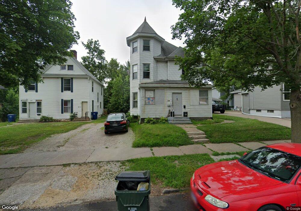
215 E 14th St Unit 1/2 Davenport, IA 52803
Central Davenport NeighborhoodEstimated Value: $87,169 - $116,000
2
Beds
2
Baths
1,860
Sq Ft
$56/Sq Ft
Est. Value
About This Home
This home is located at 215 E 14th St Unit 1/2, Davenport, IA 52803 and is currently estimated at $104,042, approximately $55 per square foot. 215 E 14th St Unit 1/2 is a home located in Scott County with nearby schools including Walnut Hill Elementary School, Madison Elementary School, and Casey County Middle School.
Ownership History
Date
Name
Owned For
Owner Type
Purchase Details
Closed on
May 22, 2009
Sold by
Deutsche Bank National Trust Company
Bought by
Al Ken Llc
Current Estimated Value
Home Financials for this Owner
Home Financials are based on the most recent Mortgage that was taken out on this home.
Original Mortgage
$45,000
Outstanding Balance
$28,508
Interest Rate
4.9%
Mortgage Type
Future Advance Clause Open End Mortgage
Estimated Equity
$75,534
Create a Home Valuation Report for This Property
The Home Valuation Report is an in-depth analysis detailing your home's value as well as a comparison with similar homes in the area
Home Values in the Area
Average Home Value in this Area
Purchase History
| Date | Buyer | Sale Price | Title Company |
|---|---|---|---|
| Al Ken Llc | $27,000 | None Available | |
| Deutsche Bank National Trust Company | -- | None Available |
Source: Public Records
Mortgage History
| Date | Status | Borrower | Loan Amount |
|---|---|---|---|
| Open | Al Ken Llc | $45,000 |
Source: Public Records
Tax History Compared to Growth
Tax History
| Year | Tax Paid | Tax Assessment Tax Assessment Total Assessment is a certain percentage of the fair market value that is determined by local assessors to be the total taxable value of land and additions on the property. | Land | Improvement |
|---|---|---|---|---|
| 2025 | $1,066 | $75,650 | $12,510 | $63,140 |
| 2024 | $1,040 | $59,670 | $12,510 | $47,160 |
| 2023 | $962 | $59,670 | $12,510 | $47,160 |
| 2022 | $968 | $45,080 | $6,160 | $38,920 |
| 2021 | $968 | $45,080 | $6,160 | $38,920 |
| 2020 | $980 | $45,080 | $6,160 | $38,920 |
| 2019 | $1,012 | $45,080 | $6,160 | $38,920 |
| 2018 | $944 | $45,080 | $6,160 | $38,920 |
| 2017 | $978 | $43,030 | $6,160 | $36,870 |
| 2016 | $942 | $43,030 | $0 | $0 |
| 2015 | $977 | $45,680 | $0 | $0 |
| 2014 | $1,014 | $45,680 | $0 | $0 |
| 2013 | $998 | $0 | $0 | $0 |
| 2012 | -- | $52,780 | $7,690 | $45,090 |
Source: Public Records
Map
Nearby Homes
- 209 E 13th St
- 1222 Pershing Ave
- 320 E 14th St
- 1429 Brady St
- 407 E 14th St
- 409 E 14th St
- 325 Kirkwood Blvd
- 1518 N Main St
- 420 Kirkwood Blvd
- 511 Kirkwood Blvd
- 1812 Pershing Ave
- 125 E Locust St
- 1605 N Harrison St
- 1215 Farnam St
- 1127 N Ripley St
- 637 E 15th St
- 1720 N Harrison St
- 618 Douglas Ct
- 914 Farnam St
- 707 Brady St
- 215 E 14th St
- 217 E 14th St
- 1327 N Perry St
- 1321 N Perry St
- 221 E 14th St
- 1315 N Perry St
- 225 E 14th St
- 0 W 14th St
- 1326 Pershing Ave
- 1316 Pershing Ave
- 1312 Pershing Ave
- 228 E 13th St
- 1312 Pershing Ave
- 1301 N Perry St
- o 46th
- 1302 N Perry St
- 1229 N Perry St
- 302 E 13th St
- 1230 Pershing Ave
- 1226 Pershing Ave