215 George Thomas Rd New Sharon, ME 04955
Estimated Value: $177,048 - $378,000
--
Bed
--
Bath
--
Sq Ft
3.3
Acres
About This Home
This home is located at 215 George Thomas Rd, New Sharon, ME 04955 and is currently estimated at $280,012. 215 George Thomas Rd is a home with nearby schools including Mt. Blue High School.
Ownership History
Date
Name
Owned For
Owner Type
Purchase Details
Closed on
Aug 16, 2017
Sold by
Linda Caprara
Bought by
Richards Kevin and Wood Darry
Current Estimated Value
Home Financials for this Owner
Home Financials are based on the most recent Mortgage that was taken out on this home.
Original Mortgage
$144,000
Outstanding Balance
$121,678
Interest Rate
3.9%
Estimated Equity
$158,964
Create a Home Valuation Report for This Property
The Home Valuation Report is an in-depth analysis detailing your home's value as well as a comparison with similar homes in the area
Home Values in the Area
Average Home Value in this Area
Purchase History
| Date | Buyer | Sale Price | Title Company |
|---|---|---|---|
| Richards Kevin | -- | -- |
Source: Public Records
Mortgage History
| Date | Status | Borrower | Loan Amount |
|---|---|---|---|
| Open | Wood Darryl A | $50,000 | |
| Open | Wood Darryl | $144,000 | |
| Closed | Wood Darryl | -- | |
| Previous Owner | Wood Darryl A | $42,600 | |
| Previous Owner | Wood Darryl A | $126,150 | |
| Previous Owner | Wood Darryl | $65,000 | |
| Previous Owner | Wood Darryl | $50,000 |
Source: Public Records
Tax History Compared to Growth
Tax History
| Year | Tax Paid | Tax Assessment Tax Assessment Total Assessment is a certain percentage of the fair market value that is determined by local assessors to be the total taxable value of land and additions on the property. | Land | Improvement |
|---|---|---|---|---|
| 2024 | $3,280 | $300,950 | $37,350 | $263,600 |
| 2023 | $2,273 | $129,910 | $24,600 | $105,310 |
| 2022 | $2,076 | $129,910 | $24,600 | $105,310 |
| 2021 | $2,233 | $129,910 | $24,600 | $105,310 |
| 2020 | $2,321 | $129,910 | $24,600 | $105,310 |
| 2019 | $1,759 | $129,910 | $24,600 | $105,310 |
| 2018 | $2,079 | $129,910 | $24,600 | $105,310 |
| 2017 | $2,092 | $129,910 | $24,600 | $105,310 |
| 2016 | $1,816 | $129,910 | $24,600 | $105,310 |
| 2014 | $1,975 | $129,910 | $24,600 | $105,310 |
Source: Public Records
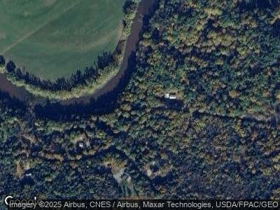
Map
Nearby Homes
- 05 Farmington Falls Rd
- 129 Philbrick St
- 1092 Farmington Falls Rd
- Lot #33 Cape Cod Hill Rd
- R-01-031 Mason Rd
- 59 Chandler Rd
- Lot 74 Flagg Rd
- Lot 9 & 12 Smith Rd
- 20 Webster Rd
- 5 Nadeau Ln
- 35 Industry Rd
- 48 Starks Rd
- 33 Kimball Pond
- 64 Mile Hill Rd
- 82 Lane Rd
- 110 Kashke Dr
- 159 Hillside Dr
- Map5 L30-8 Knowlton Corner Rd
- 496 Farmington Falls Rd
- 386 Zions Hill Rd
- 215 George Thomas Rd
- 210 George Thomas Rd
- - George Thomas Rd
- 2 George Thomas Rd
- 229 George Thomas Rd
- M3 L4 George Thomas Rd
- 161 George Thomas Rd
- 168 George Thomas Rd
- 160 George Thomas Rd
- 191 George Thomas Rd
- 153 George Thomas Rd
- 152 George Thomas Rd
- 147 George Thomas Rd
- 701 Farmington Falls Rd
- 679 Farmington Falls Rd
- 669 Farmington Falls Rd
- 659 Farmington Falls Rd
- 719 Farmington Falls Rd
- 677 Farmington Falls Rd
- 639 Farmington Falls Rd