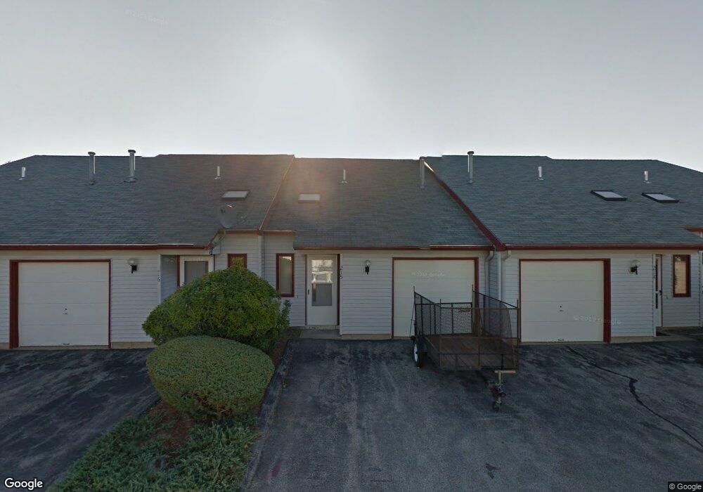
215 Millwright Dr Nashua, NH 03063
Northwest Nashua NeighborhoodEstimated Value: $246,000 - $306,000
2
Beds
1
Bath
1,072
Sq Ft
$258/Sq Ft
Est. Value
About This Home
This home is located at 215 Millwright Dr, Nashua, NH 03063 and is currently estimated at $276,216, approximately $257 per square foot. 215 Millwright Dr is a home located in Hillsborough County with nearby schools including Birch Hill Elementary School, Pennichuck Middle School, and Nashua High School North.
Ownership History
Date
Name
Owned For
Owner Type
Purchase Details
Closed on
Dec 21, 2022
Sold by
Laster Charliie T
Bought by
Rivard Michael
Current Estimated Value
Home Financials for this Owner
Home Financials are based on the most recent Mortgage that was taken out on this home.
Original Mortgage
$204,092
Outstanding Balance
$197,711
Interest Rate
7.08%
Mortgage Type
Purchase Money Mortgage
Estimated Equity
$78,505
Purchase Details
Closed on
Jun 15, 2022
Sold by
Surwic Joshua P
Bought by
Taft-Laster Charlie
Purchase Details
Closed on
Jul 20, 2020
Sold by
Vansicklen-Lang James
Bought by
Laster Carlie and Surwie Joshua
Home Financials for this Owner
Home Financials are based on the most recent Mortgage that was taken out on this home.
Original Mortgage
$128,250
Interest Rate
3.1%
Mortgage Type
FHA
Purchase Details
Closed on
Jul 31, 2017
Sold by
Euliano Matthew
Bought by
Vansicklen-Lang James M
Home Financials for this Owner
Home Financials are based on the most recent Mortgage that was taken out on this home.
Original Mortgage
$115,995
Interest Rate
3.91%
Mortgage Type
FHA
Purchase Details
Closed on
May 12, 2014
Sold by
Prince Bruce A and Prince Linda L
Bought by
Euliano Matthew
Purchase Details
Closed on
Aug 23, 2011
Sold by
Fnma
Bought by
Prince Bruce A and Prince Linda L
Home Financials for this Owner
Home Financials are based on the most recent Mortgage that was taken out on this home.
Original Mortgage
$47,600
Interest Rate
4.62%
Mortgage Type
Purchase Money Mortgage
Purchase Details
Closed on
Jul 27, 2011
Sold by
Correia Maria J and Fnma
Bought by
Federal National Mortgage Association
Home Financials for this Owner
Home Financials are based on the most recent Mortgage that was taken out on this home.
Original Mortgage
$47,600
Interest Rate
4.62%
Mortgage Type
Purchase Money Mortgage
Purchase Details
Closed on
Nov 9, 2007
Sold by
Fnma
Bought by
Correia Maria J
Create a Home Valuation Report for This Property
The Home Valuation Report is an in-depth analysis detailing your home's value as well as a comparison with similar homes in the area
Home Values in the Area
Average Home Value in this Area
Purchase History
| Date | Buyer | Sale Price | Title Company |
|---|---|---|---|
| Rivard Michael | $197,000 | None Available | |
| Rivard Michael | $197,000 | None Available | |
| Taft-Laster Charlie | -- | None Available | |
| Taft-Laster Charlie | -- | None Available | |
| Laster Carlie | $135,000 | None Available | |
| Laster Carlie | $135,000 | None Available | |
| Vansicklen-Lang James M | $120,000 | -- | |
| Vansicklen-Lang James M | $120,000 | -- | |
| Euliano Matthew | $78,500 | -- | |
| Euliano Matthew | $78,500 | -- | |
| Prince Bruce A | $59,600 | -- | |
| Prince Bruce A | $59,600 | -- | |
| Federal National Mortgage Association | $69,800 | -- | |
| Federal National Mortgage Association | $69,800 | -- | |
| Correia Maria J | $95,100 | -- | |
| Correia Maria J | $95,100 | -- |
Source: Public Records
Mortgage History
| Date | Status | Borrower | Loan Amount |
|---|---|---|---|
| Open | Rivard Michael | $204,092 | |
| Closed | Rivard Michael | $204,092 | |
| Previous Owner | Laster Carlie | $128,250 | |
| Previous Owner | Vansicklen-Lang James M | $115,995 | |
| Previous Owner | Correia Maria J | $47,600 |
Source: Public Records
Tax History Compared to Growth
Tax History
| Year | Tax Paid | Tax Assessment Tax Assessment Total Assessment is a certain percentage of the fair market value that is determined by local assessors to be the total taxable value of land and additions on the property. | Land | Improvement |
|---|---|---|---|---|
| 2024 | $3,692 | $232,200 | $0 | $232,200 |
| 2023 | $2,961 | $162,400 | $0 | $162,400 |
| 2022 | $2,935 | $162,400 | $0 | $162,400 |
| 2021 | $2,587 | $111,400 | $0 | $111,400 |
| 2020 | $2,614 | $115,600 | $0 | $115,600 |
| 2019 | $2,515 | $115,600 | $0 | $115,600 |
| 2018 | $2,452 | $115,600 | $0 | $115,600 |
| 2017 | $1,798 | $69,700 | $0 | $69,700 |
| 2016 | $1,747 | $69,700 | $0 | $69,700 |
| 2015 | $1,710 | $69,700 | $0 | $69,700 |
| 2014 | $1,676 | $69,700 | $0 | $69,700 |
Source: Public Records
Map
Nearby Homes
- 218 Millwright Dr Unit 218
- 201 Millwright Dr
- 3 Roedean Dr Unit C-207
- 5 Dumaine Ave Unit B
- 5 Dumaine Ave Unit N
- 75 Deerwood Dr Unit B
- 77 Deerwood Dr Unit E
- 66 Tinker Rd
- 26 Andover Down Unit 276
- 38 Highbridge Hill Rd Unit 186
- 8 Pilgrim Cir
- 9 Cambridge Dr
- 123 Cannongate III
- 15 Four Winds Rd
- 5 Chatfield Dr Unit U18
- 4 Jared Cir Unit U21
- 74 Profile Cir
- 11 Queens Way
- 7 Robert Dr
- 206 S Merrimack Rd
- 215 Millwright Dr
- 215 Millwright Dr Unit 215
- 216 Millwright Dr
- 216 Millwright Dr
- 216 Millwright Dr Unit 216
- 214 Millwright Dr
- 214 Millwright Dr
- 214 Millwright Dr Unit 214
- 217 Millwright Dr
- 217 Millwright Dr
- 213 Millwright Dr
- 213 Millwright Dr
- 257 Stonebridge Dr
- 257 Stonebridge Dr
- 257 Stonebridge Dr Unit 257
- 258 Stonebridge Dr
- 258 Stonebridge Dr
- 258 Stonebridge Dr Unit 258
- 256 Stonebridge Dr
- 256 Stonebridge Dr