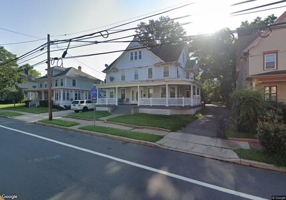
215 N Main St Hightstown, NJ 08520
Estimated Value: $546,000 - $595,000
9
Beds
2
Baths
2,104
Sq Ft
$269/Sq Ft
Est. Value
About This Home
This home is located at 215 N Main St, Hightstown, NJ 08520 and is currently estimated at $565,711, approximately $268 per square foot. 215 N Main St is a home located in Mercer County with nearby schools including Melvin H. Kreps Middle School, Hightstown High School, and SciCore Academy.
Ownership History
Date
Name
Owned For
Owner Type
Purchase Details
Closed on
Jan 1, 2008
Sold by
Espinoza Monica
Bought by
Espinoza Jamie and Espinoza Mercedes
Current Estimated Value
Purchase Details
Closed on
Dec 20, 2006
Sold by
Robbins Sandra
Bought by
Espinoza Monica
Home Financials for this Owner
Home Financials are based on the most recent Mortgage that was taken out on this home.
Original Mortgage
$307,400
Interest Rate
6.29%
Purchase Details
Closed on
Jan 13, 1995
Sold by
Dec Mark K Long
Bought by
Robbins Sandra M
Home Financials for this Owner
Home Financials are based on the most recent Mortgage that was taken out on this home.
Original Mortgage
$84,000
Interest Rate
9.23%
Create a Home Valuation Report for This Property
The Home Valuation Report is an in-depth analysis detailing your home's value as well as a comparison with similar homes in the area
Home Values in the Area
Average Home Value in this Area
Purchase History
| Date | Buyer | Sale Price | Title Company |
|---|---|---|---|
| Espinoza Jamie | -- | -- | |
| Espinoza Monica | $307,400 | -- | |
| Robbins Sandra M | $118,000 | -- |
Source: Public Records
Mortgage History
| Date | Status | Borrower | Loan Amount |
|---|---|---|---|
| Previous Owner | Espinoza Monica | $307,400 | |
| Previous Owner | Robbins Sandra M | $84,000 |
Source: Public Records
Tax History Compared to Growth
Tax History
| Year | Tax Paid | Tax Assessment Tax Assessment Total Assessment is a certain percentage of the fair market value that is determined by local assessors to be the total taxable value of land and additions on the property. | Land | Improvement |
|---|---|---|---|---|
| 2025 | $11,017 | $224,700 | $80,500 | $144,200 |
| 2024 | $10,905 | $224,700 | $80,500 | $144,200 |
| 2023 | $10,905 | $224,700 | $80,500 | $144,200 |
| 2022 | $10,527 | $224,700 | $80,500 | $144,200 |
| 2021 | $10,147 | $224,700 | $80,500 | $144,200 |
| 2020 | $9,916 | $224,700 | $80,500 | $144,200 |
| 2019 | $9,640 | $224,700 | $80,500 | $144,200 |
| 2018 | $9,359 | $224,700 | $80,500 | $144,200 |
| 2017 | $9,262 | $224,700 | $80,500 | $144,200 |
| 2016 | $9,181 | $224,700 | $80,500 | $144,200 |
| 2015 | $9,123 | $224,700 | $80,500 | $144,200 |
| 2014 | $9,181 | $224,700 | $80,500 | $144,200 |
Source: Public Records
Map
Nearby Homes
- 128 Monmouth St
- 344 Monmouth St
- 23 Barton Dr
- 104 1st Ave
- 5 Mill Run W
- 4 Brakeman Ct
- 219 Maxwell Ave
- 158 Mill Run E
- 309 Lincoln Ave
- 164 Mill Run E Unit 141
- 23 Powell Ct
- 4 Sandstone Rd
- 336 Stockton St
- 302 S Main St
- 43 Norton Ave
- 141 Lincoln Ave
- 126 Mill Run E
- 126 Mill Run E Unit 84
- 145 Lincoln Ave
- 124 Mill Run E Unit 85
- 207 N Main St
- 205 N Main St
- 201 N Main St
- 221 N Main St
- 200 N Main St
- 200 N Main St Unit B
- 200 N Main St Unit A
- 212 N Main St
- 220 N Main St
- 169 N Main St Unit 71
- 112-114 Monmouth St
- 112 Monmouth St Unit 114
- 222 N Main St
- 229 N Main St
- 226 -228 Main
- 226 N Main St Unit 228
- 226-228 228 N Main
- 226-228 N Main St
- 116 Monmouth St Unit 118
- 114 Monmouth St