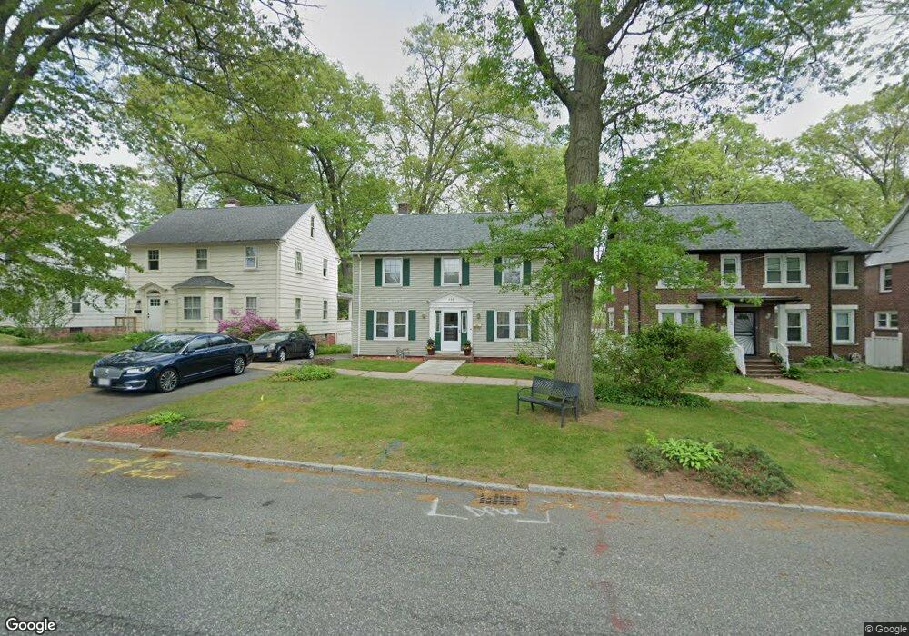
215 Norfolk St Springfield, MA 01109
Upper Hill NeighborhoodEstimated Value: $269,000 - $298,000
3
Beds
2
Baths
1,770
Sq Ft
$163/Sq Ft
Est. Value
About This Home
This home is located at 215 Norfolk St, Springfield, MA 01109 and is currently estimated at $289,338, approximately $163 per square foot. 215 Norfolk St is a home located in Hampden County with nearby schools including Daniel B Brunton, John J Duggan Middle, and Springfield High School of Science and Technology.
Ownership History
Date
Name
Owned For
Owner Type
Purchase Details
Closed on
May 22, 1998
Sold by
Ficarra Robert R and Ficarra Deanna
Bought by
Osborne Adrienne C
Current Estimated Value
Home Financials for this Owner
Home Financials are based on the most recent Mortgage that was taken out on this home.
Original Mortgage
$2,600
Outstanding Balance
$523
Interest Rate
7.12%
Estimated Equity
$288,815
Purchase Details
Closed on
Nov 7, 1997
Sold by
Lusseir Germaine Est
Bought by
Ficarra Robert R and Ficarra Deanna
Home Financials for this Owner
Home Financials are based on the most recent Mortgage that was taken out on this home.
Original Mortgage
$43,450
Interest Rate
7.19%
Mortgage Type
Purchase Money Mortgage
Create a Home Valuation Report for This Property
The Home Valuation Report is an in-depth analysis detailing your home's value as well as a comparison with similar homes in the area
Home Values in the Area
Average Home Value in this Area
Purchase History
| Date | Buyer | Sale Price | Title Company |
|---|---|---|---|
| Osborne Adrienne C | $80,000 | -- | |
| Ficarra Robert R | $26,500 | -- |
Source: Public Records
Mortgage History
| Date | Status | Borrower | Loan Amount |
|---|---|---|---|
| Open | Ficarra Robert R | $2,600 | |
| Open | Ficarra Robert R | $78,850 | |
| Previous Owner | Ficarra Robert R | $43,450 |
Source: Public Records
Tax History
| Year | Tax Paid | Tax Assessment Tax Assessment Total Assessment is a certain percentage of the fair market value that is determined by local assessors to be the total taxable value of land and additions on the property. | Land | Improvement |
|---|---|---|---|---|
| 2025 | $3,550 | $226,400 | $42,200 | $184,200 |
| 2024 | $3,307 | $205,900 | $35,100 | $170,800 |
| 2023 | $3,154 | $185,000 | $31,900 | $153,100 |
| 2022 | $3,580 | $190,200 | $29,900 | $160,300 |
| 2021 | $3,430 | $181,500 | $27,200 | $154,300 |
| 2020 | $3,281 | $168,000 | $27,200 | $140,800 |
| 2019 | $2,958 | $150,300 | $27,200 | $123,100 |
| 2018 | $2,688 | $136,600 | $27,200 | $109,400 |
| 2017 | $2,511 | $127,700 | $25,100 | $102,600 |
| 2016 | $2,436 | $123,900 | $25,100 | $98,800 |
| 2015 | $2,386 | $121,300 | $15,700 | $105,600 |
Source: Public Records
Map
Nearby Homes
- 135-137 Suffolk St
- 0 NS (24) Alden St
- 124-126 Westford Cir
- 89 Bristol St
- 111 Marlborough St
- 11 Ina St
- 62-64 Bristol St
- 87 Fenwick St
- 31-33 Suffolk St
- 21 Westford Cir
- 283 Wilbraham Rd
- 22 Amanda St
- 44 Amanda St
- 236 Pondview Dr
- 189 Northampton Ave
- 48-50 Dresden St
- 25 Dresden St
- 19 Westford Ave
- 41 Olive St
- 290 Quincy St
- 221 Norfolk St
- 209 Norfolk St
- 225 Norfolk St
- 205 Norfolk St
- 229 Norfolk St
- 201 Norfolk St
- 216 Norfolk St
- 220 Norfolk St Unit 222
- 210 Norfolk St
- 235 Norfolk St
- 226 Norfolk St
- 204 Norfolk St
- 241 Norfolk St
- 195 Norfolk St
- 196 Norfolk St
- 205 Bristol St
- 209 Bristol St
- 199 Bristol St
- 215 Bristol St
- 245 Norfolk St
Your Personal Tour Guide
Ask me questions while you tour the home.