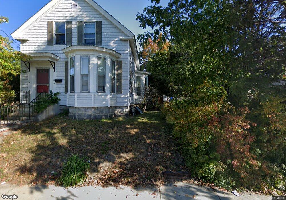
215 Parker St Unit 1 Lowell, MA 01851
Lower Highlands NeighborhoodEstimated Value: $796,000 - $853,242
5
Beds
2
Baths
4,124
Sq Ft
$201/Sq Ft
Est. Value
About This Home
This home is located at 215 Parker St Unit 1, Lowell, MA 01851 and is currently estimated at $830,811, approximately $201 per square foot. 215 Parker St Unit 1 is a home located in Middlesex County with nearby schools including Charles W. Morey Elementary School, Dr. Gertrude Bailey Elementary School, and Abraham Lincoln Elementary School.
Ownership History
Date
Name
Owned For
Owner Type
Purchase Details
Closed on
Dec 13, 2017
Sold by
Michael A Baliestiero A and Michael Baliestiero
Bought by
Sun & Moon Rt and Baliestiero
Current Estimated Value
Purchase Details
Closed on
Oct 10, 2014
Sold by
Baliestiero Laura L
Bought by
Michael A Baliestiero A and Michael Baliestiero
Purchase Details
Closed on
May 23, 2003
Sold by
Robinson Roscoe F
Bought by
Baliestiero Laura
Home Financials for this Owner
Home Financials are based on the most recent Mortgage that was taken out on this home.
Original Mortgage
$155,000
Interest Rate
5.86%
Mortgage Type
Purchase Money Mortgage
Purchase Details
Closed on
Dec 3, 2001
Sold by
Heng Alycia K
Bought by
Robinson Roscoe F
Home Financials for this Owner
Home Financials are based on the most recent Mortgage that was taken out on this home.
Original Mortgage
$264,000
Interest Rate
6.66%
Mortgage Type
Purchase Money Mortgage
Purchase Details
Closed on
Nov 25, 1992
Sold by
Betses George J and Betses Priscilla
Bought by
Heng Kimberly
Create a Home Valuation Report for This Property
The Home Valuation Report is an in-depth analysis detailing your home's value as well as a comparison with similar homes in the area
Home Values in the Area
Average Home Value in this Area
Purchase History
| Date | Buyer | Sale Price | Title Company |
|---|---|---|---|
| Sun & Moon Rt | -- | -- | |
| Sun & Moon Rt | -- | -- | |
| Michael A Baliestiero A | -- | -- | |
| Baliestiero Michael A | -- | -- | |
| Baliestiero Laura | $354,000 | -- | |
| Baliestiero Laura | $354,000 | -- | |
| Robinson Roscoe F | $294,600 | -- | |
| Robinson Roscoe F | $294,600 | -- | |
| Heng Kimberly | $118,000 | -- | |
| Heng Kimberly | $118,000 | -- |
Source: Public Records
Mortgage History
| Date | Status | Borrower | Loan Amount |
|---|---|---|---|
| Previous Owner | Baliestiero Laura | $155,000 | |
| Previous Owner | Heng Kimberly | $270,000 | |
| Previous Owner | Heng Kimberly | $264,000 |
Source: Public Records
Tax History Compared to Growth
Tax History
| Year | Tax Paid | Tax Assessment Tax Assessment Total Assessment is a certain percentage of the fair market value that is determined by local assessors to be the total taxable value of land and additions on the property. | Land | Improvement |
|---|---|---|---|---|
| 2025 | $9,601 | $836,300 | $233,100 | $603,200 |
| 2024 | $8,721 | $732,200 | $217,900 | $514,300 |
| 2023 | $8,288 | $667,300 | $189,500 | $477,800 |
| 2022 | $7,285 | $574,100 | $172,200 | $401,900 |
| 2021 | $6,935 | $515,200 | $149,800 | $365,400 |
| 2020 | $6,259 | $468,500 | $134,500 | $334,000 |
| 2019 | $5,734 | $408,400 | $133,300 | $275,100 |
| 2018 | $5,434 | $377,600 | $126,900 | $250,700 |
| 2017 | $5,467 | $366,400 | $123,000 | $243,400 |
| 2016 | $5,127 | $338,200 | $110,800 | $227,400 |
| 2015 | $4,782 | $308,900 | $110,800 | $198,100 |
| 2013 | $4,389 | $292,400 | $126,400 | $166,000 |
Source: Public Records
Map
Nearby Homes
- 215 Parker St
- 686 Wilder St Unit 1
- 207 Parker St
- 676 Wilder St
- 156 Winthrop Ave
- 210 Parker St
- 144 Winthrop Ave
- 224 Parker St
- 228 Parker St
- 658 Wilder St
- 153 Winthrop Ave
- 140 Winthrop Ave
- 704 Wilder St
- 701 Wilder St
- 200 Parker St
- 234 Parker St
- 145 Winthrop Ave
- 707 Wilder St
- 238 Parker St
- 656 Wilder St