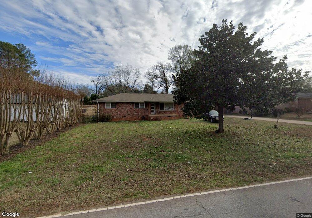
215 Polaris St Anderson, SC 29621
Estimated Value: $186,821 - $194,000
3
Beds
2
Baths
1,480
Sq Ft
$128/Sq Ft
Est. Value
About This Home
This home is located at 215 Polaris St, Anderson, SC 29621 and is currently estimated at $189,955, approximately $128 per square foot. 215 Polaris St is a home located in Anderson County with nearby schools including Nevitt Forest Elementary School, Glenview Middle School, and T.L. Hanna High School.
Ownership History
Date
Name
Owned For
Owner Type
Purchase Details
Closed on
Apr 6, 2009
Sold by
Wright Jerry D
Bought by
White Latchia
Current Estimated Value
Home Financials for this Owner
Home Financials are based on the most recent Mortgage that was taken out on this home.
Original Mortgage
$76,095
Outstanding Balance
$48,388
Interest Rate
5.05%
Mortgage Type
FHA
Estimated Equity
$141,567
Purchase Details
Closed on
Oct 21, 2008
Sold by
Howard Marion L
Bought by
Wright Jerry
Purchase Details
Closed on
Oct 27, 2004
Sold by
Wright Jerry
Bought by
Howard Marion L
Create a Home Valuation Report for This Property
The Home Valuation Report is an in-depth analysis detailing your home's value as well as a comparison with similar homes in the area
Home Values in the Area
Average Home Value in this Area
Purchase History
| Date | Buyer | Sale Price | Title Company |
|---|---|---|---|
| White Latchia | $77,500 | -- | |
| Wright Jerry | -- | -- | |
| Howard Marion L | -- | -- |
Source: Public Records
Mortgage History
| Date | Status | Borrower | Loan Amount |
|---|---|---|---|
| Open | White Latchia | $76,095 |
Source: Public Records
Tax History Compared to Growth
Tax History
| Year | Tax Paid | Tax Assessment Tax Assessment Total Assessment is a certain percentage of the fair market value that is determined by local assessors to be the total taxable value of land and additions on the property. | Land | Improvement |
|---|---|---|---|---|
| 2024 | $316 | $3,320 | $280 | $3,040 |
| 2023 | $316 | $3,320 | $280 | $3,040 |
| 2022 | $774 | $3,320 | $280 | $3,040 |
| 2021 | $767 | $3,150 | $320 | $2,830 |
| 2020 | $764 | $3,150 | $320 | $2,830 |
| 2019 | $764 | $3,150 | $320 | $2,830 |
| 2018 | $771 | $3,150 | $320 | $2,830 |
| 2017 | -- | $3,150 | $320 | $2,830 |
| 2016 | $778 | $3,150 | $320 | $2,830 |
| 2015 | $785 | $3,150 | $320 | $2,830 |
| 2014 | $780 | $3,150 | $320 | $2,830 |
Source: Public Records
Map
Nearby Homes
- 304 Fleming Dr
- 2510 Fleming Dr
- 2211 E River St
- 1300 Belhaven Rd
- 107 Lowland Dr
- 217 Islay Way
- 103 Lowland Dr
- 105 Lowland Dr
- 209 Islay Way
- 3105 U S 29 Unit Lot 16 - 11 Wood For
- 102 Lowland Dr
- Palmetto II Plan at Clarke Townes
- Aspen Plan at Clarke Townes
- 100 Lowland Dr
- 108 Lowland Dr
- 106 Lowland Dr
- 101 Lowland Dr
- 104 Lowland Dr
- East West E West Parkway Hobson Rd
- 213 Polaris St
- 217 Polaris St
- 219 Polaris St
- 211 Polaris St
- 306 Fleming Dr
- 302 Fleming Dr
- 214 Polaris St
- 210 Polaris St
- 308 Fleming Dr
- 216 Polaris St
- 221 Polaris St
- 209 Polaris St
- 208 Polaris St
- 218 Polaris St
- 400 Fleming Dr
- 206 Fleming Dr
- 223 Polaris St
- 2508 Fleming Dr
- 220 Polaris St
- 207 Polaris St