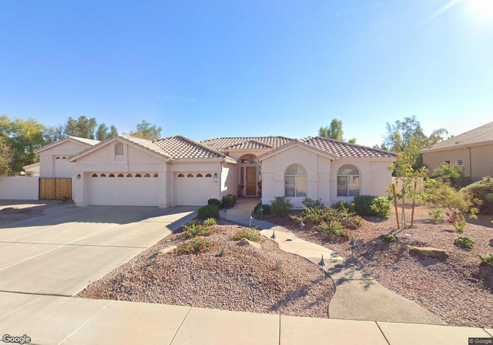
215 S Joan Ln Gilbert, AZ 85296
East Gilbert NeighborhoodEstimated Value: $936,000 - $996,882
Studio
5
Baths
2,952
Sq Ft
$330/Sq Ft
Est. Value
About This Home
This home is located at 215 S Joan Ln, Gilbert, AZ 85296 and is currently estimated at $972,721, approximately $329 per square foot. 215 S Joan Ln is a home located in Maricopa County with nearby schools including Finley Farms Elementary School, Greenfield Junior High School, and Gilbert Arts Academy.
Ownership History
Date
Name
Owned For
Owner Type
Purchase Details
Closed on
Mar 26, 2013
Sold by
Nelson Robert P and Nelson Roxanne S
Bought by
Nelson Robert P and Nelson Roxanne S
Current Estimated Value
Purchase Details
Closed on
May 13, 1996
Sold by
Jackson Properties Inc
Bought by
Nelson Robert P and Nelson Roxane S
Home Financials for this Owner
Home Financials are based on the most recent Mortgage that was taken out on this home.
Original Mortgage
$248,220
Interest Rate
7.8%
Mortgage Type
Seller Take Back
Create a Home Valuation Report for This Property
The Home Valuation Report is an in-depth analysis detailing your home's value as well as a comparison with similar homes in the area
Home Values in the Area
Average Home Value in this Area
Purchase History
| Date | Buyer | Sale Price | Title Company |
|---|---|---|---|
| Nelson Robert P | -- | None Available | |
| Nelson Robert P | $354,966 | Security Title Agency | |
| Jackson Properties Inc | -- | Security Title |
Source: Public Records
Mortgage History
| Date | Status | Borrower | Loan Amount |
|---|---|---|---|
| Closed | Nelson Robert P | $248,220 | |
| Closed | Nelson Robert P | $264,519 |
Source: Public Records
Tax History
| Year | Tax Paid | Tax Assessment Tax Assessment Total Assessment is a certain percentage of the fair market value that is determined by local assessors to be the total taxable value of land and additions on the property. | Land | Improvement |
|---|---|---|---|---|
| 2025 | $4,396 | $54,296 | -- | -- |
| 2024 | $4,234 | $51,711 | -- | -- |
| 2023 | $4,234 | $74,730 | $14,940 | $59,790 |
| 2022 | $4,097 | $55,100 | $11,020 | $44,080 |
| 2021 | $4,259 | $52,360 | $10,470 | $41,890 |
| 2020 | $4,185 | $49,850 | $9,970 | $39,880 |
| 2019 | $3,845 | $48,400 | $9,680 | $38,720 |
| 2018 | $3,728 | $47,020 | $9,400 | $37,620 |
| 2017 | $3,589 | $45,130 | $9,020 | $36,110 |
| 2016 | $3,681 | $44,020 | $8,800 | $35,220 |
| 2015 | $3,320 | $41,510 | $8,300 | $33,210 |
Source: Public Records
Map
Nearby Homes
- 2069 E Sierra Madre Ave
- 2333 E Finley St
- 1745 E Cheyenne St
- 2062 E Palomino Dr
- 1831 E Linda Ln
- 1866 E Sagebrush St
- 1911 E Bruce Ave
- 2601 E Mesquite St
- 1754 E Cotton Ct
- 1894 E Palomino Dr
- 127 N Date Palm Dr
- 1644 E Orangewood St
- 1645 E Orangewood St
- 2222 E Arabian Dr
- 2062 E Arabian Dr
- 1678 E Rawhide St
- 557 S Lemon Ct
- 1735 E Saratoga St
- 2611 E Catclaw St
- 633 S Parkcrest St
- 231 S Joan Ln
- 207 S Joan Ln
- 245 S Joan Ln
- 2130 E Marlene Dr
- 2116 E Marlene Dr
- 2102 E Stephens Rd
- 2093 E Marlene Dr
- 206 S Debra Ct
- 2100 E Marlene Dr
- 2157 E Sierra Madre Ave
- 2139 E Sierra Madre Ave
- 196 S Debra Ct
- 2192 E Stephens Rd Unit 1
- 2175 E Sierra Madre Ave
- 2119 E Sierra Madre Ave
- 2209 E Manor Dr
- 2123 E Stephens Rd
- 2088 E Stephens Rd
- 2111 E Sierra Madre Ave
- 2079 E Marlene Dr
Your Personal Tour Guide
Ask me questions while you tour the home.