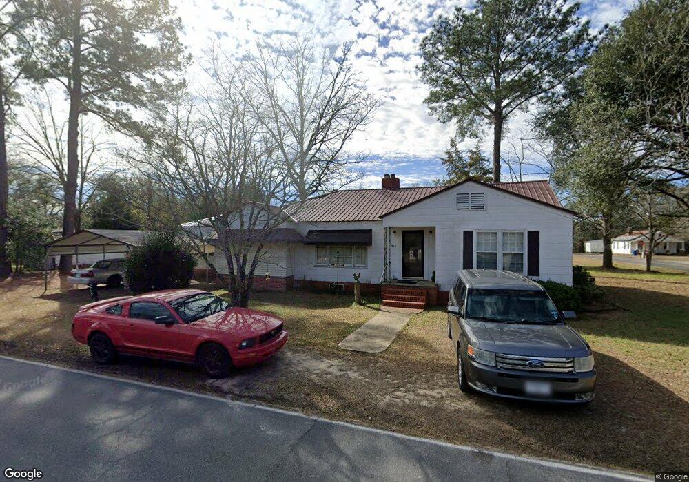
215 SW Holland St Collins, GA 30421
Estimated Value: $98,254 - $170,000
--
Bed
--
Bath
2,060
Sq Ft
$66/Sq Ft
Est. Value
About This Home
This home is located at 215 SW Holland St, Collins, GA 30421 and is currently estimated at $136,314, approximately $66 per square foot. 215 SW Holland St is a home with nearby schools including Tattnall County High School.
Ownership History
Date
Name
Owned For
Owner Type
Purchase Details
Closed on
Jan 7, 2005
Sold by
Harvey Louise
Bought by
Tomlinson Larry C
Current Estimated Value
Home Financials for this Owner
Home Financials are based on the most recent Mortgage that was taken out on this home.
Original Mortgage
$21,215
Outstanding Balance
$10,394
Interest Rate
5.61%
Mortgage Type
New Conventional
Estimated Equity
$125,920
Purchase Details
Closed on
Jun 25, 2002
Sold by
Stafford Robert
Bought by
Harvey Louise
Create a Home Valuation Report for This Property
The Home Valuation Report is an in-depth analysis detailing your home's value as well as a comparison with similar homes in the area
Home Values in the Area
Average Home Value in this Area
Purchase History
| Date | Buyer | Sale Price | Title Company |
|---|---|---|---|
| Tomlinson Larry C | $20,000 | -- | |
| Harvey Louise | -- | -- |
Source: Public Records
Mortgage History
| Date | Status | Borrower | Loan Amount |
|---|---|---|---|
| Open | Tomlinson Larry C | $21,215 |
Source: Public Records
Tax History Compared to Growth
Tax History
| Year | Tax Paid | Tax Assessment Tax Assessment Total Assessment is a certain percentage of the fair market value that is determined by local assessors to be the total taxable value of land and additions on the property. | Land | Improvement |
|---|---|---|---|---|
| 2025 | $875 | $43,040 | $1,280 | $41,760 |
| 2024 | $891 | $30,080 | $1,280 | $28,800 |
| 2023 | $282 | $30,080 | $1,280 | $28,800 |
| 2022 | $644 | $25,000 | $1,280 | $23,720 |
| 2021 | $629 | $25,164 | $1,280 | $23,884 |
| 2020 | $629 | $25,164 | $1,280 | $23,884 |
| 2019 | $611 | $24,040 | $1,280 | $22,760 |
| 2018 | $622 | $24,040 | $1,280 | $22,760 |
| 2017 | $611 | $24,040 | $1,280 | $22,760 |
| 2016 | $630 | $24,200 | $1,280 | $22,920 |
| 2015 | -- | $24,360 | $1,280 | $23,080 |
| 2014 | -- | $20,760 | $1,280 | $19,480 |
| 2013 | -- | $20,760 | $1,280 | $19,480 |
Source: Public Records
Map
Nearby Homes
- 1060 Georgia 292
- 611 NE Pearl St
- 27746 Ga Highway 23
- 75 Rudolph Rd
- 106 Willis Rewis Rd
- 250 Bobby Sapp Rd
- 481 Clifford Purvis Rd
- 92 Graham Ln
- 108 Mccall Ave
- 62 Manassas Station Rd
- 47 Manassas Station Rd
- 211 E Brazell St
- 132 Mimosa Dr
- 319 A Rupert Wood Ln
- 175 E Brazell St
- 1072 Rd
- 104 Azalea Ln
- 2610 U S 280
- 9.59 AC Jarriel's Bridge Spur Rd
- 0 U S Highway 280
- 214 SW Live Oak St SW
- 417 SW Church St
- 412 SW Church St
- 214 SW Church St
- 113 SE Holland St
- 411 SW Church St
- 140 Live Oak St SW
- 203 Live Oak St SW
- 207 Live Oak St SW
- 410 SW Church St
- 108 SW Holland St
- 323 Live Oak St SW
- 247 Live Oak St
- 325 Live Oak St SW
- 111 SE Holland St
- 100 Live Oak St SW
- 137 Live Oak St
- 410 SW Ward St
- 135 Live Oak St SW
- 614 SW Ward St