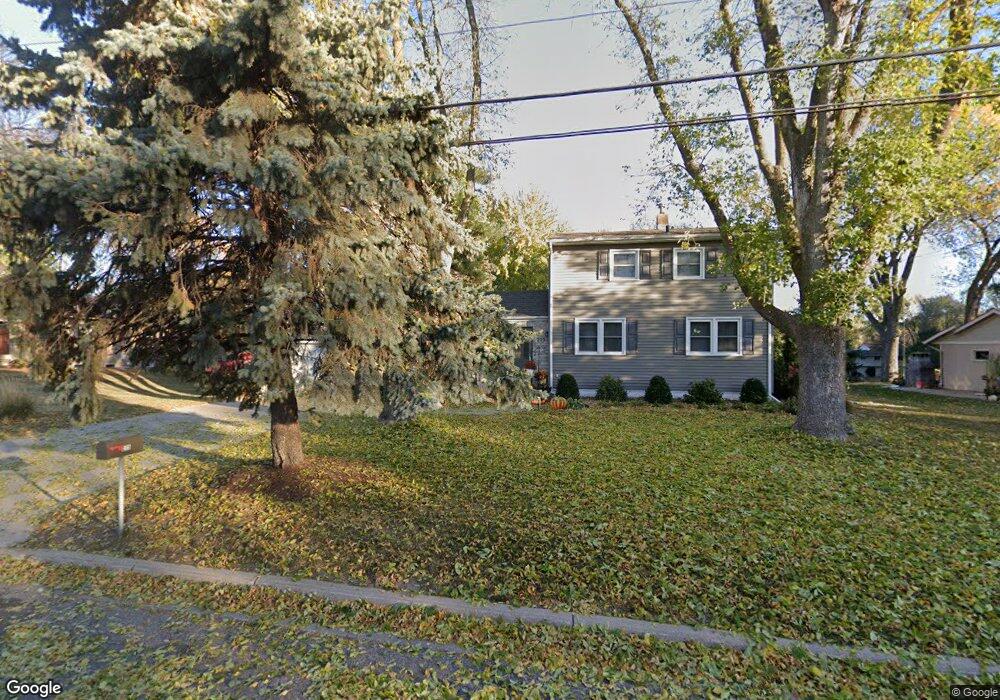
215 Thompson Ave W West St. Paul, MN 55118
Estimated Value: $325,000 - $341,326
3
Beds
1
Bath
1,456
Sq Ft
$229/Sq Ft
Est. Value
About This Home
This home is located at 215 Thompson Ave W, West St. Paul, MN 55118 and is currently estimated at $333,332, approximately $228 per square foot. 215 Thompson Ave W is a home located in Dakota County with nearby schools including Garlough Environmental Magnet, Heritage E-STEM Magnet School, and Two Rivers High School.
Ownership History
Date
Name
Owned For
Owner Type
Purchase Details
Closed on
Jul 15, 2025
Sold by
Bravo Leroy and Bravo Carolee
Bought by
Resemius Sarah and Schultz Joshua
Current Estimated Value
Home Financials for this Owner
Home Financials are based on the most recent Mortgage that was taken out on this home.
Original Mortgage
$269,600
Outstanding Balance
$269,147
Interest Rate
6.89%
Mortgage Type
New Conventional
Estimated Equity
$64,185
Create a Home Valuation Report for This Property
The Home Valuation Report is an in-depth analysis detailing your home's value as well as a comparison with similar homes in the area
Home Values in the Area
Average Home Value in this Area
Purchase History
| Date | Buyer | Sale Price | Title Company |
|---|---|---|---|
| Resemius Sarah | $337,000 | -- |
Source: Public Records
Mortgage History
| Date | Status | Borrower | Loan Amount |
|---|---|---|---|
| Open | Resemius Sarah | $269,600 |
Source: Public Records
Tax History Compared to Growth
Tax History
| Year | Tax Paid | Tax Assessment Tax Assessment Total Assessment is a certain percentage of the fair market value that is determined by local assessors to be the total taxable value of land and additions on the property. | Land | Improvement |
|---|---|---|---|---|
| 2024 | $3,730 | $302,900 | $94,500 | $208,400 |
| 2023 | $3,730 | $308,700 | $100,100 | $208,600 |
| 2022 | $3,400 | $286,400 | $99,700 | $186,700 |
| 2021 | $3,228 | $268,700 | $86,700 | $182,000 |
| 2020 | $3,200 | $254,900 | $82,600 | $172,300 |
| 2019 | $3,252 | $246,200 | $78,600 | $167,600 |
| 2018 | $2,836 | $238,800 | $73,500 | $165,300 |
| 2017 | $2,696 | $219,900 | $70,000 | $149,900 |
| 2016 | $2,732 | $202,700 | $63,700 | $139,000 |
| 2015 | $2,510 | $186,712 | $56,833 | $129,879 |
| 2014 | -- | $165,796 | $51,666 | $114,130 |
| 2013 | -- | $150,644 | $46,797 | $103,847 |
Source: Public Records
Map
Nearby Homes
- 280 Edith Dr
- 69 Langer Cir
- 1450 Bidwell St Unit 110
- 63 Langer Cir
- 170 Wentworth Ave W Unit F
- 1620 Charlton St Unit 109
- 100 Imperial Dr W Unit 204
- 111 Imperial Dr W Unit 102
- 180 Wentworth Ave W Unit E
- 1513 Smith Ave S
- 389 Edith Dr
- 1384 Smith Ave S
- 158 Southwind Ln
- 1277 Hall Ave
- 1220 Stryker Ave
- 25 W Kraft Rd
- 69 Amelia Ave
- 242 Butler Ave W
- 8XX Humboldt Ave
- 8 Dorset Rd
- 215 215 Thompson-Avenue-w
- 209 Thompson Ave W
- 225 Thompson Ave W
- 225 Thompson Ave W
- 225 225 Thompson-Avenue-w
- 235 Thompson Ave W
- 199 Thompson Ave W
- 212-232 Thompson Ave W
- 239 Thompson Ave W
- 193 Thompson Ave W
- 188 188 Thompson-Avenue-w
- 188 188 Thompson Ave W
- 218 Edith Dr
- 1466 Charlton St
- 185 Thompson Ave W
- 1468 Charlton St
- 1460 Charlton St
- 184 184 Thompson-Avenue-w
- 184 184 Thompson Ave W
- 212 Edith Dr