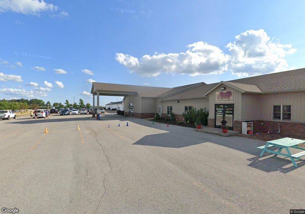
2150 E Le Claire Rd Eldridge, IA 52748
Studio
--
Bath
9,450
Sq Ft
112,820
Sq Ft
About This Home
This home is located at 2150 E Le Claire Rd, Eldridge, IA 52748. 2150 E Le Claire Rd is a home located in Scott County with nearby schools including Alan Shepard Elementary School, North Scott Junior High School, and North Scott Senior High School.
Ownership History
Date
Name
Owned For
Owner Type
Purchase Details
Closed on
Feb 9, 2021
Sold by
The Growing Tree Inc
Bought by
City Of Eldridge
Purchase Details
Closed on
Oct 25, 2018
Sold by
Haedt Chad A and Haedt Alisa A
Bought by
Growing Tree Inc
Purchase Details
Closed on
Jun 11, 2018
Sold by
Tradition Of Eldridge Llc
Bought by
Growing Tree Inc
Home Financials for this Owner
Home Financials are based on the most recent Mortgage that was taken out on this home.
Original Mortgage
$341,907
Interest Rate
4.6%
Mortgage Type
New Conventional
Purchase Details
Closed on
Dec 30, 2008
Sold by
Lindle James J and Lindle Tina J
Bought by
Traditions Of Eldridge Llc
Create a Home Valuation Report for This Property
The Home Valuation Report is an in-depth analysis detailing your home's value as well as a comparison with similar homes in the area
Home Values in the Area
Average Home Value in this Area
Purchase History
| Date | Buyer | Sale Price | Title Company |
|---|---|---|---|
| City Of Eldridge | $1,000 | None Available | |
| Growing Tree Inc | -- | -- | |
| Growing Tree Inc | -- | -- | |
| Traditions Of Eldridge Llc | -- | None Available |
Source: Public Records
Mortgage History
| Date | Status | Borrower | Loan Amount |
|---|---|---|---|
| Previous Owner | Growing Tree Inc | $341,907 |
Source: Public Records
Tax History
| Year | Tax Paid | Tax Assessment Tax Assessment Total Assessment is a certain percentage of the fair market value that is determined by local assessors to be the total taxable value of land and additions on the property. | Land | Improvement |
|---|---|---|---|---|
| 2023 | -- | $0 | $0 | $0 |
| 2022 | $0 | $0 | $0 | $0 |
| 2021 | $15,398 | $739,470 | $71,800 | $667,670 |
| 2020 | $15,280 | $734,510 | $71,800 | $662,710 |
| 2019 | $15,260 | $734,510 | $71,800 | $662,710 |
| 2018 | $15,956 | $734,510 | $71,800 | $662,710 |
| 2017 | $15,674 | $734,510 | $71,800 | $662,710 |
| 2016 | $15,690 | $726,060 | $0 | $0 |
| 2015 | $16,278 | $0 | $0 | $0 |
| 2014 | $15,422 | $0 | $0 | $0 |
| 2013 | $18,276 | $0 | $0 | $0 |
| 2012 | -- | $694,230 | $89,750 | $604,480 |
Source: Public Records
Map
Nearby Homes
- 800 N 16th Ave
- 307 E Donahue St
- 319 E Donahue St
- 0 S 6th Unit 4104359
- 420 E Franklin St Unit 104
- 547 N 4th Ave
- 541 N 4th Ave
- 559 N 4th Ave
- 535 N 4th Ave
- 534 N 4th Ave
- 546 N 4th Ave
- 522 N 4th Ave
- 464 N 4th Ave
- 452 N 4th Ave
- 361 E Donahue St
- 300 E Franklin St Unit 203
- 301 E Donahue St
- 210 E Franklin St Unit 101
- 213 E Price St Unit 202
- 101 W Sheridan Dr
- 2150 E Le Claire Rd
- 2100 E Leclaire Rd
- 2100 E Le Claire Rd
- 2100 E Leclaire Rd Unit A B C D
- 2100 E Leclaire Rd Unit A
- 2100 E Leclaire Rd Unit C
- 2100 E Leclaire Rd Unit B
- 2100 E Leclaire Rd Unit D
- 2020 E Le Claire Rd
- 2200 E Leclaire Rd
- 120 N Scott Park Rd
- 2319 E Leclaire Rd
- Lot 2 Lobos Addition
- 116 S Scott Park Rd
- 304 N Scott Park Rd
- 304 N Scott Park Rd
- 2307 E Leclaire Rd
- 131 S Scott Park Rd
- 135 S Scott Park Rd
- 2313 E Leclaire Rd
Your Personal Tour Guide
Ask me questions while you tour the home.