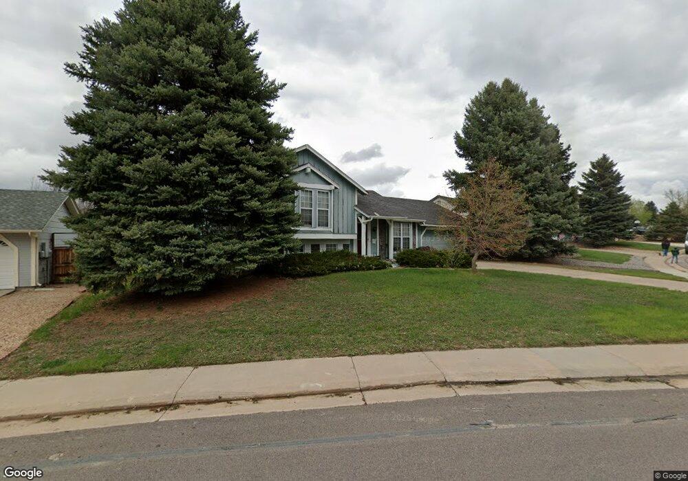
21501 E Powers Cir N Centennial, CO 80015
Park View NeighborhoodEstimated Value: $477,255 - $488,000
2
Beds
2
Baths
1,164
Sq Ft
$413/Sq Ft
Est. Value
About This Home
This home is located at 21501 E Powers Cir N, Centennial, CO 80015 and is currently estimated at $480,564, approximately $412 per square foot. 21501 E Powers Cir N is a home located in Arapahoe County with nearby schools including Canyon Creek Elementary School, Thunder Ridge Middle School, and Cherokee Trail High School.
Ownership History
Date
Name
Owned For
Owner Type
Purchase Details
Closed on
Aug 12, 1987
Sold by
Icm Mortgage Corp
Bought by
Baker Carol J Baker Clarence L
Current Estimated Value
Purchase Details
Closed on
Jul 29, 1987
Sold by
Conversion Arapco
Bought by
Icm Mortgage Corp
Purchase Details
Closed on
Jul 1, 1985
Sold by
Conversion Arapco
Bought by
Conversion Arapco
Purchase Details
Closed on
May 1, 1984
Sold by
Conversion Arapco
Bought by
Conversion Arapco
Purchase Details
Closed on
Jul 1, 1983
Bought by
Conversion Arapco
Create a Home Valuation Report for This Property
The Home Valuation Report is an in-depth analysis detailing your home's value as well as a comparison with similar homes in the area
Home Values in the Area
Average Home Value in this Area
Purchase History
| Date | Buyer | Sale Price | Title Company |
|---|---|---|---|
| Baker Carol J Baker Clarence L | -- | -- | |
| Icm Mortgage Corp | -- | -- | |
| Conversion Arapco | -- | -- | |
| Conversion Arapco | -- | -- | |
| Conversion Arapco | -- | -- |
Source: Public Records
Tax History
| Year | Tax Paid | Tax Assessment Tax Assessment Total Assessment is a certain percentage of the fair market value that is determined by local assessors to be the total taxable value of land and additions on the property. | Land | Improvement |
|---|---|---|---|---|
| 2025 | $3,414 | $31,106 | -- | -- |
| 2024 | $3,035 | $32,435 | -- | -- |
| 2023 | $3,035 | $32,435 | $0 | $0 |
| 2022 | $2,412 | $24,277 | $0 | $0 |
| 2021 | $2,421 | $24,277 | $0 | $0 |
| 2020 | $2,480 | $25,404 | $0 | $0 |
| 2019 | $2,393 | $25,404 | $0 | $0 |
| 2018 | $2,190 | $20,750 | $0 | $0 |
| 2017 | $2,154 | $20,750 | $0 | $0 |
| 2016 | $2,194 | $20,075 | $0 | $0 |
| 2015 | $2,118 | $20,075 | $0 | $0 |
| 2014 | $1,616 | $13,834 | $0 | $0 |
| 2013 | -- | $13,620 | $0 | $0 |
Source: Public Records
Map
Nearby Homes
- 21631 E Crestridge Place
- 21238 E Powers Place
- 21417 E Crestridge Place
- 5503 S Malta St
- 5523 S Malta St
- 5839 S Perth Place
- 21920 E Powers Dr
- 21903 E Crestline Ln
- 5915 S Nepal St
- 21984 E Crestline Ln
- 5883 S Quemoy Cir
- 5412 S Quatar Cir
- 5853 S Quemoy Cir
- 5716 S Lisbon Way
- 22156 E Berry Place
- 20786 E Powers Cir
- 5414 S Rome St
- 5633 S Sicily Cir
- 5555 S Rome St
- 5466 S Shawnee Way
- 21489 E Powers Ave
- 21521 E Powers Cir N
- 21429 E Powers Ave
- 21541 E Powers Cir N
- 21490 E Powers Ave
- 5606 S Odessa St
- 21430 E Powers Ave
- 21387 E Powers Ave
- 21551 E Powers Cir N
- 21522 E Powers Cir N
- 5626 S Odessa St
- 21388 E Powers Ave
- 5625 S Odessa St
- 21542 E Powers Cir N
- 21357 E Powers Ave
- 21571 E Powers Cir N
- 21523 E Powers Place
- 21358 E Powers Ave
- 21543 E Powers Place
- 5645 S Odessa St
Your Personal Tour Guide
Ask me questions while you tour the home.