Estimated Value: $151,000 - $175,000
3
Beds
2
Baths
1,592
Sq Ft
$105/Sq Ft
Est. Value
About This Home
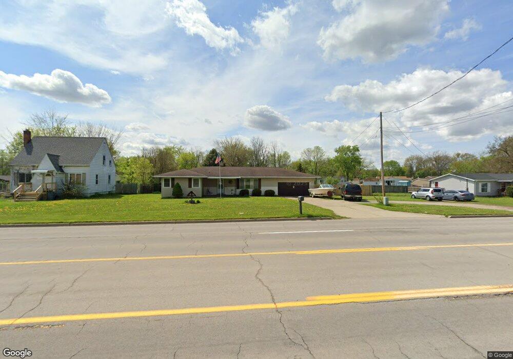
This home is located at 2152 S Dye Rd, Flint, MI 48532 and is currently estimated at $167,795, approximately $105 per square foot. 2152 S Dye Rd is a home located in Genesee County with nearby schools including Carman-Ainsworth High School, Genesee STEM Academy, and First Flint Seventh-day Adventist Christian School.
Ownership History
Date
Name
Owned For
Owner Type
Purchase Details
Closed on
Aug 20, 2021
Sold by
Ketchum Bradley H
Bought by
Ketchum Barry
Current Estimated Value
Purchase Details
Closed on
Jul 28, 2021
Sold by
Griffus Debra A
Bought by
Ketchum Bradley H
Purchase Details
Closed on
Dec 5, 2011
Sold by
Ketchum Wilbur D
Bought by
Ketchum Bradley H
Purchase Details
Closed on
Feb 12, 2007
Sold by
Ketchum Wilber D and Ketchum Frances N
Bought by
Ketchum Wilber D and Ketchum Frances N
Home Financials for this Owner
Home Financials are based on the most recent Mortgage that was taken out on this home.
Original Mortgage
$95,200
Interest Rate
6.27%
Mortgage Type
New Conventional
Create a Home Valuation Report for This Property
The Home Valuation Report is an in-depth analysis detailing your home's value as well as a comparison with similar homes in the area
Home Values in the Area
Average Home Value in this Area
Purchase History
| Date | Buyer | Sale Price | Title Company |
|---|---|---|---|
| Ketchum Barry | -- | Sargents Title Company | |
| Ketchum Bradley H | -- | None Listed On Document | |
| Ketchum Bradley H | -- | None Available | |
| Ketchum Wilber D | -- | Cislo Title Co |
Source: Public Records
Mortgage History
| Date | Status | Borrower | Loan Amount |
|---|---|---|---|
| Previous Owner | Ketchum Wilber D | $95,200 |
Source: Public Records
Tax History
| Year | Tax Paid | Tax Assessment Tax Assessment Total Assessment is a certain percentage of the fair market value that is determined by local assessors to be the total taxable value of land and additions on the property. | Land | Improvement |
|---|---|---|---|---|
| 2025 | $2,961 | $65,300 | $0 | $0 |
| 2024 | $1,548 | $66,200 | $0 | $0 |
| 2023 | $1,581 | $58,000 | $0 | $0 |
| 2022 | $1,140 | $50,700 | $0 | $0 |
| 2021 | $2,216 | $48,700 | $0 | $0 |
| 2020 | $1,009 | $48,200 | $0 | $0 |
| 2019 | $995 | $47,700 | $0 | $0 |
| 2018 | $1,851 | $44,700 | $0 | $0 |
| 2017 | $1,777 | $44,700 | $0 | $0 |
| 2016 | $1,816 | $43,900 | $0 | $0 |
| 2015 | $1,671 | $43,900 | $0 | $0 |
| 2014 | $991 | $42,000 | $0 | $0 |
| 2012 | -- | $42,000 | $42,000 | $0 |
Source: Public Records
Map
Nearby Homes
- 5290 Brobeck St
- 5323 Elmsford Dr
- 5227 Dania St
- 5200 Elko St
- 5151 Brobeck St
- 5423 Meadowcrest Dr
- 0000 Reuben Reuben St
- 1460 S Dye Rd
- 2356 S Dye Rd
- 2521 White Oak Place
- 1455 S Linden Rd
- 6007 Corunna Rd
- 5526 Corunna Rd
- 1417 Grassmere Ave
- 1442 Mintola Ave
- 4480 Corunna Rd
- 4474 Corunna Rd
- 10 Acres T A Mansour Blvd
- 3.9 Acres W Court St
- 6090 Lancaster Dr
- 2158 S Dye Rd
- 2140 S Dye Rd
- 2164 S Dye Rd
- 2128 S Dye Rd Unit Bldg-Unit
- 2128 S Dye Rd
- 5305 Elmsford Dr
- 5249 Dania St
- 2157 S Dye Rd
- 2133 S Dye Rd
- 2133 S Dye Rd
- 2127 Deerfield Dr
- 2118 S Dye Rd
- 2121 Deerfield Dr
- 5246 Dania St Unit Bldg-Unit
- 5246 Dania St
- 5241 Dania St
- 2188 S Dye Rd
- 5311 Elmsford Dr
- 2173 S Dye Rd Unit Bldg-Unit
- 2173 S Dye Rd
Your Personal Tour Guide
Ask me questions while you tour the home.