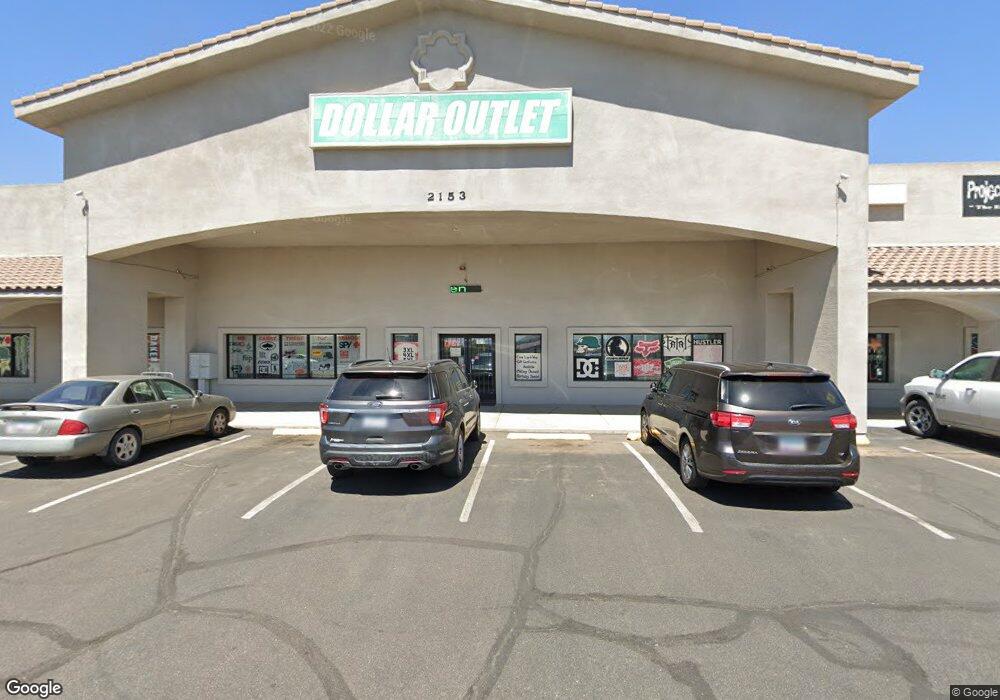
2153 E Gordon Dr Kingman, AZ 86409
--
Bed
--
Bath
24,060
Sq Ft
2.04
Acres
About This Home
This home is located at 2153 E Gordon Dr, Kingman, AZ 86409. 2153 E Gordon Dr is a home located in Mohave County with nearby schools including Manzanita Elementary School, Kingman Middle School, and Kingman High School.
Ownership History
Date
Name
Owned For
Owner Type
Purchase Details
Closed on
Jan 3, 2003
Sold by
Orr Kevin C and Orr Yvonne J
Bought by
Orb Investments Llc
Purchase Details
Closed on
Dec 20, 2002
Sold by
Smith Clifford Arthur
Bought by
Orr Kevin C and Orr Yvonne J
Purchase Details
Closed on
Dec 14, 2001
Sold by
Khan M Azam
Bought by
Orr Kevin C and Orr Yvonne J
Home Financials for this Owner
Home Financials are based on the most recent Mortgage that was taken out on this home.
Original Mortgage
$40,000
Interest Rate
7.08%
Mortgage Type
Purchase Money Mortgage
Create a Home Valuation Report for This Property
The Home Valuation Report is an in-depth analysis detailing your home's value as well as a comparison with similar homes in the area
Home Values in the Area
Average Home Value in this Area
Purchase History
| Date | Buyer | Sale Price | Title Company |
|---|---|---|---|
| Orb Investments Llc | $66,322 | -- | |
| Orr Kevin C | $35,750 | -- | |
| Orr Kevin C | $60,000 | First American Title |
Source: Public Records
Mortgage History
| Date | Status | Borrower | Loan Amount |
|---|---|---|---|
| Previous Owner | Orr Kevin C | $40,000 |
Source: Public Records
Tax History Compared to Growth
Tax History
| Year | Tax Paid | Tax Assessment Tax Assessment Total Assessment is a certain percentage of the fair market value that is determined by local assessors to be the total taxable value of land and additions on the property. | Land | Improvement |
|---|---|---|---|---|
| 2026 | -- | -- | -- | -- |
| 2025 | $25,990 | $418,293 | $0 | $0 |
| 2024 | $25,990 | $399,688 | $0 | $0 |
| 2023 | $25,990 | $301,714 | $0 | $0 |
| 2022 | $25,008 | $305,267 | $0 | $0 |
| 2021 | $25,533 | $249,610 | $0 | $0 |
| 2019 | $23,283 | $254,517 | $0 | $0 |
| 2018 | $23,607 | $261,021 | $0 | $0 |
| 2017 | $21,880 | $255,682 | $0 | $0 |
| 2016 | $20,865 | $240,415 | $0 | $0 |
| 2015 | $21,558 | $152,908 | $0 | $0 |
Source: Public Records
Map
Nearby Homes
- 2131 Alan Ladd Dr
- 2142 Alan Ladd Dr
- 2251 Alan Ladd Dr
- 2232 Alan Ladd Dr
- 2214 Alan Ladd Dr
- 2247 Alan Ladd Dr
- 3962 Rex Allen Cir
- 3963 Rex Allen Cir
- 3958 Rex Allen Ct
- 3956 Rex Allen Ct
- 3937 Rex Allen Dr
- 3940 Rex Allen Dr
- 2117 Rex Allen Dr
- 4100 N Skylark Rd
- 3935 Alan Ladd Dr
- 3955 Alan Ladd Dr
- 3950 Alan Ladd Dr
- 3942 Alan Ladd Dr
- 3974 Alan Ladd Dr
- 2085 John Wayne Dr
- 4025 N Bond St
- 2115 Alan Ladd Dr
- 4025 N Skylark Rd
- 2225 E Gordon Dr
- 2263 Alan Ladd Dr
- 2271 Alan Ladd Dr
- 4040 N Skylark Rd
- 4020 N Bond St
- 2099 Alan Ladd Dr
- 4045 N Bond St
- 2091 Alan Ladd Dr
- 3968 Walleck Ranch Dr
- 2055 Gordon Dr
- 3971 Walleck Ranch Dr
- 2085 Alan Ladd Dr
- 4045 N Skylark Rd
- 3962 Walleck Ranch Dr
- 4040 Bond
- 4040 N Bond St
- 3965 Walleck Ranch Dr
