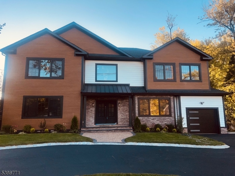
2154 W Broad St Scotch Plains, NJ 07076
Estimated payment $9,599/month
Highlights
- Deck
- Contemporary Architecture
- 1 Car Attached Garage
- William J. McGinn Elementary School Rated A-
- Circular Driveway
- 5-minute walk to Brookside Park
About This Home
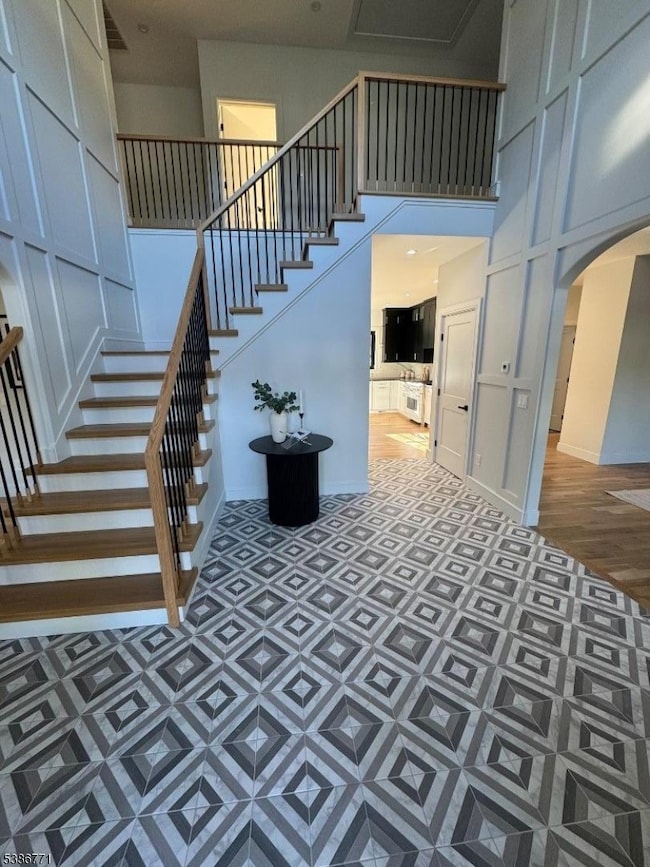
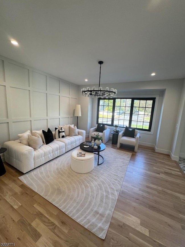
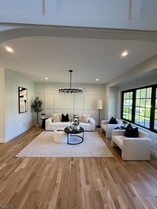
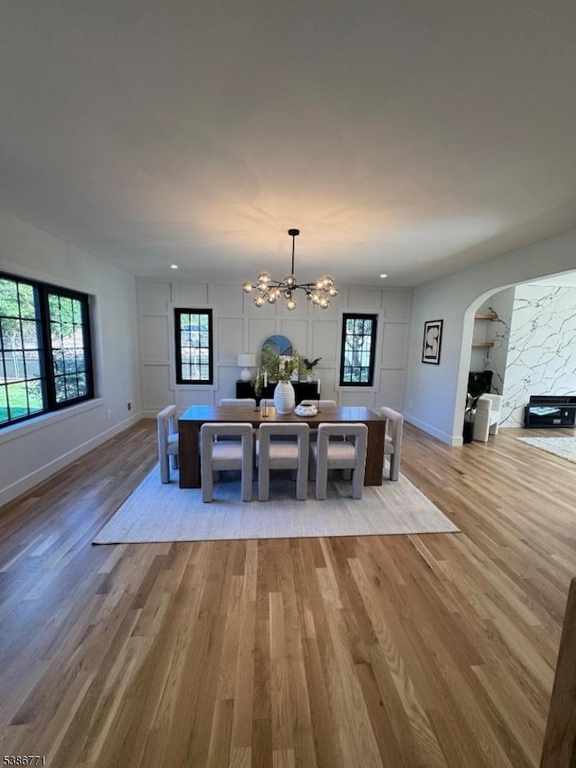
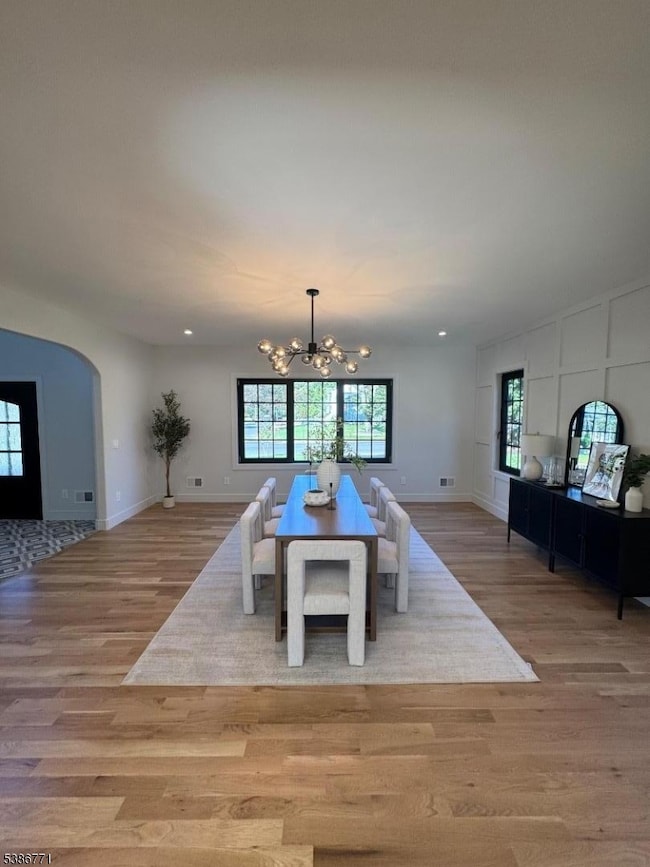
Experience the pinnacle of refined living in this fully renovated, meticulously designed 6-bedroom, 5.5-bath luxury residence. This exceptional home offers not only spacious and elegant accommodations but also the functionality today's lifestyle demands, including a beautifully finished basement designed for both entertainment and relaxation. The gourmet kitchen is a chef's dream, featuring high-end cafe appliances, custom cabinetry, and ample counter space for culinary creativity. Four heating and cooling systems ensure personalized climate control and year-round comfort throughout the home. 5 bedrooms include an en-suite bath, providing ultimate privacy and convenience. Situated in a quiet, upscale neighborhood, the home offers a serene retreat while remaining just minutes away from the energy of vibrant downtown, fine dining, cultural attractions, and premier shopping destinations. This home seamlessly combines timeless elegance, modern comfort, and unmatched convenience making it the ideal sanctuary for sophisticated living.
Listing Agent
DANIELLE JENKINS
EXIT PLATINUM REALTY Brokerage Phone: 862-684-8149 Listed on: 09/25/2025
Home Details
Home Type
- Single Family
Est. Annual Taxes
- $14,192
Year Built
- Built in 1960 | Remodeled
Lot Details
- 0.36 Acre Lot
Parking
- 1 Car Attached Garage
- Inside Entrance
- Garage Door Opener
- Circular Driveway
- Off-Street Parking
Home Design
- Contemporary Architecture
- Metal Roof
- Stone Siding
- Siding
- Composite Building Materials
Interior Spaces
- 4,800 Sq Ft Home
- Family Room with Fireplace
Kitchen
- Breakfast Bar
- Gas Oven or Range
- Dishwasher
- Kitchen Island
Bedrooms and Bathrooms
- 6 Bedrooms
Laundry
- Dryer
- Washer
Finished Basement
- Walk-Out Basement
- Basement Fills Entire Space Under The House
- French Drain
Outdoor Features
- Deck
- Storage Shed
Utilities
- Zoned Heating and Cooling
- Two Cooling Systems Mounted To A Wall/Window
- Multiple Heating Units
Listing and Financial Details
- Assessor Parcel Number 2916-10001-0000-00007-0000-
Map
Home Values in the Area
Average Home Value in this Area
Tax History
| Year | Tax Paid | Tax Assessment Tax Assessment Total Assessment is a certain percentage of the fair market value that is determined by local assessors to be the total taxable value of land and additions on the property. | Land | Improvement |
|---|---|---|---|---|
| 2025 | $14,192 | $120,600 | $36,400 | $84,200 |
| 2024 | $13,774 | $120,600 | $36,400 | $84,200 |
| 2023 | $13,774 | $120,600 | $36,400 | $84,200 |
| 2022 | $13,610 | $120,600 | $36,400 | $84,200 |
| 2021 | $13,587 | $120,600 | $36,400 | $84,200 |
| 2020 | $13,522 | $120,600 | $36,400 | $84,200 |
| 2019 | $13,422 | $120,600 | $36,400 | $84,200 |
| 2018 | $13,196 | $120,600 | $36,400 | $84,200 |
| 2017 | $12,903 | $120,600 | $36,400 | $84,200 |
| 2016 | $12,655 | $120,600 | $36,400 | $84,200 |
| 2015 | $12,197 | $120,600 | $36,400 | $84,200 |
| 2014 | $11,787 | $120,600 | $36,400 | $84,200 |
Property History
| Date | Event | Price | List to Sale | Price per Sq Ft |
|---|---|---|---|---|
| 10/20/2025 10/20/25 | Price Changed | $1,600,000 | -3.0% | $333 / Sq Ft |
| 10/04/2025 10/04/25 | For Sale | $1,650,000 | -- | $344 / Sq Ft |
Purchase History
| Date | Type | Sale Price | Title Company |
|---|---|---|---|
| Deed | $670,000 | Shepherd Title | |
| Deed | $670,000 | Shepherd Title | |
| Deed | $670,000 | Shepherd Title |
Mortgage History
| Date | Status | Loan Amount | Loan Type |
|---|---|---|---|
| Previous Owner | $1,041,000 | Credit Line Revolving |
Source: Garden State MLS
MLS Number: 3989118
APN: 16-10001-0000-00007
Disclaimer: Certain information contained herein is derived from information provided by parties other than Homes.com. All information provided is deemed reliable, but is not guaranteed to be accurate and should be independently verified.
![]() The data relating to real estate for sale on this website comes in part from the IDX Program of Garden State Multiple Listing Service, L.L.C. Real estate listings held by other brokerage firms are marked as IDX Listing.
The data relating to real estate for sale on this website comes in part from the IDX Program of Garden State Multiple Listing Service, L.L.C. Real estate listings held by other brokerage firms are marked as IDX Listing.
Information deemed reliable but not guaranteed.
Copyright © 2025 Garden State Multiple Listing Service, L.L.C. All rights reserved.
Notice: The dissemination of listings on this website does not constitute the consent required by N.J.A.C. 11:5.6.1 (n) for the advertisement of listings exclusively for sale by another broker. Any such consent must be obtained in writing from the listing broker.
This information is being provided for Consumers’ personal, non-commercial use and may not be used for any purpose other than to identify prospective properties Consumers may be interested in purchasing.
- 119 Lamberts Mill Rd
- 1466 Lamberts Mill Rd
- 2 Brookside Ct
- 554 Hort St
- 1933 W Broad St
- 524 Edgar Rd
- 525 Edgar Rd
- 1933 Mary Ellen Ln
- 614 Dorian Rd
- 779 Lamberts Mill Rd
- 2212 Shady Ln
- 724 South Ave W Unit 724A
- 350 W Dudley Ave
- 4 Brandywine Ct
- 2314 Longfellow Ave
- 2 Dutch Ln
- 538 Westfield Ave
- 2219 North Ave Unit 6
- 57 Rambling Dr
- 187 King St
- 787 W Broad St Unit 2
- 634 W Broad St Unit Floor 2
- 634 W Broad St
- 575 1st St
- 443 Downer St
- 458 W Broad St
- 722 Hyslip Ave
- 802 South Ave W Unit 2A
- 809 North Ave W
- 339 W Broad St
- 339 W Broad St Unit 304
- 501 South Ave W Unit 208
- 734 Rahway Ave
- 115 Ludlow Place
- 11 Maclennan Place Unit A
- 1 Lincoln Plaza
- 109 E Broad St Unit F
- 224 Prospect St Unit 5A
- 224 Prospect St Unit 224 Prospect Street 5A
- 310 Prospect St