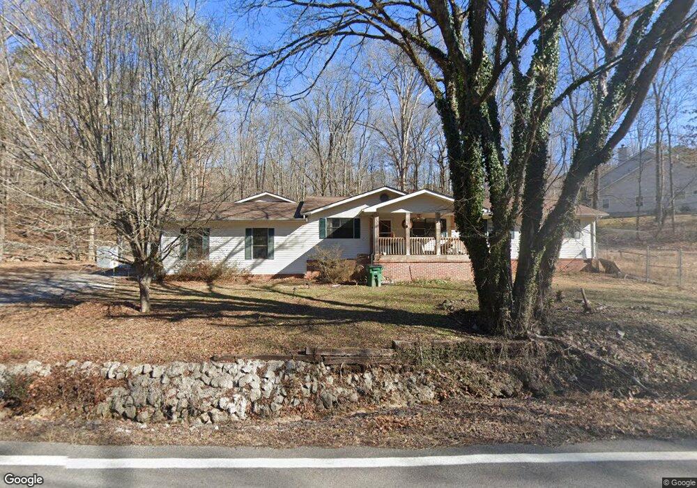
2155 Gold Point Cir S Hixson, TN 37343
Estimated Value: $400,000 - $469,000
4
Beds
3
Baths
2,500
Sq Ft
$172/Sq Ft
Est. Value
About This Home
This home is located at 2155 Gold Point Cir S, Hixson, TN 37343 and is currently estimated at $430,287, approximately $172 per square foot. 2155 Gold Point Cir S is a home located in Hamilton County with nearby schools including McConnell Elementary School, Loftis Middle School, and Hixson High School.
Ownership History
Date
Name
Owned For
Owner Type
Purchase Details
Closed on
Jun 27, 2007
Sold by
Hotle Valerie
Bought by
Cox Hurshell Ray and Letson Sheila
Current Estimated Value
Home Financials for this Owner
Home Financials are based on the most recent Mortgage that was taken out on this home.
Original Mortgage
$184,500
Interest Rate
6.16%
Mortgage Type
Seller Take Back
Purchase Details
Closed on
Jun 1, 2006
Sold by
The Title Guaranty & Tr Co Chattanooga
Bought by
Hotle Valerie
Purchase Details
Closed on
Sep 20, 2005
Sold by
Folkner James A
Bought by
The Title Guaranty & Trust Co Of Chattan
Purchase Details
Closed on
Jun 20, 2001
Sold by
Kay Craft Joe Kenneth and Kay Debra
Bought by
Folkner James A
Create a Home Valuation Report for This Property
The Home Valuation Report is an in-depth analysis detailing your home's value as well as a comparison with similar homes in the area
Home Values in the Area
Average Home Value in this Area
Purchase History
| Date | Buyer | Sale Price | Title Company |
|---|---|---|---|
| Cox Hurshell Ray | $194,500 | First Title | |
| Hotle Valerie | $240,000 | None Available | |
| The Title Guaranty & Trust Co Of Chattan | -- | Title Guaranty & Trust | |
| Folkner James A | $86,000 | Legal Title & Escrow Inc |
Source: Public Records
Mortgage History
| Date | Status | Borrower | Loan Amount |
|---|---|---|---|
| Closed | Cox Hurshell Ray | $184,500 |
Source: Public Records
Tax History Compared to Growth
Tax History
| Year | Tax Paid | Tax Assessment Tax Assessment Total Assessment is a certain percentage of the fair market value that is determined by local assessors to be the total taxable value of land and additions on the property. | Land | Improvement |
|---|---|---|---|---|
| 2024 | $1,347 | $60,200 | $0 | $0 |
| 2023 | $1,356 | $60,200 | $0 | $0 |
| 2022 | $1,356 | $60,200 | $0 | $0 |
| 2021 | $1,356 | $60,200 | $0 | $0 |
| 2020 | $1,463 | $52,575 | $0 | $0 |
| 2019 | $1,463 | $52,575 | $0 | $0 |
| 2018 | $1,463 | $52,575 | $0 | $0 |
| 2017 | $1,463 | $52,575 | $0 | $0 |
| 2016 | $1,247 | $0 | $0 | $0 |
| 2015 | $1,247 | $44,775 | $0 | $0 |
| 2014 | $1,247 | $0 | $0 | $0 |
Source: Public Records
Map
Nearby Homes
- 1826 Rock Bluff Rd Unit 5
- 1926 Rock Bluff Rd
- 6507 Shallow Mar Ln
- 6572 Fairview Rd
- 2112 River Bluff Dr
- 6517 Shelter Cove Dr
- 0 Hixson Pike Unit RTC3015987
- 0 Hixson Pike Unit 1522313
- The Norwood II Plan at Emerson Ridge
- The Maddux II Plan at Emerson Ridge
- The Ellison II Plan at Emerson Ridge
- 1949 Farmstead Dr
- 6970 Bullock Way
- 1924 Bay Pointe Dr
- 7857 Parkshore Cir
- 000 Hixson Pike
- 6512 Fairview Rd
- 6853 Manassas Gap Ln
- 1341 Jackson Mill Dr
- Edmon Plan at The Cove at Thrasher Landing
- 2303 Gold Point Cir S
- 2303 Gold Point Cir S
- 2149 Gold Point Cir S
- 2311 Gold Point Cir S
- 2139 Gold Point Cir S
- 2315 Gold Point Cir S
- 2113 Gold Point Cir S
- 2312 Gold Point Cir S
- 2318 Gold Point Cir S
- 2319 Gold Point Cir S
- 2121 Gold Point Cir S
- 6615 White Sands Ln Unit 7
- 6613 White Sands Ln
- 6619 White Sands Ln
- 6621 White Sands Ln
- 6721 Country Oaks Ln
- 6623 White Sands Ln
- 6623 White Sands Ln Unit 731
- 6611 White Sands Ln Unit 7
- 2326 Gold Point Cir S