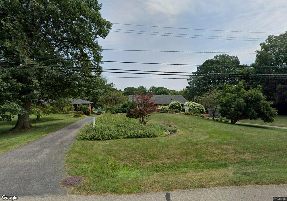
21587 Thorofare Rd Grosse Ile, MI 48138
Estimated Value: $484,460 - $641,000
--
Bed
1
Bath
2,374
Sq Ft
$232/Sq Ft
Est. Value
About This Home
This home is located at 21587 Thorofare Rd, Grosse Ile, MI 48138 and is currently estimated at $549,615, approximately $231 per square foot. 21587 Thorofare Rd is a home located in Wayne County with nearby schools including St. Cyprian Elementary School.
Ownership History
Date
Name
Owned For
Owner Type
Purchase Details
Closed on
Mar 25, 2014
Sold by
Noyce John Henry and Noyce Marjorie Ann
Bought by
Lakataosh Keith W and Lakatosh Heather N
Current Estimated Value
Purchase Details
Closed on
Jan 17, 2012
Sold by
Noyce John H and Noyce Marjorie
Bought by
Noyce John Henry and Noyce Marjorie Ann
Create a Home Valuation Report for This Property
The Home Valuation Report is an in-depth analysis detailing your home's value as well as a comparison with similar homes in the area
Home Values in the Area
Average Home Value in this Area
Purchase History
| Date | Buyer | Sale Price | Title Company |
|---|---|---|---|
| Lakataosh Keith W | $312,500 | Michigan Title Insurance Age | |
| Noyce John Henry | -- | None Available |
Source: Public Records
Tax History Compared to Growth
Tax History
| Year | Tax Paid | Tax Assessment Tax Assessment Total Assessment is a certain percentage of the fair market value that is determined by local assessors to be the total taxable value of land and additions on the property. | Land | Improvement |
|---|---|---|---|---|
| 2025 | $3,214 | $245,200 | $0 | $0 |
| 2024 | $3,214 | $233,900 | $0 | $0 |
| 2023 | $3,677 | $229,800 | $0 | $0 |
| 2022 | $8,557 | $214,100 | $0 | $0 |
| 2021 | $8,186 | $197,600 | $0 | $0 |
| 2019 | $8,118 | $189,000 | $0 | $0 |
| 2018 | $3,491 | $185,200 | $0 | $0 |
| 2017 | $9,015 | $179,800 | $0 | $0 |
| 2016 | $7,978 | $171,800 | $0 | $0 |
| 2015 | $17,020 | $170,200 | $0 | $0 |
| 2013 | $16,970 | $174,600 | $0 | $0 |
| 2012 | $3,571 | $166,600 | $77,000 | $89,600 |
Source: Public Records
Map
Nearby Homes
- 21644 Knudsen Dr
- 21819 Meridian Rd
- 21438 Meridian Rd
- 22133 Meridian Rd
- 21321 Knudsen Dr
- 21071 Thorofare Rd
- 9281 Island Dr
- 8614 Island Blvd
- 22015 Ember Ct
- 9447 Whitall Ln
- 8232 Island Blvd
- 21599 Parke Ln
- 7806 Island Blvd
- 21604 E River Rd
- 9000 Ferry Rd
- 22271 W River Rd
- 22220 E River Rd
- 0 Ferry Rd Unit 20250033371
- 8855 Ferry Rd
- Lot 503 Gi Pkwy
- 21567 Thorofare Rd
- 21615 Thorofare Rd
- 21545 Thorofare Rd
- 21645 Thorofare Rd
- 21630 Knudsen Dr
- 21531 Thorofare Rd
- 21608 Thorofare Rd
- 21660 Knudsen Dr
- 21618 Knudsen Dr
- 21681 Thorofare Rd
- 21644 Thorofare Rd
- 21540 Thorofare Rd Unit Bldg-Unit
- 21540 Thorofare Rd
- 21676 Knudsen Dr
- 21692 Knudsen Dr
- 21515 Thorofare Rd
- 21524 Thorofare Rd
- 21725 Thorofare Rd
- 8574 Concord Rd
- 21716 Knudsen Dr