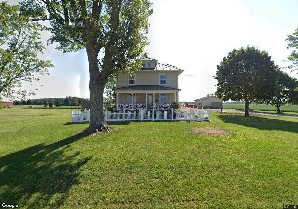
2159 Isaac Beal Rd Bucyrus, OH 44820
Estimated Value: $146,000 - $266,000
4
Beds
2
Baths
960
Sq Ft
$222/Sq Ft
Est. Value
About This Home
This home is located at 2159 Isaac Beal Rd, Bucyrus, OH 44820 and is currently estimated at $213,215, approximately $222 per square foot. 2159 Isaac Beal Rd is a home located in Crawford County with nearby schools including Bucyrus Elementary School, Bucyrus Secondary School, and CENTER FOR AUTISM / DYSLEXIA - BUCYRUS.
Ownership History
Date
Name
Owned For
Owner Type
Purchase Details
Closed on
Mar 30, 2019
Sold by
Greenick Raymond T and Greenick Barbara J
Bought by
Hiler Heather R and Raymond And Barbara Greenick Irlt
Current Estimated Value
Purchase Details
Closed on
Jan 8, 2018
Sold by
Greenick Ryamond T and Greenick Barbara J
Bought by
Hord Livestock Compnay Inc
Purchase Details
Closed on
Oct 14, 2011
Sold by
Greenick Raymond T and Greenick Barbara J
Bought by
The Peoples Savings And Loan Co
Home Financials for this Owner
Home Financials are based on the most recent Mortgage that was taken out on this home.
Original Mortgage
$186,500
Interest Rate
4.12%
Purchase Details
Closed on
Dec 10, 2002
Bought by
Greenick Barbara J and Greenick Raymond T
Create a Home Valuation Report for This Property
The Home Valuation Report is an in-depth analysis detailing your home's value as well as a comparison with similar homes in the area
Home Values in the Area
Average Home Value in this Area
Purchase History
| Date | Buyer | Sale Price | Title Company |
|---|---|---|---|
| Hiler Heather R | -- | None Available | |
| Hord Livestock Compnay Inc | $606,500 | Acs Title | |
| The Peoples Savings And Loan Co | -- | None Available | |
| Greenick Barbara J | -- | -- |
Source: Public Records
Mortgage History
| Date | Status | Borrower | Loan Amount |
|---|---|---|---|
| Previous Owner | The Peoples Savings And Loan Co | $186,500 |
Source: Public Records
Tax History Compared to Growth
Tax History
| Year | Tax Paid | Tax Assessment Tax Assessment Total Assessment is a certain percentage of the fair market value that is determined by local assessors to be the total taxable value of land and additions on the property. | Land | Improvement |
|---|---|---|---|---|
| 2024 | $1,984 | $54,240 | $7,690 | $46,550 |
| 2023 | $1,984 | $30,990 | $5,960 | $25,030 |
| 2022 | $1,656 | $30,990 | $5,960 | $25,030 |
| 2021 | $1,697 | $30,990 | $5,960 | $25,030 |
| 2020 | $1,739 | $30,990 | $5,960 | $25,030 |
| 2019 | $1,677 | $29,980 | $4,950 | $25,030 |
| 2018 | $4,230 | $30,980 | $5,950 | $25,030 |
| 2017 | $6,539 | $109,160 | $83,490 | $25,670 |
| 2016 | $6,342 | $109,140 | $83,470 | $25,670 |
| 2015 | $6,265 | $109,140 | $83,470 | $25,670 |
| 2014 | $3,945 | $69,220 | $43,550 | $25,670 |
| 2013 | $3,945 | $69,220 | $43,550 | $25,670 |
Source: Public Records
Map
Nearby Homes
- 1465 Oakridge Dr
- 318 Charlotte St
- 1211 S Sandusky Ave
- 1021 S Sandusky Ave
- 452 Pleasant Ln
- 1267 N Dundee Trail
- 948 S Highland Ave
- 419 Short St
- 1555 Rosedale Ave
- 1320 E Southern Ave
- 900 S Spring St
- 111 Kincora Dr
- 1315 Lynne Ave
- 708 S Sandusky Ave
- 2208 State Route 19
- 0 Lynne Ave
- 583 Rogers St
- 346 Hopley Ave
- 1145 Lynne Ave
- 550 S Walnut St
- 2195 Isaac Beal Rd
- 2195 Isaac Beal Rd
- 2070 Isaac Beal Rd
- 2070 Isaac Beal Rd
- 2030 Isaac Beal Rd
- 2953 Mount Zion Rd
- 3065 Mount Zion Rd
- 2075 Whetstone St
- 2055 Whetstone St
- 3113 Mount Zion Rd
- 2025 Whetstone St
- 2171 Winchester West Rd
- 3140 Mount Zion Rd
- 2171 Winchester Rd W
- 2169 Winchester West Rd
- 2169 Winchester West Rd
- 2169 Winchester West Rd
- 3220 Harper Rd
- 3209 Harper Rd
- 2103 Winchester West Rd