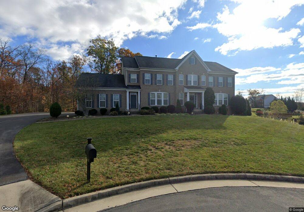
21592 Burnt Hickory Ct Broadlands, VA 20148
Estimated Value: $1,482,853 - $1,661,000
5
Beds
5
Baths
4,703
Sq Ft
$334/Sq Ft
Est. Value
About This Home
This home is located at 21592 Burnt Hickory Ct, Broadlands, VA 20148 and is currently estimated at $1,568,463, approximately $333 per square foot. 21592 Burnt Hickory Ct is a home located in Loudoun County with nearby schools including Mill Run Elementary School, Eagle Ridge Middle School, and Briar Woods High School.
Ownership History
Date
Name
Owned For
Owner Type
Purchase Details
Closed on
Sep 22, 2009
Sold by
Van Metr Homes At Broadlands
Bought by
Lee Tzumin
Current Estimated Value
Home Financials for this Owner
Home Financials are based on the most recent Mortgage that was taken out on this home.
Original Mortgage
$417,000
Outstanding Balance
$271,745
Interest Rate
5.12%
Mortgage Type
New Conventional
Estimated Equity
$1,296,718
Create a Home Valuation Report for This Property
The Home Valuation Report is an in-depth analysis detailing your home's value as well as a comparison with similar homes in the area
Home Values in the Area
Average Home Value in this Area
Purchase History
| Date | Buyer | Sale Price | Title Company |
|---|---|---|---|
| Lee Tzumin | $741,392 | -- |
Source: Public Records
Mortgage History
| Date | Status | Borrower | Loan Amount |
|---|---|---|---|
| Open | Lee Tzumin | $417,000 |
Source: Public Records
Tax History Compared to Growth
Tax History
| Year | Tax Paid | Tax Assessment Tax Assessment Total Assessment is a certain percentage of the fair market value that is determined by local assessors to be the total taxable value of land and additions on the property. | Land | Improvement |
|---|---|---|---|---|
| 2025 | $12,155 | $1,509,890 | $443,600 | $1,066,290 |
| 2024 | $12,168 | $1,406,750 | $428,600 | $978,150 |
| 2023 | $11,549 | $1,319,870 | $428,600 | $891,270 |
| 2022 | $10,562 | $1,186,700 | $318,600 | $868,100 |
| 2021 | $9,613 | $980,890 | $293,600 | $687,290 |
| 2020 | $9,935 | $959,860 | $258,600 | $701,260 |
| 2019 | $10,320 | $987,570 | $238,600 | $748,970 |
| 2018 | $10,183 | $938,560 | $228,600 | $709,960 |
| 2017 | $10,402 | $924,590 | $228,600 | $695,990 |
| 2016 | $10,674 | $932,240 | $0 | $0 |
| 2015 | $10,358 | $684,020 | $0 | $684,020 |
| 2014 | $9,446 | $589,870 | $0 | $589,870 |
Source: Public Records
Map
Nearby Homes
- 21518 Wild Timber Ct
- 21563 Awbrey Place
- 21507 Tithables Cir
- 42623 Trappe Rock Ct
- 42612 Hardage Terrace
- 42577 Sunset Ridge Square
- 21816 Ainsley Ct
- 42920 Cattail Meadows Place
- 21077 Ashburn Heights Dr
- 40396 Milford Dr
- 21360 Shady Wood Terrace
- 43382 Farringdon Square
- 43376 Farringdon Square
- 43189 Riders Square
- 22273 Rampsbeck Terrace
- 21752 Dollis Hill Terrace
- 21748 Dollis Hill Terrace
- 43497 Farringdon Square
- 21843 Beckhorn Station Terrace
- 21823 Beckhorn Station Terrace
- 21588 Burnt Hickory Ct
- 21555 Wild Timber Ct
- 21559 Wild Timber Ct
- 21584 Burnt Hickory Ct
- 21593 Burnt Hickory Ct
- 21551 Wild Timber Ct
- 21589 Burnt Hickory Ct
- 21580 Burnt Hickory Ct
- 21547 Wild Timber Ct
- 21585 Burnt Hickory Ct
- 21576 Burnt Hickory Ct
- 21566 Wild Timber Ct
- 21558 Wild Timber Ct
- 21561 Arora Heights Dr
- 21554 Wild Timber Ct
- 21581 Burnt Hickory Ct
- 21562 Wild Timber Ct
- 21577 Burnt Hickory Ct
- 21568 Burnt Hickory Ct
- 21546 Wild Timber Ct