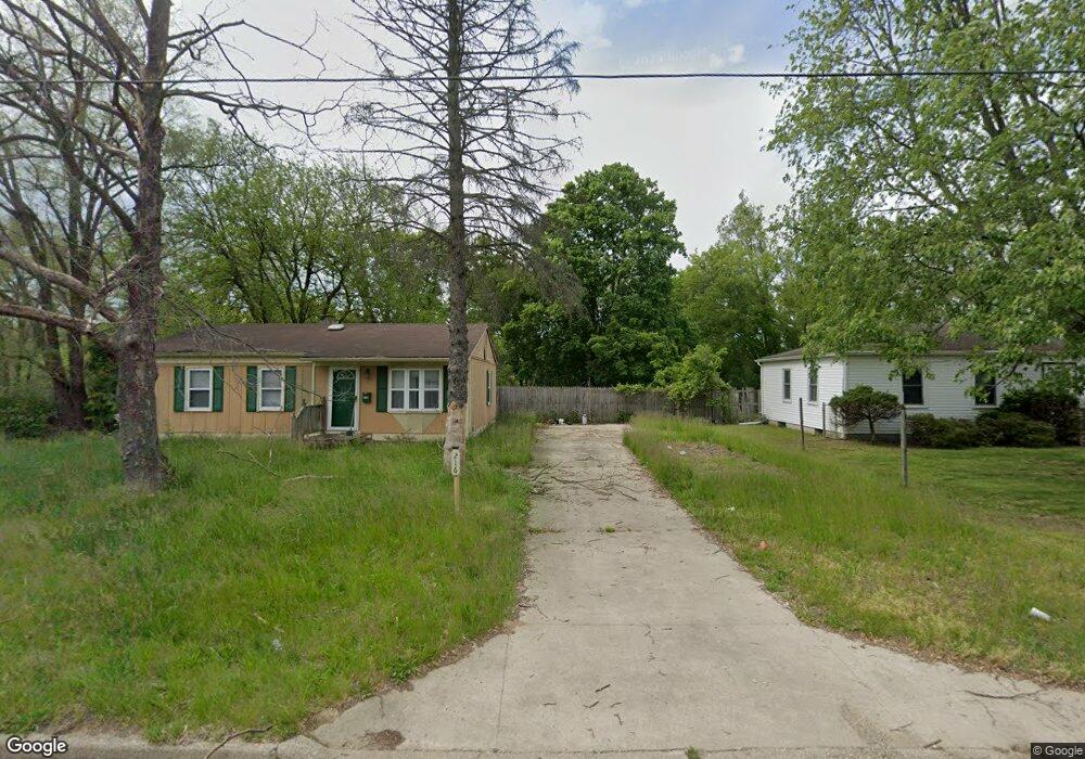
216 Ardmoor Dr Battle Creek, MI 49037
Estimated Value: $114,000 - $141,126
2
Beds
1
Bath
1,625
Sq Ft
$80/Sq Ft
Est. Value
About This Home
This home is located at 216 Ardmoor Dr, Battle Creek, MI 49037 and is currently estimated at $130,032, approximately $80 per square foot. 216 Ardmoor Dr is a home located in Calhoun County with nearby schools including Dudley School, Northwestern Middle School, and Battle Creek Central High School.
Ownership History
Date
Name
Owned For
Owner Type
Purchase Details
Closed on
Oct 3, 2011
Sold by
Federal Home Loan Mortgage Corporation
Bought by
Gorlewski Alan James
Current Estimated Value
Purchase Details
Closed on
Mar 10, 2011
Sold by
Blackamore Melva
Bought by
Federal Home Loan Mortgage Corp
Purchase Details
Closed on
Jan 28, 2008
Sold by
Flanders Scot A and Flanders Christine
Bought by
Blackamore Melva
Home Financials for this Owner
Home Financials are based on the most recent Mortgage that was taken out on this home.
Original Mortgage
$61,750
Interest Rate
6.2%
Mortgage Type
Purchase Money Mortgage
Purchase Details
Closed on
Oct 13, 2006
Sold by
Mccord Evelyn and Longmire Dannie
Bought by
Lasalle Bank Na and Afc Mortgage Loan Asset Backed Notes Ser
Purchase Details
Closed on
Dec 26, 1996
Sold by
Draime Lindsay
Bought by
Mccord Evelyn and Longmire Dannie
Create a Home Valuation Report for This Property
The Home Valuation Report is an in-depth analysis detailing your home's value as well as a comparison with similar homes in the area
Home Values in the Area
Average Home Value in this Area
Purchase History
| Date | Buyer | Sale Price | Title Company |
|---|---|---|---|
| Gorlewski Alan James | $16,250 | Attorneys Title Agency Llc | |
| Federal Home Loan Mortgage Corp | $63,392 | None Available | |
| Blackamore Melva | $65,000 | None Available | |
| Lasalle Bank Na | $39,000 | None Available | |
| Mccord Evelyn | $22,000 | -- |
Source: Public Records
Mortgage History
| Date | Status | Borrower | Loan Amount |
|---|---|---|---|
| Previous Owner | Blackamore Melva | $61,750 |
Source: Public Records
Tax History Compared to Growth
Tax History
| Year | Tax Paid | Tax Assessment Tax Assessment Total Assessment is a certain percentage of the fair market value that is determined by local assessors to be the total taxable value of land and additions on the property. | Land | Improvement |
|---|---|---|---|---|
| 2025 | $1,901 | $53,700 | $0 | $0 |
| 2024 | $690 | $51,900 | $0 | $0 |
| 2023 | $1,525 | $43,200 | $0 | $0 |
| 2022 | $626 | $31,500 | $0 | $0 |
| 2021 | $1,104 | $27,800 | $0 | $0 |
| 2020 | $1,239 | $25,900 | $0 | $0 |
| 2019 | $1,147 | $24,900 | $0 | $0 |
| 2018 | $1,127 | $22,900 | $3,900 | $19,000 |
| 2017 | $1,127 | $20,800 | $0 | $0 |
| 2016 | $1,127 | $19,600 | $0 | $0 |
| 2015 | -- | $17,700 | $0 | $0 |
| 2014 | -- | $19,450 | $0 | $0 |
Source: Public Records
Map
Nearby Homes
- 341 Algonquin St
- 904 Washington Ave N
- 62 Coolidge Ave W
- 69 Coolidge Ave W
- 11 Coolidge Ave W
- 161 Wilds Ave
- 17 Gordon Blvd
- 208 Glendale Ave
- 202 Viking Dr
- V/L Parkview Ave
- 000 5 Mile Rd
- 138 Knoll Dr
- V/L Altavista Unit Lot 11
- V/L Altavista Unit Lot 10
- 310 Oneita St
- 5 Beglin Ct
- 115 Briars Farm Ln
- 6722 Morgan Rd E
- 52 Roseneath Ave
- 146 Indian Rd
- 210 Ardmoor Dr
- 217 Ardmoor Dr
- 204 Ardmoor Dr
- 223 Ardmoor Dr
- 337 Sunwood Dr
- 229 Ardmoor Dr
- 329 Sunwood Dr
- 138 Ardmoor Dr
- 321 Sunwood Dr
- 235 Ardmoor Dr
- 132 Ardmoor Dr
- 138 Arlington Dr
- 127 Ardmoor Dr
- 142 Arlington Dr
- 313 Sunwood Dr
- 333 Algonquin St
- 241 Ardmoor Dr
- 126 Ardmoor Dr
- 146 Arlington Dr
- 121 Ardmoor Dr