A
Seller's Agent in 2025
Austin Bouchard
1st Class Real Estate KC
(816) 447-6545
1 in this area
44 Total Sales
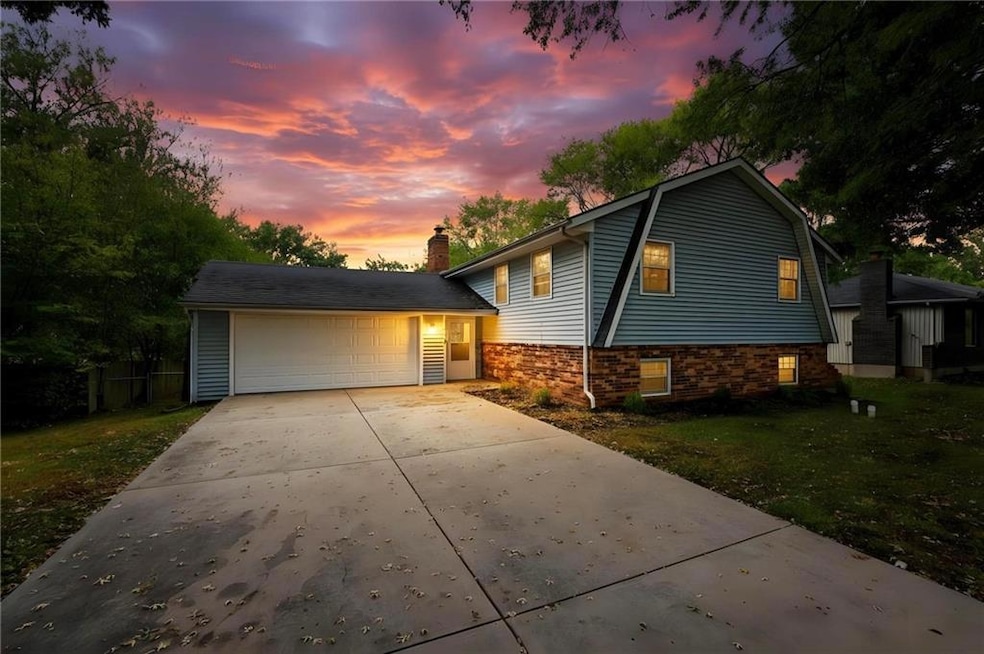
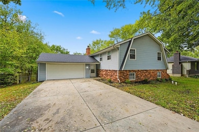
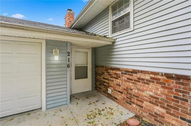
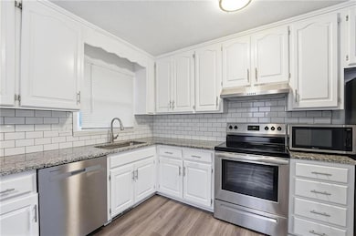
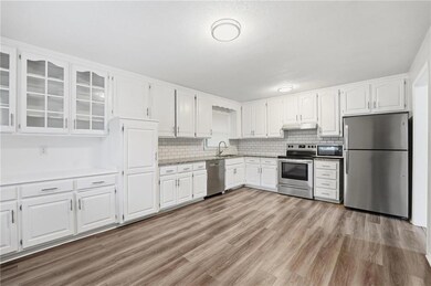

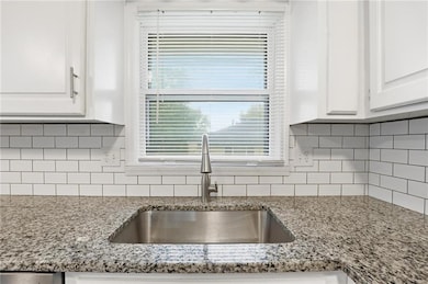
Welcome to 216 Bittersweet Lane in the heart of Lansing, Kansas—a beautifully remodeled 4-bedroom, 3-bath home that perfectly blends comfort and modern style. Recently updated inside and out, this spacious split-level features an inviting kitchen with granite countertops, stainless steel appliances, and bright white cabinetry. The bathrooms have been tastefully upgraded with clean tile finishes and contemporary fixtures, while the open floor plan and durable vinyl flooring make everyday living effortless. With just a few minor personal touchups, this home will feel good as new. Enjoy a large two-car garage, generous driveway, and a peaceful tree-lined lot offering both privacy and charm. Ideally located just minutes from Lansing schools, the historic downtown district, Leavenworth’s shops and restaurants, and a short drive to Fort Leavenworth or the Legends area—this home combines convenience, value, and modern living in one exceptional package.
Last Agent to Sell the Property
1st Class Real Estate KC Brokerage Phone: 816-447-6545 License #2020025260 Listed on: 10/30/2025

| Date | Type | Sale Price | Title Company |
|---|---|---|---|
| Warranty Deed | -- | Alpha Title | |
| Special Warranty Deed | -- | Title Exchange |
| Date | Status | Loan Amount | Loan Type |
|---|---|---|---|
| Open | $274,829 | FHA | |
| Previous Owner | $143,000 | Credit Line Revolving |
| Date | Event | Price | List to Sale | Price per Sq Ft |
|---|---|---|---|---|
| 11/21/2025 11/21/25 | Sold | -- | -- | -- |
| 11/03/2025 11/03/25 | Pending | -- | -- | -- |
| 10/30/2025 10/30/25 | For Sale | $279,900 | -- | $128 / Sq Ft |
| Year | Tax Paid | Tax Assessment Tax Assessment Total Assessment is a certain percentage of the fair market value that is determined by local assessors to be the total taxable value of land and additions on the property. | Land | Improvement |
|---|---|---|---|---|
| 2025 | $3,692 | $28,883 | $5,078 | $23,805 |
| 2024 | $3,443 | $27,772 | $4,020 | $23,752 |
| 2023 | $3,443 | $26,704 | $4,020 | $22,684 |
| 2022 | $5,603 | $24,277 | $3,073 | $21,204 |
| 2021 | $4,884 | $21,740 | $3,073 | $18,667 |
| 2020 | $4,681 | $19,803 | $3,073 | $16,730 |
| 2019 | $4,413 | $18,943 | $3,073 | $15,870 |
| 2018 | $2,566 | $17,643 | $2,539 | $15,104 |
| 2017 | $2,346 | $16,122 | $2,539 | $13,583 |
| 2016 | $2,323 | $15,962 | $2,539 | $13,423 |
| 2015 | $2,316 | $15,962 | $2,539 | $13,423 |
| 2014 | $2,269 | $15,962 | $2,539 | $13,423 |
A
Seller's Agent in 2025
Austin Bouchard
1st Class Real Estate KC
(816) 447-6545
1 in this area
44 Total Sales
Buyer's Agent in 2025
Jim Denham
Platinum Realty LLC
(913) 426-1153
6 in this area
32 Total Sales
Source: Heartland MLS
MLS Number: 2584286
APN: 106-24-0-10-11-010.00-0
Disclaimer: Certain information contained herein is derived from information provided by parties other than Homes.com. All information provided is deemed reliable, but is not guaranteed to be accurate and should be independently verified.
![]() Based on information submitted to the MLS Grid. All data is obtained from various sources and may not have been verified by broker or MLS GRID. Supplied Open House Information is subject to change without notice. All information should be independently reviewed and verified for accuracy. Properties may or may not be listed by the office/agent presenting the information. Some IDX listings have been excluded from this website. Prices displayed on all Sold listings are the Last Known Listing Price and may not be the actual selling price.
Based on information submitted to the MLS Grid. All data is obtained from various sources and may not have been verified by broker or MLS GRID. Supplied Open House Information is subject to change without notice. All information should be independently reviewed and verified for accuracy. Properties may or may not be listed by the office/agent presenting the information. Some IDX listings have been excluded from this website. Prices displayed on all Sold listings are the Last Known Listing Price and may not be the actual selling price.
Listing Information presented by local MLS brokerage: TEN-X, INC., local REALTOR®- Arlene Richardson - (888) 952-6393
Based on information submitted to the MLS GRID.
Ask me questions while you tour the home.