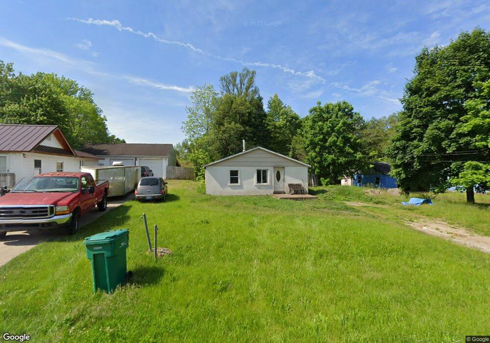
216 Cohasset Ave Battle Creek, MI 49014
Estimated Value: $90,000 - $106,000
3
Beds
1
Bath
1,176
Sq Ft
$86/Sq Ft
Est. Value
About This Home
This home is located at 216 Cohasset Ave, Battle Creek, MI 49014 and is currently estimated at $100,832, approximately $85 per square foot. 216 Cohasset Ave is a home located in Calhoun County with nearby schools including Verona Elementary School, Springfield Middle School, and Battle Creek Central High School.
Ownership History
Date
Name
Owned For
Owner Type
Purchase Details
Closed on
Jan 17, 2023
Sold by
Parnell Landon
Bought by
Parnell Kathryn
Current Estimated Value
Purchase Details
Closed on
Jan 26, 2022
Sold by
Raymond Parnell
Bought by
Parnell Raymond and Parnell Kathryn
Purchase Details
Closed on
Aug 21, 2009
Sold by
Asher William J and Asher Lois A
Bought by
Parnell Raymond and Parnell Landon
Create a Home Valuation Report for This Property
The Home Valuation Report is an in-depth analysis detailing your home's value as well as a comparison with similar homes in the area
Home Values in the Area
Average Home Value in this Area
Purchase History
| Date | Buyer | Sale Price | Title Company |
|---|---|---|---|
| Parnell Kathryn | -- | -- | |
| Parnell Raymond | -- | None Listed On Document | |
| Parnell Raymond | -- | None Available |
Source: Public Records
Tax History Compared to Growth
Tax History
| Year | Tax Paid | Tax Assessment Tax Assessment Total Assessment is a certain percentage of the fair market value that is determined by local assessors to be the total taxable value of land and additions on the property. | Land | Improvement |
|---|---|---|---|---|
| 2025 | $2,058 | $42,380 | $0 | $0 |
| 2024 | $671 | $37,550 | $0 | $0 |
| 2023 | $1,160 | $30,830 | $0 | $0 |
| 2022 | $257 | $26,700 | $0 | $0 |
| 2021 | $1,092 | $15,950 | $0 | $0 |
| 2020 | $1,089 | $15,550 | $0 | $0 |
| 2019 | $464 | $15,700 | $0 | $0 |
| 2018 | $879 | $13,000 | $900 | $12,100 |
| 2017 | $879 | $12,450 | $0 | $0 |
| 2016 | $879 | $12,000 | $0 | $0 |
| 2015 | $229 | $11,250 | $0 | $0 |
| 2014 | $229 | $11,550 | $0 | $0 |
Source: Public Records
Map
Nearby Homes
- 0 Rook St Unit 25019652
- 153 Martin St
- 113 Rook Ct
- 329 Vass Ave
- 23 Bradford St
- 140 Princeton St S
- 605 Westbrook Ave
- 52 Maple Grove Ave
- 45 Traverse St
- 85 East Ave S
- 723 Capital Ave NE
- 28 Convis St
- 15 Sanderson St
- 28 East Ave S
- 186 Bryant St
- 0 Pickford Ave
- 179 Bryant St
- 488 Capital Ave NE
- 0 E River Rd
- 495 Emmett St E
- 200 Cohasset Ave
- 205 Cohasset Ave
- 222 Cohasset Ave
- 224 Cohasset Ave
- 219 Cohasset Ave
- 223 Cohasset Ave
- 226 Cohasset Ave
- 128 Cohasset Ave
- 133 Wildwood Ave
- 129 Cohasset Ave
- 55 Sprague St
- 125 Cohasset Ave
- 123 Wildwood Ave
- 206 Wildwood Ave
- 233 Cohasset Ave
- 75 Sprague St
- 54 Sprague St
- 121 Cohasset Ave
- 121 Wildwood Ave
- 237 Cohasset Ave