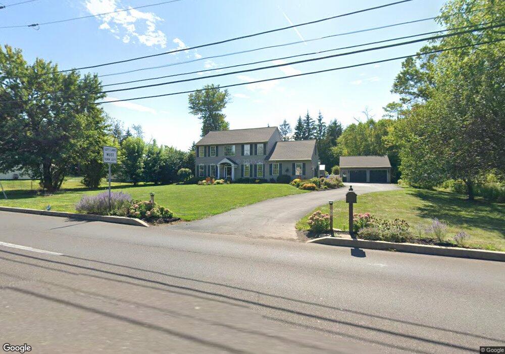
216 Cowpath Rd Hatfield, PA 19440
Estimated Value: $712,683 - $841,000
4
Beds
3
Baths
3,171
Sq Ft
$245/Sq Ft
Est. Value
About This Home
This home is located at 216 Cowpath Rd, Hatfield, PA 19440 and is currently estimated at $778,421, approximately $245 per square foot. 216 Cowpath Rd is a home located in Montgomery County with nearby schools including Oak Park El School, Penndale Middle School, and North Penn Senior High School.
Ownership History
Date
Name
Owned For
Owner Type
Purchase Details
Closed on
Jul 28, 2003
Sold by
Hassan Anne E and Hassan Harry E
Bought by
Lawrence Carol B and Lawrence Jeff
Current Estimated Value
Create a Home Valuation Report for This Property
The Home Valuation Report is an in-depth analysis detailing your home's value as well as a comparison with similar homes in the area
Home Values in the Area
Average Home Value in this Area
Purchase History
| Date | Buyer | Sale Price | Title Company |
|---|---|---|---|
| Lawrence Carol B | $385,048 | -- |
Source: Public Records
Tax History
| Year | Tax Paid | Tax Assessment Tax Assessment Total Assessment is a certain percentage of the fair market value that is determined by local assessors to be the total taxable value of land and additions on the property. | Land | Improvement |
|---|---|---|---|---|
| 2025 | $9,751 | $243,550 | $45,780 | $197,770 |
| 2024 | $9,751 | $243,550 | $45,780 | $197,770 |
| 2023 | $9,333 | $243,550 | $45,780 | $197,770 |
| 2022 | $9,029 | $243,550 | $45,780 | $197,770 |
| 2021 | $8,772 | $243,550 | $45,780 | $197,770 |
| 2020 | $8,565 | $243,550 | $45,780 | $197,770 |
| 2019 | $8,422 | $243,550 | $45,780 | $197,770 |
Source: Public Records
Map
Nearby Homes
- 5 Fortuna Dr
- 6 Fortuna Dr
- 9 Fortuna Dr
- 8 Fortuna Dr
- 83 Bethlehem Pike Unit 1306- HAMILTON PLAN
- 83 Bethlehem Pike Unit 1405
- 83 Bethlehem Pike Unit 1111
- 83 Bethlehem Pike Unit 1213 FIRESTONE
- 83 Bethlehem Pike Unit 1106- MADISON PLAN
- 83 Bethlehem Pike Unit 1102- IVY FLOORPLAN
- 83 Bethlehem Pike Unit 1104
- 83 Bethlehem Pike Unit 1109 LEWIS FLOORPLAN
- 816 Kenilworth Ave
- 737 Shaw Ave
- 52 Arbor Cir
- 1315 Deer Run Rd
- 2732 Valley Woods Rd
- 1107 Lansdale Ave
- 2943 E Walnut St Unit 59
- 30 W 6th St
- 134 Cowpath Rd
- 219 Cowpath Rd
- 1926 Lenhart Rd
- 222 Cowpath Rd
- 223 Cowpath Rd
- 281 Fortuna Dr
- 289 Fortuna Dr
- 0 Filbert St Unit PAMC678242
- 1081 Chapman Cir
- 1025 Chapman Cir
- 1079 Chapman Cir
- 1077 Chapman Cir
- 1075 Chapman Cir
- 297 Fortuna Dr
- 230 Cowpath Rd
- 1073 Chapman Cir
- 1027 Chapman Cir
- 227 Cowpath Rd
- 1071 Chapman Cir
- 282 Fortuna Dr
Your Personal Tour Guide
Ask me questions while you tour the home.