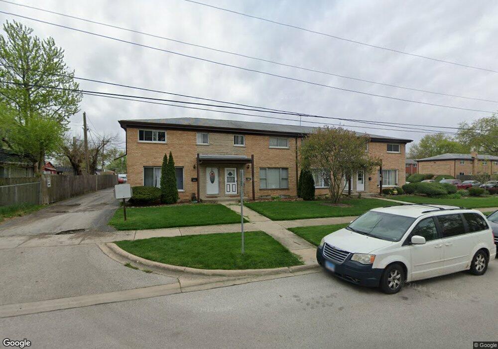
216 Dee Rd Unit B North Aurora, IL 60542
Estimated Value: $118,000 - $319,000
3
Beds
2
Baths
1,218
Sq Ft
$184/Sq Ft
Est. Value
About This Home
This home is located at 216 Dee Rd Unit B, North Aurora, IL 60542 and is currently estimated at $223,945, approximately $183 per square foot. 216 Dee Rd Unit B is a home located in Kane County with nearby schools including Schneider Elementary School, Herget Middle School, and West Aurora High School.
Ownership History
Date
Name
Owned For
Owner Type
Purchase Details
Closed on
Feb 8, 2021
Sold by
Eric Ramos
Bought by
Ramos Eric and Ramos Melecio
Current Estimated Value
Purchase Details
Closed on
Jul 17, 2020
Sold by
Ramos Melecio
Bought by
Ramos Eric
Purchase Details
Closed on
Jul 19, 2011
Sold by
Residential Fund Manager 498 Llc
Bought by
Residential Fund 498 Llc
Purchase Details
Closed on
Feb 10, 2011
Sold by
Lang Jennifer
Bought by
Residential Fund Manager 498 Llc
Purchase Details
Closed on
Mar 2, 2006
Sold by
Ronald Masiokas Joseph and Ronald Penhala
Bought by
Lang Jennifer
Home Financials for this Owner
Home Financials are based on the most recent Mortgage that was taken out on this home.
Original Mortgage
$144,000
Interest Rate
6.22%
Mortgage Type
Fannie Mae Freddie Mac
Purchase Details
Closed on
Aug 29, 2005
Sold by
Thomas Eugenia and Beneficial Illinois Inc
Bought by
Masickas Joseph and Penkala Ronald
Create a Home Valuation Report for This Property
The Home Valuation Report is an in-depth analysis detailing your home's value as well as a comparison with similar homes in the area
Home Values in the Area
Average Home Value in this Area
Purchase History
| Date | Buyer | Sale Price | Title Company |
|---|---|---|---|
| Ramos Eric | -- | Chicago Title | |
| Ramos Eric | -- | Chicago Title Insurance Co | |
| Residential Fund 498 Llc | -- | Parks Title | |
| Ramos Melecio | $40,000 | Parks Title | |
| Residential Fund Manager 498 Llc | -- | None Available | |
| Lang Jennifer | $144,000 | Chicago Title Insurance Comp | |
| Masickas Joseph | -- | -- |
Source: Public Records
Mortgage History
| Date | Status | Borrower | Loan Amount |
|---|---|---|---|
| Previous Owner | Lang Jennifer | $144,000 |
Source: Public Records
Tax History
| Year | Tax Paid | Tax Assessment Tax Assessment Total Assessment is a certain percentage of the fair market value that is determined by local assessors to be the total taxable value of land and additions on the property. | Land | Improvement |
|---|---|---|---|---|
| 2024 | $3,002 | $47,934 | $5,360 | $42,574 |
| 2023 | $2,682 | $40,960 | $4,865 | $36,095 |
| 2022 | $1,803 | $27,812 | $4,547 | $23,265 |
| 2021 | $1,732 | $26,377 | $4,312 | $22,065 |
| 2020 | $1,883 | $27,770 | $4,229 | $23,541 |
| 2019 | $1,890 | $26,787 | $4,079 | $22,708 |
| 2018 | $1,828 | $25,339 | $3,924 | $21,415 |
| 2017 | $1,791 | $24,504 | $3,795 | $20,709 |
| 2016 | $1,909 | $19,150 | $3,684 | $15,466 |
| 2015 | -- | $15,226 | $3,600 | $11,626 |
| 2014 | -- | $14,747 | $3,487 | $11,260 |
| 2013 | -- | $14,459 | $3,419 | $11,040 |
Source: Public Records
Map
Nearby Homes
- 210 Linn Ct Unit D
- 200 Linn Ct Unit C
- 320 Sussex Ln
- 318 Dee Rd
- 407 Butterfield Rd
- 218 Sussex Ct
- 242 Sussex Ln
- 313 Carrie Ct
- 306 Carrie Ct
- 906 Homerton Blvd
- 28 Oak Creek Ct
- 63 Oak Creek Ct
- 10 N Adams St
- 346 Timber Oaks Dr
- 344 Timber Oaks Dr
- 243 Durham St
- 239 Durham St
- 307 Hill Ave
- 310 Oak St
- 451 Pheasant Hill Dr
- 216 Dee Rd Unit A
- 216 Dee Rd Unit C
- 216C Dee Rd
- 216D Dee Rd
- 225 Linn Ct Unit B
- 225 Linn Ct Unit A
- 225 Linn Ct Unit C
- 225 Linn Ct Unit D
- 218A Dee Rd Unit B
- 223 Linn Ct Unit B
- 223 Linn Ct Unit A
- 223 Linn Ct Unit D
- 223 Linn Ct Unit C
- 208 Dee Rd Unit A
- 208 Dee Rd Unit D
- 224 Linn Ct Unit C
- 224 Linn Ct Unit A
- 224 Linn Ct Unit D
- 208B Dee Rd
- 224B Linn Ct Unit B
Your Personal Tour Guide
Ask me questions while you tour the home.