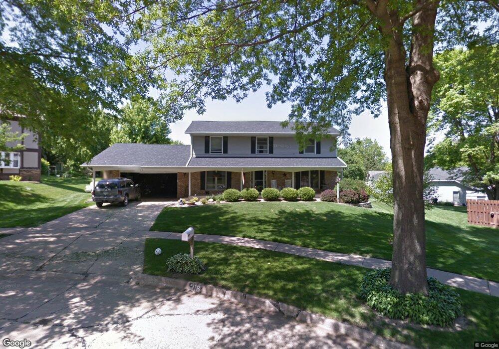
216 Kent Ct NE Cedar Rapids, IA 52402
Estimated Value: $283,000 - $312,715
4
Beds
3
Baths
2,737
Sq Ft
$110/Sq Ft
Est. Value
About This Home
This home is located at 216 Kent Ct NE, Cedar Rapids, IA 52402 and is currently estimated at $300,179, approximately $109 per square foot. 216 Kent Ct NE is a home located in Linn County with nearby schools including Bowman Woods Elementary School, Oak Ridge School, and Linn-Mar High School.
Ownership History
Date
Name
Owned For
Owner Type
Purchase Details
Closed on
Mar 18, 2015
Sold by
Jorgenson Thomas C and Jorgenson Julie A
Bought by
Sentman Thad R and Sentman Rebecca L
Current Estimated Value
Home Financials for this Owner
Home Financials are based on the most recent Mortgage that was taken out on this home.
Original Mortgage
$115,000
Outstanding Balance
$41,134
Interest Rate
3.56%
Mortgage Type
New Conventional
Estimated Equity
$259,045
Purchase Details
Closed on
Jan 12, 2009
Sold by
Parrish Michael J and Parrish Mary E
Bought by
Jorgenson Thomas C and Jorgenson Julie A
Home Financials for this Owner
Home Financials are based on the most recent Mortgage that was taken out on this home.
Original Mortgage
$171,800
Interest Rate
5.53%
Mortgage Type
Unknown
Create a Home Valuation Report for This Property
The Home Valuation Report is an in-depth analysis detailing your home's value as well as a comparison with similar homes in the area
Home Values in the Area
Average Home Value in this Area
Purchase History
| Date | Buyer | Sale Price | Title Company |
|---|---|---|---|
| Sentman Thad R | $195,000 | None Available | |
| Jorgenson Thomas C | $190,500 | None Available |
Source: Public Records
Mortgage History
| Date | Status | Borrower | Loan Amount |
|---|---|---|---|
| Open | Sentman Thad R | $115,000 | |
| Previous Owner | Jorgenson Thomas C | $171,800 |
Source: Public Records
Tax History Compared to Growth
Tax History
| Year | Tax Paid | Tax Assessment Tax Assessment Total Assessment is a certain percentage of the fair market value that is determined by local assessors to be the total taxable value of land and additions on the property. | Land | Improvement |
|---|---|---|---|---|
| 2025 | $5,152 | $303,600 | $61,900 | $241,700 |
| 2024 | $5,070 | $285,700 | $57,400 | $228,300 |
| 2023 | $5,070 | $273,400 | $57,400 | $216,000 |
| 2022 | $4,770 | $230,700 | $48,600 | $182,100 |
| 2021 | $4,936 | $224,400 | $48,600 | $175,800 |
| 2020 | $4,936 | $218,800 | $42,000 | $176,800 |
| 2019 | $4,544 | $204,100 | $42,000 | $162,100 |
| 2018 | $4,346 | $204,100 | $42,000 | $162,100 |
| 2017 | $4,321 | $197,900 | $42,000 | $155,900 |
| 2016 | $4,321 | $193,200 | $42,000 | $151,200 |
| 2015 | $4,259 | $190,235 | $41,970 | $148,265 |
| 2014 | $4,064 | $186,127 | $26,507 | $159,620 |
| 2013 | $3,836 | $186,127 | $26,507 | $159,620 |
Source: Public Records
Map
Nearby Homes
- 342 Cambridge Dr NE
- 6726 Bowman Ln NE
- 316 Sussex Dr NE
- 1151 Plumwood Ct NE
- 7320 Hampshire Dr NE
- 2140 Newcastle Rd
- 1000 Hampshire Cir
- 980 Hampshire Cir
- 7415 Pin Tail Dr NE
- 960 Hampshire Cir
- 2010 Newcastle Rd
- 948 Hampshire Cir
- 3310 Timber Ridge Ct
- 932 Prescott Ln
- 916 Hampshire Cir
- 201 Teakwood Ln NE
- 1310 Linnview Dr
- 2025 Newcastle Rd
- 884 Hampshire Cir
- 862 Hampshire Cir
- 357 Essex Dr NE
- 212 Kent Ct NE
- 359 Essex Dr NE
- 6924 Larkwood Dr NE
- 355 Essex Dr NE
- 6920 Larkwood Dr NE
- 221 Kent Ct NE
- 6916 Larkwood Dr NE
- 215 Kent Ct NE
- 6912 Larkwood Dr NE
- 6908 Kent Dr NE
- 6904 Kent Dr NE
- 7005 Kent Dr NE
- 6912 Kent Dr NE Unit X
- 358 Essex Dr NE
- 6844 Kent Dr NE
- 360 Essex Dr NE
- 6916 Kent Dr NE
- 6837 Kent Dr NE
- 222 Boyson Rd NE