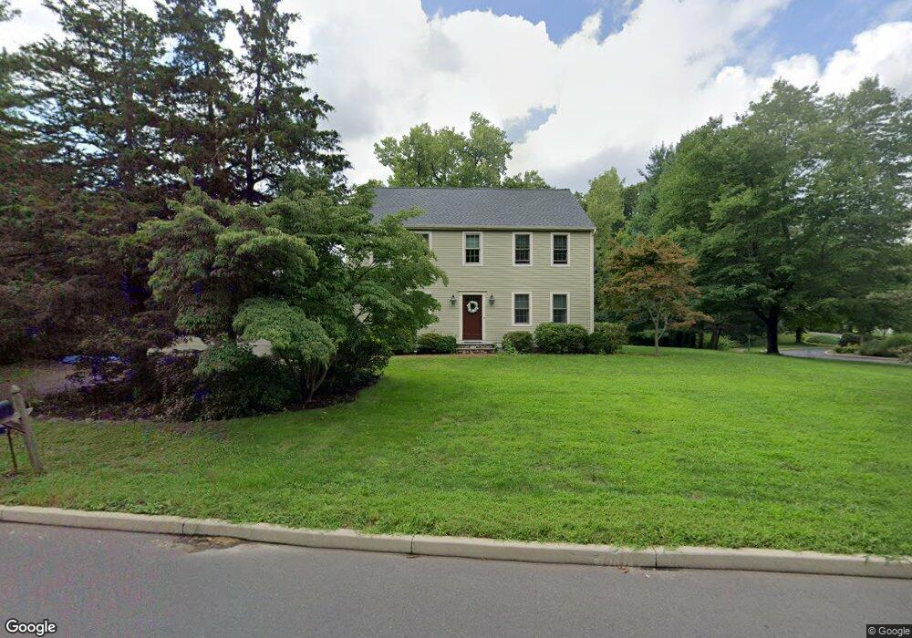
216 Poplar Rd Middletown, CT 06457
Westfield NeighborhoodEstimated Value: $497,496 - $620,000
3
Beds
3
Baths
2,160
Sq Ft
$262/Sq Ft
Est. Value
About This Home
This home is located at 216 Poplar Rd, Middletown, CT 06457 and is currently estimated at $564,874, approximately $261 per square foot. 216 Poplar Rd is a home located in Middlesex County with nearby schools including The Lawrence School, Middletown High School, and St John Paul II School.
Ownership History
Date
Name
Owned For
Owner Type
Purchase Details
Closed on
Aug 20, 2004
Sold by
Guptill Kevin J and Guptill Ann M
Bought by
Holden Karen L
Current Estimated Value
Home Financials for this Owner
Home Financials are based on the most recent Mortgage that was taken out on this home.
Original Mortgage
$249,900
Interest Rate
6.03%
Purchase Details
Closed on
Mar 20, 1992
Sold by
Minnitti John D and Minnitti Kathy
Bought by
Guptill Kevin J and Guptill Ann M
Create a Home Valuation Report for This Property
The Home Valuation Report is an in-depth analysis detailing your home's value as well as a comparison with similar homes in the area
Home Values in the Area
Average Home Value in this Area
Purchase History
| Date | Buyer | Sale Price | Title Company |
|---|---|---|---|
| Holden Karen L | $349,900 | -- | |
| Guptill Kevin J | $212,000 | -- |
Source: Public Records
Mortgage History
| Date | Status | Borrower | Loan Amount |
|---|---|---|---|
| Open | Guptill Kevin J | $210,000 | |
| Closed | Guptill Kevin J | $249,900 | |
| Previous Owner | Guptill Kevin J | $193,700 | |
| Previous Owner | Guptill Kevin J | $55,000 |
Source: Public Records
Tax History
| Year | Tax Paid | Tax Assessment Tax Assessment Total Assessment is a certain percentage of the fair market value that is determined by local assessors to be the total taxable value of land and additions on the property. | Land | Improvement |
|---|---|---|---|---|
| 2025 | $9,638 | $286,110 | $63,600 | $222,510 |
| 2024 | $9,138 | $286,110 | $63,600 | $222,510 |
| 2023 | $8,596 | $286,110 | $63,600 | $222,510 |
| 2022 | $8,136 | $216,870 | $42,400 | $174,470 |
| 2021 | $8,117 | $216,870 | $42,400 | $174,470 |
| 2020 | $8,129 | $216,870 | $42,400 | $174,470 |
| 2019 | $8,172 | $216,870 | $42,400 | $174,470 |
| 2018 | $7,882 | $216,870 | $42,400 | $174,470 |
| 2017 | $6,562 | $185,100 | $45,360 | $139,740 |
| 2016 | $6,435 | $185,100 | $45,360 | $139,740 |
| 2015 | $6,137 | $180,410 | $45,360 | $135,050 |
| 2014 | $6,139 | $180,410 | $45,360 | $135,050 |
Source: Public Records
Map
Nearby Homes
- 145 Webster Ln Unit 2-41
- 137 Webster Ln Unit 2-42
- 128 Webster Ln
- 60 Sonoma Ln
- 886 East St
- 7 W Meadow Ln Unit 5
- 10 Talias Trail
- 3 Braeburn Ln
- 215 Carriage Crossing Ln Unit 215
- 118 Carriage Crossing Ln
- 133 Carriage Crossing Ln
- 44 Carriage Crossing Ln Unit 44
- 12 Carriage Crossing Ln Unit 12
- 318 Carriage Crossing Ln Unit 318
- 180 Carriage Crossing Ln Unit 180
- 159 Carriage Crossing Ln Unit 159
- 1 Forest Glen Cir Unit 11
- 14 Forest Glen Cir Unit 10
- 473 Westfield St
- 153 Country Club Rd
- 227 Poplar Rd
- 198 Poplar Rd
- 26 W Poplar Rd
- 26 Poplar Rd - W
- 26 W Poplar Rd
- 217 Poplar Rd
- Lot 1-26 W Poplar Rd
- LT 4 Poplar Rd - W
- Lot 1 Poplar Road - W
- Lot 8 W Poplar
- LOT 12 Poplar Road - W
- LOT 15 Poplar Rd - W
- Lot 12 Poplar Rd W
- LT 11 W Poplar Rd
- LT 5 W Poplar Rd
- Lot 9 W Poplar
- 205 Poplar Rd
- 31 Goodman Dr
- 221 Poplar Rd
- 237 Poplar Rd
Your Personal Tour Guide
Ask me questions while you tour the home.