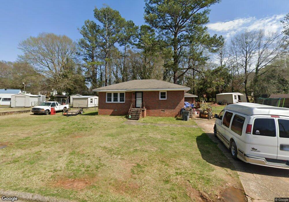
216 Rutland Cir Lagrange, GA 30241
Estimated Value: $132,000 - $181,000
3
Beds
1
Bath
1,041
Sq Ft
$145/Sq Ft
Est. Value
About This Home
This home is located at 216 Rutland Cir, Lagrange, GA 30241 and is currently estimated at $151,136, approximately $145 per square foot. 216 Rutland Cir is a home located in Troup County with nearby schools including Franklin Forest Elementary School, Hollis Hand Elementary School, and Ethel W. Kight Elementary School.
Ownership History
Date
Name
Owned For
Owner Type
Purchase Details
Closed on
Dec 15, 1985
Sold by
Dyer Dyer C and Dyer Karen M
Bought by
Gunter Daniel Gregory
Current Estimated Value
Purchase Details
Closed on
Dec 14, 1985
Sold by
Dyer Dyer C and Dyer Karen M
Bought by
Dyer Dyer C and Dyer Karen M
Purchase Details
Closed on
Mar 20, 1976
Sold by
Smith George Bruce and Smith Betty H
Bought by
Dyer Dyer C and Dyer Karen M
Purchase Details
Closed on
Mar 21, 1974
Sold by
Wright Buddy T
Bought by
Smith George Bruce and Smith Betty H
Purchase Details
Closed on
Jan 1, 1973
Sold by
Smith Betty Huff and Smith George E
Bought by
Wright Buddy T
Purchase Details
Closed on
Jul 1, 1967
Sold by
Crowe James L
Bought by
Smith Betty Huff and Smith George E
Create a Home Valuation Report for This Property
The Home Valuation Report is an in-depth analysis detailing your home's value as well as a comparison with similar homes in the area
Home Values in the Area
Average Home Value in this Area
Purchase History
| Date | Buyer | Sale Price | Title Company |
|---|---|---|---|
| Gunter Daniel Gregory | $44,500 | -- | |
| Dyer Dyer C | $44,500 | -- | |
| Dyer Dyer C | $24,200 | -- | |
| Smith George Bruce | $5,700 | -- | |
| Wright Buddy T | $6,000 | -- | |
| Smith Betty Huff | $14,900 | -- |
Source: Public Records
Tax History Compared to Growth
Tax History
| Year | Tax Paid | Tax Assessment Tax Assessment Total Assessment is a certain percentage of the fair market value that is determined by local assessors to be the total taxable value of land and additions on the property. | Land | Improvement |
|---|---|---|---|---|
| 2024 | $1,052 | $40,560 | $8,000 | $32,560 |
| 2023 | $499 | $38,200 | $6,920 | $31,280 |
| 2022 | $968 | $36,680 | $6,920 | $29,760 |
| 2021 | $807 | $28,760 | $6,920 | $21,840 |
| 2020 | $807 | $28,760 | $6,920 | $21,840 |
| 2019 | $701 | $25,224 | $6,944 | $18,280 |
| 2018 | $701 | $25,224 | $6,944 | $18,280 |
| 2017 | $701 | $25,224 | $6,944 | $18,280 |
| 2016 | $685 | $24,698 | $6,944 | $17,754 |
| 2015 | $686 | $24,698 | $6,944 | $17,754 |
| 2014 | $649 | $23,441 | $6,944 | $16,497 |
| 2013 | -- | $24,646 | $6,944 | $17,702 |
Source: Public Records
Map
Nearby Homes
- 210 Hearthstone Dr
- 618 S Harlem Cir
- 616 S Harlem Cir
- 706 N Harlem Cir
- 608 S Harlem Cir
- 121 Ct
- 606 S Harlem Cir
- 130 Clara Jean Ct
- 600 S Harlem Cir
- 131 Foch St
- 305 Lenox Cir
- 105 Lenox Cir
- 101 Lenox Cir
- 226 Lenox Cir
- 5 Curran Ave
- 0 N Barnard Ave
- 109 Dogwood Dr
- 121 de Groat St
- 600,606,608,616 S Harlem
- 906 Georgia Ave
- 220 Rutland Cir
- 214 Rutland Cir
- 224 Rutland Cir
- 210 Rutland Cir
- 231 Rutland Cir
- 229 Rutland Cir
- 233 Rutland Cir
- 208 Rutland Cir
- 226 Rutland Cir
- 227 Rutland Cir
- 225 Rutland Cir
- 206 Rutland Cir
- 228 Rutland Cir
- 243 Rutland Cir
- 241 Rutland Cir
- 245 Rutland Cir
- 217 Rutland Cir
- 247 Rutland Cir
- 239 Rutland Cir
- 215 Rutland Cir