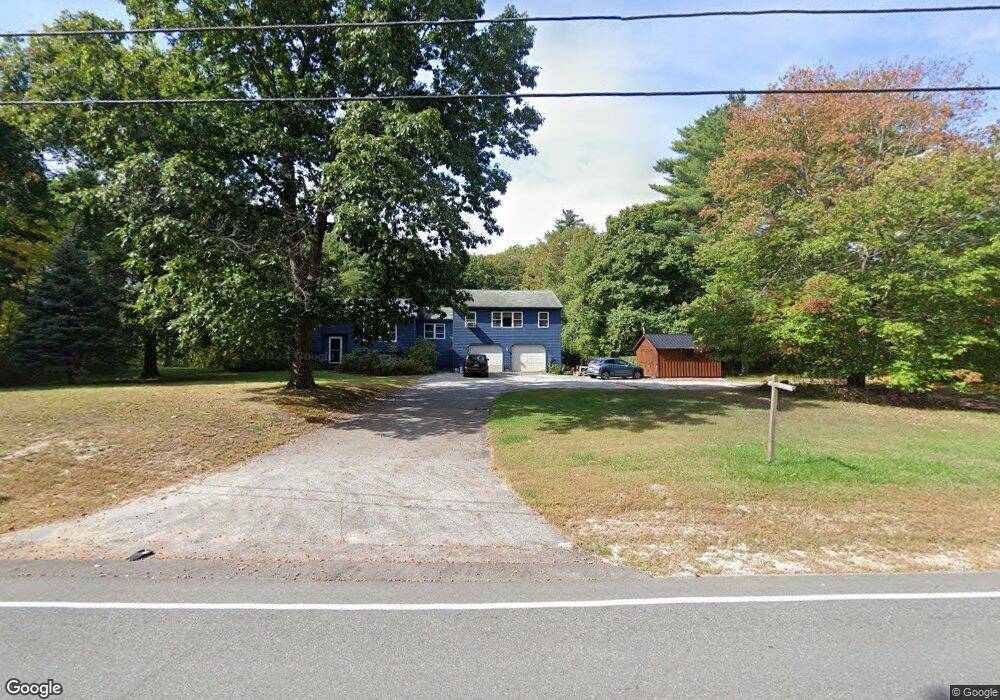
216 Sabbathday Rd New Gloucester, ME 04260
Estimated Value: $342,000 - $479,000
3
Beds
2
Baths
864
Sq Ft
$459/Sq Ft
Est. Value
About This Home
This home is located at 216 Sabbathday Rd, New Gloucester, ME 04260 and is currently estimated at $396,737, approximately $459 per square foot. 216 Sabbathday Rd is a home located in Cumberland County with nearby schools including Gray-New Gloucester High School.
Ownership History
Date
Name
Owned For
Owner Type
Purchase Details
Closed on
Feb 6, 2006
Sold by
Smith Laura J and Smith Terry L
Bought by
Easy Thomas and Esty Jennifer
Current Estimated Value
Home Financials for this Owner
Home Financials are based on the most recent Mortgage that was taken out on this home.
Original Mortgage
$199,200
Outstanding Balance
$111,586
Interest Rate
6.31%
Mortgage Type
Purchase Money Mortgage
Estimated Equity
$285,151
Create a Home Valuation Report for This Property
The Home Valuation Report is an in-depth analysis detailing your home's value as well as a comparison with similar homes in the area
Home Values in the Area
Average Home Value in this Area
Purchase History
| Date | Buyer | Sale Price | Title Company |
|---|---|---|---|
| Easy Thomas | -- | -- |
Source: Public Records
Mortgage History
| Date | Status | Borrower | Loan Amount |
|---|---|---|---|
| Open | Easy Thomas | $199,200 |
Source: Public Records
Tax History Compared to Growth
Tax History
| Year | Tax Paid | Tax Assessment Tax Assessment Total Assessment is a certain percentage of the fair market value that is determined by local assessors to be the total taxable value of land and additions on the property. | Land | Improvement |
|---|---|---|---|---|
| 2025 | $3,303 | $213,500 | $67,000 | $146,500 |
| 2024 | $3,179 | $213,500 | $67,000 | $146,500 |
| 2023 | $3,051 | $213,500 | $67,000 | $146,500 |
| 2022 | $2,946 | $213,500 | $67,000 | $146,500 |
| 2021 | $2,946 | $213,500 | $67,000 | $146,500 |
| 2020 | $2,914 | $213,500 | $67,000 | $146,500 |
| 2019 | $3,470 | $205,300 | $61,400 | $143,900 |
| 2018 | $3,244 | $205,300 | $61,400 | $143,900 |
| 2017 | $3,203 | $205,300 | $61,400 | $143,900 |
| 2016 | $3,018 | $205,300 | $61,400 | $143,900 |
| 2015 | $3,008 | $205,300 | $61,400 | $143,900 |
| 2014 | $2,977 | $205,300 | $61,400 | $143,900 |
| 2013 | $2,761 | $205,300 | $61,400 | $143,900 |
Source: Public Records
Map
Nearby Homes
- 423 Sabbathday Rd
- 14 Golden Way
- 24 Swamp Rd
- TBD Targett Rd
- 271 Bennett Rd
- 22 Shaw Rd
- 343 Shaker Rd
- 4 Chelsey Ln
- 15 May Meadow Dr
- 155 & 151 Gloucester Hill Rd
- 0018-C Gloucester Hill Rd
- 160 Gloucester Hill Rd
- 74 May Meadow Dr
- 13 Mill Brook Rd Unit A
- 164 Intervale Rd
- 10 Cobbs Bridge Rd
- 161 Beaver Dam Dr
- 21 Westwood Rd
- 148 Spiller Hill Rd
- 157 Egypt Rd
- 7 Hillside Dr
- 9 Hillside Dr
- 5 Hillside Dr
- 11 Hillside Dr
- 9 Lot # 9 Hillside
- 11 Lot # 11 Hillside Dr
- 7 Lot # 7 Hillside Dr
- 13 Hillside Dr
- 3 Hillside Dr
- 10 Lot # 10 Hillside
- 10 Hillside Dr
- 8 Lot # 8 Hillside
- 6 Lot # 6 Hillside
- Lot 4 Hillside Estates
- 4 Hillside
- 2 Hillside Dr
- 226 Sabbathday Rd
- 978 Mayall Rd
- 204 Sabbathday Rd
- 6 Hillside Dr