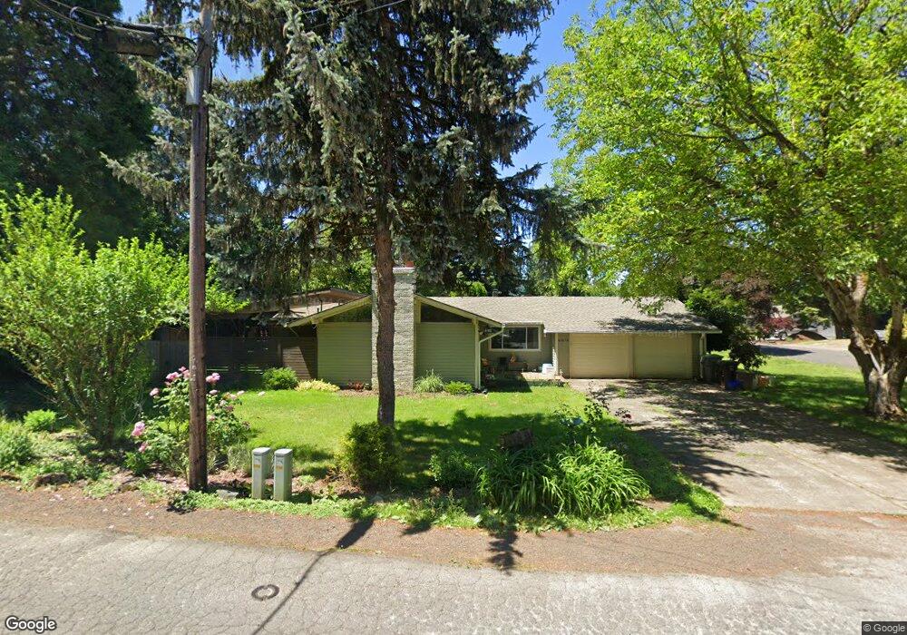
2160 Ostman Rd West Linn, OR 97068
Willamette NeighborhoodEstimated Value: $426,000 - $650,000
3
Beds
2
Baths
1,240
Sq Ft
$446/Sq Ft
Est. Value
About This Home
This home is located at 2160 Ostman Rd, West Linn, OR 97068 and is currently estimated at $553,333, approximately $446 per square foot. 2160 Ostman Rd is a home located in Clackamas County with nearby schools including Willamette Primary School, Athey Creek Middle School, and West Linn High School.
Ownership History
Date
Name
Owned For
Owner Type
Purchase Details
Closed on
Dec 19, 2020
Sold by
Holstrom Douglas
Bought by
Holstrom Douglas and Holstrom Lucie R
Current Estimated Value
Home Financials for this Owner
Home Financials are based on the most recent Mortgage that was taken out on this home.
Original Mortgage
$139,900
Outstanding Balance
$124,491
Interest Rate
2.8%
Mortgage Type
New Conventional
Estimated Equity
$428,842
Purchase Details
Closed on
May 22, 2020
Sold by
Holstrom Harold Kip and Holstrom James E
Bought by
Holstrom Douglas
Purchase Details
Closed on
Sep 21, 2005
Sold by
Holstrom James E
Bought by
Holstrom Douglas
Purchase Details
Closed on
Jun 21, 2005
Sold by
Holstrom James E and Holstrom Edith L
Bought by
Liv Holstrom James E and James E Holstrom Revocable Living Trust
Create a Home Valuation Report for This Property
The Home Valuation Report is an in-depth analysis detailing your home's value as well as a comparison with similar homes in the area
Home Values in the Area
Average Home Value in this Area
Purchase History
| Date | Buyer | Sale Price | Title Company |
|---|---|---|---|
| Holstrom Douglas | -- | Wfg Title | |
| Holstrom Douglas | $160,000 | None Available | |
| Holstrom Douglas | $160,000 | -- | |
| Liv Holstrom James E | -- | -- |
Source: Public Records
Mortgage History
| Date | Status | Borrower | Loan Amount |
|---|---|---|---|
| Open | Holstrom Douglas | $139,900 |
Source: Public Records
Tax History Compared to Growth
Tax History
| Year | Tax Paid | Tax Assessment Tax Assessment Total Assessment is a certain percentage of the fair market value that is determined by local assessors to be the total taxable value of land and additions on the property. | Land | Improvement |
|---|---|---|---|---|
| 2025 | $4,562 | $236,746 | -- | -- |
| 2024 | $4,392 | $229,851 | -- | -- |
| 2023 | $4,392 | $223,157 | $0 | $0 |
| 2022 | $4,145 | $216,658 | $0 | $0 |
| 2021 | $3,935 | $210,348 | $0 | $0 |
| 2020 | $3,962 | $204,222 | $0 | $0 |
| 2019 | $3,778 | $198,274 | $0 | $0 |
| 2018 | $3,609 | $192,499 | $0 | $0 |
| 2017 | $3,469 | $186,892 | $0 | $0 |
| 2016 | $3,380 | $181,449 | $0 | $0 |
| 2015 | $3,186 | $176,164 | $0 | $0 |
| 2014 | $3,030 | $171,033 | $0 | $0 |
Source: Public Records
Map
Nearby Homes
- 1160 Blankenship Rd
- 812 Wendy Ct
- 1101 Ryan Ct
- 1075 Epperly Way
- 2250 River Heights Cir
- 1765 Ostman Rd
- 1925 Hillhouse Dr
- 2420 Margery St
- 975 Springtree Ln
- 640 Springtree Ln
- 880 Springtree Ln Unit 880
- 800 Springtree Ln
- 850 Springtree Ln Unit 850
- 1733 Jamie Cir
- 2026 Virginia Ln
- 1618 Village Park Place
- 1791 Blankenship Rd
- 1640 Village Park Place
- 3565 Summerlinn Dr Unit 64
- 25540 Cheryl Dr