2160 W Broad St Scotch Plains, NJ 07076
Estimated Value: $642,000 - $1,308,000
--
Bed
--
Bath
1,939
Sq Ft
$433/Sq Ft
Est. Value
About This Home
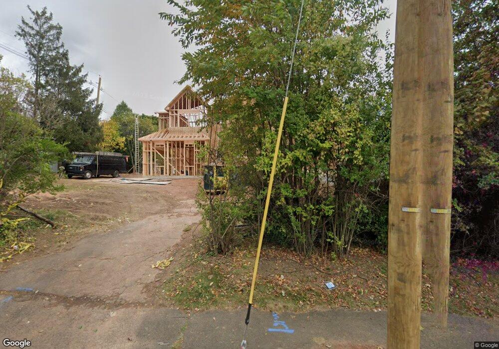
This home is located at 2160 W Broad St, Scotch Plains, NJ 07076 and is currently estimated at $839,463, approximately $432 per square foot. 2160 W Broad St is a home located in Union County with nearby schools including William J. McGinn Elementary School, Terrill Middle School, and Scotch Plains-Fanwood High School.
Ownership History
Date
Name
Owned For
Owner Type
Purchase Details
Closed on
May 22, 2025
Sold by
Durett Daniel J and Durett Lisa A
Bought by
2160 W Broad Llc
Current Estimated Value
Home Financials for this Owner
Home Financials are based on the most recent Mortgage that was taken out on this home.
Original Mortgage
$1,172,800
Outstanding Balance
$790,617
Interest Rate
6.76%
Mortgage Type
Construction
Estimated Equity
$48,846
Purchase Details
Closed on
Aug 23, 1993
Bought by
Durett Daniel J and Durett Lisa A
Create a Home Valuation Report for This Property
The Home Valuation Report is an in-depth analysis detailing your home's value as well as a comparison with similar homes in the area
Home Values in the Area
Average Home Value in this Area
Purchase History
| Date | Buyer | Sale Price | Title Company |
|---|---|---|---|
| 2160 W Broad Llc | $630,000 | Clear Skies Title | |
| 2160 W Broad Llc | $630,000 | Clear Skies Title | |
| Durett Daniel J | -- | -- |
Source: Public Records
Mortgage History
| Date | Status | Borrower | Loan Amount |
|---|---|---|---|
| Open | 2160 W Broad Llc | $1,172,800 | |
| Closed | 2160 W Broad Llc | $1,172,800 |
Source: Public Records
Tax History Compared to Growth
Tax History
| Year | Tax Paid | Tax Assessment Tax Assessment Total Assessment is a certain percentage of the fair market value that is determined by local assessors to be the total taxable value of land and additions on the property. | Land | Improvement |
|---|---|---|---|---|
| 2025 | $12,862 | $109,300 | $36,300 | $73,000 |
| 2024 | $12,483 | $109,300 | $36,300 | $73,000 |
| 2023 | $12,483 | $109,300 | $36,300 | $73,000 |
| 2022 | $12,335 | $109,300 | $36,300 | $73,000 |
| 2021 | $12,314 | $109,300 | $36,300 | $73,000 |
| 2020 | $12,255 | $109,300 | $36,300 | $73,000 |
| 2019 | $12,164 | $109,300 | $36,300 | $73,000 |
| 2018 | $11,960 | $109,300 | $36,300 | $73,000 |
| 2017 | $11,694 | $109,300 | $36,300 | $73,000 |
| 2016 | $11,469 | $109,300 | $36,300 | $73,000 |
| 2015 | $11,281 | $109,300 | $36,300 | $73,000 |
| 2014 | $10,909 | $109,300 | $36,300 | $73,000 |
Source: Public Records
Map
Nearby Homes
- 2154 W Broad St
- 119 Lamberts Mill Rd
- 314 Highgate Ave
- 1466 Lamberts Mill Rd
- 2116 Newark Ave
- 2 Brookside Ct
- 524 Edgar Rd
- 525 Edgar Rd
- 1933 W Broad St
- 1933 Mary Ellen Ln
- 614 Dorian Rd
- 2212 Shady Ln
- 724 South Ave W Unit 724A
- 350 W Dudley Ave
- 2314 Longfellow Ave
- 538 Westfield Ave
- 2 Dutch Ln
- 2219 North Ave Unit 6
- 57 Rambling Dr
- 187 King St
- 1348 Lamberts Mill Rd
- 793 W Broad St
- 791 W Broad St
- 2211 W Broad St
- 2148 W Broad St
- 1323 Hetfield Ave
- 2215 W Broad St
- 798 W Broad St
- 787 W Broad St Unit 2
- 787 W Broad St
- 1352 Lamberts Mill Rd
- 3 Oxford Rd
- 5 Oxford Rd
- 794 W Broad St
- 794 W Broad St Unit 2
- 121 Lamberts Mill Rd
- 783 W Broad St
- 2143 W Broad St
- 1315 Hetfield Ave
- 790 W Broad St