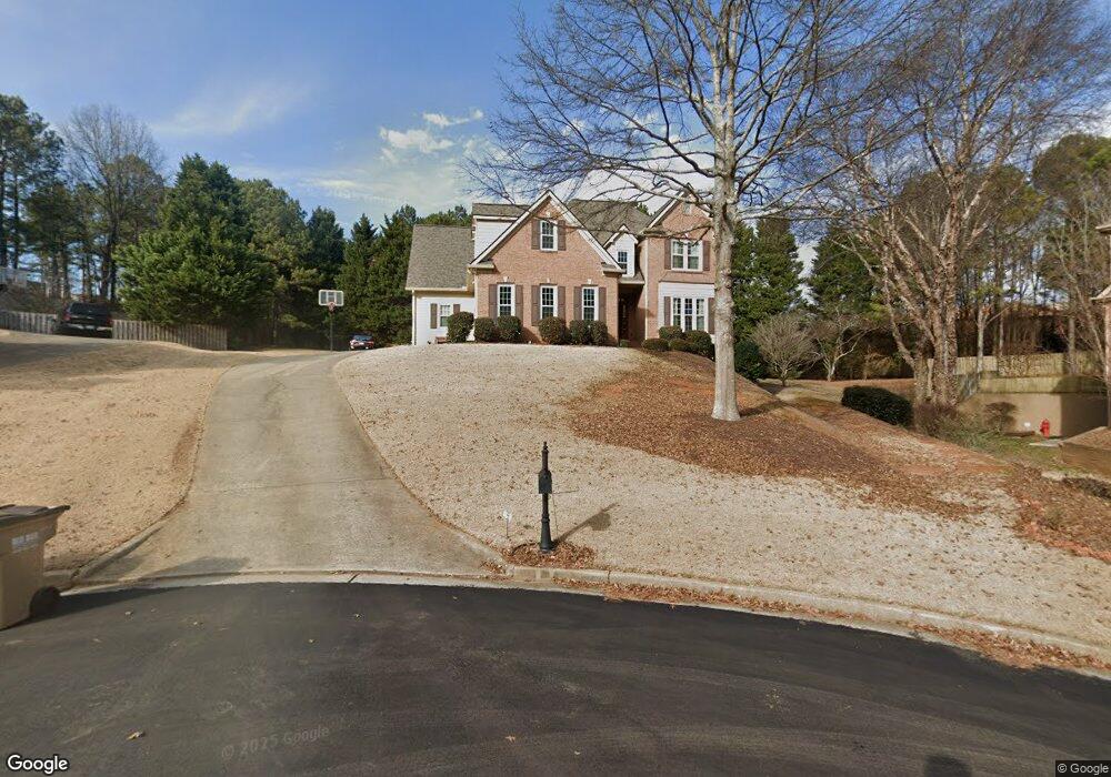
2160 Westford Cove Cumming, GA 30041
Big Creek NeighborhoodEstimated Value: $606,000 - $767,000
4
Beds
3
Baths
2,505
Sq Ft
$270/Sq Ft
Est. Value
About This Home
This home is located at 2160 Westford Cove, Cumming, GA 30041 and is currently estimated at $676,254, approximately $269 per square foot. 2160 Westford Cove is a home located in Forsyth County with nearby schools including Sharon Elementary School, South Forsyth Middle School, and South Forsyth High School.
Ownership History
Date
Name
Owned For
Owner Type
Purchase Details
Closed on
Aug 26, 1998
Sold by
Bishop Homes Ltd
Bought by
Myers Jeffrey T and Myers Deborah B
Current Estimated Value
Home Financials for this Owner
Home Financials are based on the most recent Mortgage that was taken out on this home.
Original Mortgage
$205,200
Outstanding Balance
$44,176
Interest Rate
6.99%
Mortgage Type
New Conventional
Estimated Equity
$632,078
Create a Home Valuation Report for This Property
The Home Valuation Report is an in-depth analysis detailing your home's value as well as a comparison with similar homes in the area
Home Values in the Area
Average Home Value in this Area
Purchase History
| Date | Buyer | Sale Price | Title Company |
|---|---|---|---|
| Myers Jeffrey T | $216,100 | -- |
Source: Public Records
Mortgage History
| Date | Status | Borrower | Loan Amount |
|---|---|---|---|
| Open | Myers Jeffrey T | $205,200 |
Source: Public Records
Tax History Compared to Growth
Tax History
| Year | Tax Paid | Tax Assessment Tax Assessment Total Assessment is a certain percentage of the fair market value that is determined by local assessors to be the total taxable value of land and additions on the property. | Land | Improvement |
|---|---|---|---|---|
| 2025 | $4,966 | $245,916 | $68,000 | $177,916 |
| 2024 | $4,966 | $250,160 | $60,000 | $190,160 |
| 2023 | $4,304 | $231,116 | $60,000 | $171,116 |
| 2022 | $3,951 | $156,080 | $40,000 | $116,080 |
| 2021 | $3,844 | $156,080 | $40,000 | $116,080 |
| 2020 | $3,741 | $151,056 | $40,000 | $111,056 |
| 2019 | $3,727 | $150,116 | $40,000 | $110,116 |
| 2018 | $3,288 | $128,296 | $28,000 | $100,296 |
| 2017 | $3,101 | $118,868 | $28,000 | $90,868 |
| 2016 | $2,932 | $110,868 | $20,000 | $90,868 |
| 2015 | $2,938 | $110,868 | $20,000 | $90,868 |
| 2014 | $2,376 | $93,048 | $20,000 | $73,048 |
Source: Public Records
Map
Nearby Homes
- 1760 Commonwealth Trail
- 2615 Hillandale Cir
- 2540 Hillandale Cir
- 2560 Hillandale Cir
- Davis Plan at Sterling Pointe
- Ward Plan at Sterling Pointe
- Richmond Plan at Sterling Pointe
- Valley Plan at Sterling Pointe
- Waterstone Plan at Sterling Pointe
- 2260 Thames Ct
- The Oxford Plan at Windsor Bluffs
- The Cambridge Plan at Windsor Bluffs
- The Berkshire Plan at Windsor Bluffs
- 2250 Thames Ct
- 2255 Windsor Bluffs Dr
- 2560 Bertrand Way
- 2545 Bertrand Way
- 1740 Cobble Creek Way
- 1430 Diplomat Dr
- 2335 Flat Stone Dr
- 2150 Westford Cove
- 2170 Westford Cove Unit 59
- 2170 Westford Cove
- 2140 Westford Cove
- 2165 Westford Cove
- 2155 Westford Cove
- 2145 Westford Cove
- 2130 Westford Cove
- 1637 Peachtree Pkwy
- 2135 Westford Cove
- 2170 Bricker Ct
- 0 Bricker Ct Unit 3248990
- 0 Bricker Ct Unit 7210249
- 0 Bricker Ct Unit 7258012
- 0 Westford Cove Unit 8666898
- 0 Westford Cove Unit 8641045
- 0 Westford Cove Unit 8185539
- 0 Westford Cove Unit 8367065
- 0 Westford Cove Unit 9068939
- 0 Westford Cove