2162 Mineral Rd New Marshfield, OH 45766
Estimated Value: $84,000 - $217,000
3
Beds
2
Baths
1,344
Sq Ft
$108/Sq Ft
Est. Value
About This Home
This home is located at 2162 Mineral Rd, New Marshfield, OH 45766 and is currently estimated at $145,061, approximately $107 per square foot. 2162 Mineral Rd is a home located in Athens County with nearby schools including Alexander Elementary School and Alexander Junior/Senior High School.
Ownership History
Date
Name
Owned For
Owner Type
Purchase Details
Closed on
Jun 14, 2007
Sold by
Allbaugh Leslie A
Bought by
Allbaugh Robert A and Keffer Joyce
Current Estimated Value
Home Financials for this Owner
Home Financials are based on the most recent Mortgage that was taken out on this home.
Original Mortgage
$36,000
Outstanding Balance
$6,616
Interest Rate
6.26%
Mortgage Type
Purchase Money Mortgage
Estimated Equity
$136,001
Purchase Details
Closed on
Jun 6, 2007
Sold by
Allbaugh Robert A and Allbaugh Joan L
Bought by
Cullison Harold A and Cullison Jackie R
Home Financials for this Owner
Home Financials are based on the most recent Mortgage that was taken out on this home.
Original Mortgage
$36,000
Outstanding Balance
$6,616
Interest Rate
6.26%
Mortgage Type
Purchase Money Mortgage
Estimated Equity
$136,001
Purchase Details
Closed on
May 8, 2003
Bought by
Allbaugh Leslie A
Purchase Details
Closed on
Jan 19, 2000
Sold by
Allbaugh Leslie A
Bought by
Allbaugh Leslie A & Doris H Trustees
Create a Home Valuation Report for This Property
The Home Valuation Report is an in-depth analysis detailing your home's value as well as a comparison with similar homes in the area
Home Values in the Area
Average Home Value in this Area
Purchase History
| Date | Buyer | Sale Price | Title Company |
|---|---|---|---|
| Cullison Harold A | $34,000 | Attorney | |
| Allbaugh Leslie A | -- | -- | |
| Allbaugh Leslie A & Doris H Trustees | -- | -- |
Source: Public Records
Mortgage History
| Date | Status | Borrower | Loan Amount |
|---|---|---|---|
| Open | Cullison Harold A | $36,000 |
Source: Public Records
Tax History Compared to Growth
Tax History
| Year | Tax Paid | Tax Assessment Tax Assessment Total Assessment is a certain percentage of the fair market value that is determined by local assessors to be the total taxable value of land and additions on the property. | Land | Improvement |
|---|---|---|---|---|
| 2024 | $1,130 | $25,910 | $3,930 | $21,980 |
| 2023 | $1,100 | $25,910 | $3,930 | $21,980 |
| 2022 | $972 | $21,290 | $3,270 | $18,020 |
| 2021 | $975 | $21,290 | $3,270 | $18,020 |
| 2020 | $935 | $21,290 | $3,270 | $18,020 |
| 2019 | $894 | $19,420 | $2,780 | $16,640 |
| 2018 | $894 | $19,420 | $2,780 | $16,640 |
| 2017 | $1,405 | $19,420 | $2,780 | $16,640 |
| 2016 | $935 | $19,680 | $2,530 | $17,150 |
| 2015 | $1,406 | $19,680 | $2,530 | $17,150 |
| 2014 | $1,406 | $19,680 | $2,530 | $17,150 |
| 2013 | $1,309 | $19,050 | $2,380 | $16,670 |
Source: Public Records
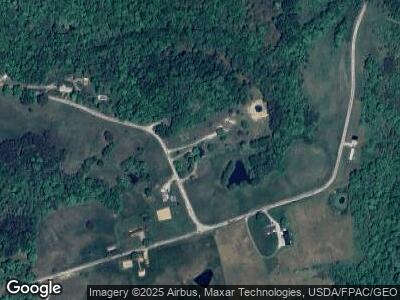
Map
Nearby Homes
- 0 Ohio 356
- 8455& 8459 Steinmeyer
- 6510 Ohio 681
- 2550 Ohio 56
- 5160 Gun Club Rd
- 4624 Rhoric Rd
- 1466 Ohio 56
- 6125 Ohio 56
- 0 Salem Rd
- 4768 Enlow Rd
- 7034 Woodmere Dr
- 8166 Lavelle Rd
- 7180 Radford Rd
- 0 Luhrig Rd
- Lot 10 Hetherstone
- Lot 19 Rosemary Ln
- 7902 Bittersweet Ct
- 7624 Edria Ln
- 8650 Lavelle Rd
- 6315 Radford Rd