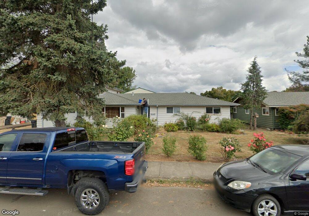
2163 Applegate St Philomath, OR 97370
Estimated Value: $487,238 - $567,000
4
Beds
3
Baths
1,910
Sq Ft
$274/Sq Ft
Est. Value
About This Home
This home is located at 2163 Applegate St, Philomath, OR 97370 and is currently estimated at $523,560, approximately $274 per square foot. 2163 Applegate St is a home located in Benton County with nearby schools including Clemens Primary School, Philomath Elementary School, and Philomath Middle School.
Ownership History
Date
Name
Owned For
Owner Type
Purchase Details
Closed on
Feb 18, 2003
Sold by
Spenst Elsie Freida
Bought by
Skinkis Randall Kevin and Skinkis Karen Michelle
Current Estimated Value
Home Financials for this Owner
Home Financials are based on the most recent Mortgage that was taken out on this home.
Original Mortgage
$50,000
Outstanding Balance
$21,128
Interest Rate
5.89%
Estimated Equity
$502,432
Create a Home Valuation Report for This Property
The Home Valuation Report is an in-depth analysis detailing your home's value as well as a comparison with similar homes in the area
Home Values in the Area
Average Home Value in this Area
Purchase History
| Date | Buyer | Sale Price | Title Company |
|---|---|---|---|
| Skinkis Randall Kevin | -- | Fidelity Natl Title Co Of Or |
Source: Public Records
Mortgage History
| Date | Status | Borrower | Loan Amount |
|---|---|---|---|
| Open | Skinkis Randall Kevin | $50,000 |
Source: Public Records
Tax History Compared to Growth
Tax History
| Year | Tax Paid | Tax Assessment Tax Assessment Total Assessment is a certain percentage of the fair market value that is determined by local assessors to be the total taxable value of land and additions on the property. | Land | Improvement |
|---|---|---|---|---|
| 2025 | $5,034 | $280,572 | -- | -- |
| 2024 | $5,034 | $272,400 | -- | -- |
| 2023 | $4,771 | $264,466 | $0 | $0 |
| 2022 | $4,633 | $256,763 | $0 | $0 |
| 2021 | $4,502 | $249,284 | $0 | $0 |
| 2020 | $4,529 | $242,023 | $0 | $0 |
| 2019 | $4,204 | $234,974 | $0 | $0 |
| 2018 | $4,232 | $228,130 | $0 | $0 |
| 2017 | $4,118 | $221,485 | $0 | $0 |
| 2016 | $3,854 | $215,034 | $0 | $0 |
| 2015 | $3,589 | $208,771 | $0 | $0 |
| 2014 | $3,523 | $202,690 | $0 | $0 |
| 2012 | -- | $195,722 | $0 | $0 |
Source: Public Records
Map
Nearby Homes
- 135 S 21st St
- 224 S 24th St
- 240 N 19th St
- 235 S 18th St
- 1717 Main St
- 2820 Newton Place
- 2759 Newton St
- 2892 Newton Place
- 223 N 14th St
- 346 Robb Place
- 1502 Timothy St
- 760 S 16th St
- 409 S 30th St
- 407 S 30th St
- 3125 Southwood Dr
- 345 N 11th (351) St
- 807 N 12th St
- 1284 N 19th St Unit 7 St
- 1284 N 19th St
- 1284 N 19th St Unit 4 St
- 2173 Applegate St
- 2151 Applegate St
- 2138 Main St
- 2207 Applegate St
- 2160 Applegate St
- 2137 Applegate St
- 2178 Applegate St
- 2148 Applegate St
- 2136 Main St
- 2125 Applegate St
- 2208 Applegate St
- 2132 Main St
- 2128 Applegate St
- 2148 Main St
- 2148 Main (& 2138) St
- 2223 Applegate St
- 2127 Applegate St
- 2130 Main St
- 2224 Applegate St
- 2120 Applegate St