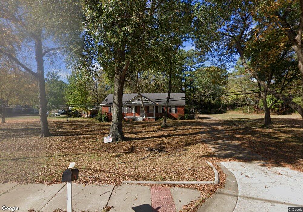
2165 Highway 51 S Hernando, MS 38632
Estimated Value: $268,000 - $753,000
3
Beds
2
Baths
1,973
Sq Ft
$259/Sq Ft
Est. Value
About This Home
This home is located at 2165 Highway 51 S, Hernando, MS 38632 and is currently estimated at $511,888, approximately $259 per square foot. 2165 Highway 51 S is a home located in DeSoto County with nearby schools including Oak Grove Central Elementary School, Hernando Elementary School, and Hernando Hills Elementary.
Ownership History
Date
Name
Owned For
Owner Type
Purchase Details
Closed on
Jul 15, 2021
Sold by
Wilkins J Cal J and Wilkins Linda J
Bought by
Prewett Services Llc
Current Estimated Value
Home Financials for this Owner
Home Financials are based on the most recent Mortgage that was taken out on this home.
Original Mortgage
$236,391
Interest Rate
2.22%
Create a Home Valuation Report for This Property
The Home Valuation Report is an in-depth analysis detailing your home's value as well as a comparison with similar homes in the area
Home Values in the Area
Average Home Value in this Area
Purchase History
| Date | Buyer | Sale Price | Title Company |
|---|---|---|---|
| Prewett Services Llc | -- | None Available | |
| Prewett Services Llc | -- | Ready George B |
Source: Public Records
Mortgage History
| Date | Status | Borrower | Loan Amount |
|---|---|---|---|
| Closed | Prewett Services Llc | $236,391 |
Source: Public Records
Tax History
| Year | Tax Paid | Tax Assessment Tax Assessment Total Assessment is a certain percentage of the fair market value that is determined by local assessors to be the total taxable value of land and additions on the property. | Land | Improvement |
|---|---|---|---|---|
| 2025 | $2,160 | $18,543 | $3,000 | $15,543 |
| 2024 | $1,916 | $13,811 | $3,000 | $10,811 |
| 2023 | $1,916 | $13,811 | $0 | $0 |
| 2022 | $1,916 | $13,811 | $3,000 | $10,811 |
| 2021 | $1,916 | $13,811 | $3,000 | $10,811 |
| 2020 | $1,796 | $12,946 | $0 | $0 |
| 2019 | $1,796 | $12,946 | $3,000 | $9,946 |
| 2017 | $1,752 | $22,122 | $12,561 | $9,561 |
| 2016 | $1,678 | $12,561 | $3,000 | $9,561 |
| 2015 | $1,678 | $22,122 | $12,561 | $9,561 |
| 2014 | $1,092 | $8,374 | $0 | $0 |
| 2013 | $114 | $8,374 | $0 | $0 |
Source: Public Records
Map
Nearby Homes
- 2035 Highway 51 S
- 313 Northwood Hills Dr
- 5 W Commerce St
- 120 N Parkway St
- 1770 Robertson Place Dr
- 186 E South St
- 1757 Robertson Place Dr
- 2948 Caffey St
- 69 Lake Pointe Dr
- 270 Gaslight Cove
- 1 E Oak Grove Rd
- 2833 Mount Pleasant S
- 509 Howell Way
- 1280 S Lake Dr
- 1207 Howell Way
- 1268 S Lake Dr
- 521 Abey Ln
- 3 Lake View Dr
- 1 Lake View Dr
- 1231 Cross Creek Dr E
- 2165 Highway 51 S
- 340 W Robinson St
- 354 W Robinson St
- 331 W Robinson St
- 2000 Memphis St
- 2170 Highway 51 S
- 374 W Robinson St
- 2105 Highway 51 S
- 351 W Robinson St
- 361 W Robinson St
- 2225 Memphis St
- 2144 Gale Cove
- 390 W Robinson St
- 2170 Highway Unit 3 51
- 2170 Highway Unit 4 51
- 2170 Highway Unit 51
- 371 W Robinson St
- 2220 S Hwy Unit 51
- 2128 Gale Cove
- 248 W Robinson St
Your Personal Tour Guide
Ask me questions while you tour the home.