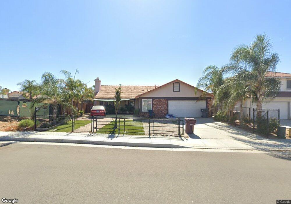
21651 Dawes St Perris, CA 92570
Estimated Value: $504,000 - $589,000
3
Beds
2
Baths
1,541
Sq Ft
$358/Sq Ft
Est. Value
About This Home
This home is located at 21651 Dawes St, Perris, CA 92570 and is currently estimated at $552,382, approximately $358 per square foot. 21651 Dawes St is a home located in Riverside County with nearby schools including Manuel L. Real Elementary School, Tomas Rivera Middle School, and Citrus Hill High School.
Ownership History
Date
Name
Owned For
Owner Type
Purchase Details
Closed on
Apr 16, 2022
Sold by
Mora Quijas Salvador
Bought by
Salvador Mora Quijas Revocable Living Trust
Current Estimated Value
Purchase Details
Closed on
Aug 8, 2011
Sold by
Federal Home Loan Mortgage Corporation
Bought by
Quijas Salvador Mora and Jauregui Maria Guadalupe Marin
Home Financials for this Owner
Home Financials are based on the most recent Mortgage that was taken out on this home.
Original Mortgage
$134,501
Interest Rate
4.46%
Mortgage Type
FHA
Purchase Details
Closed on
Apr 22, 2011
Sold by
Kearney Joseph S
Bought by
Federal Home Loan Mortgage Corporation
Purchase Details
Closed on
May 21, 2007
Sold by
Stonewood Housing Partners Lp
Bought by
Kearney Joseph S
Home Financials for this Owner
Home Financials are based on the most recent Mortgage that was taken out on this home.
Original Mortgage
$321,490
Interest Rate
6.65%
Mortgage Type
New Conventional
Create a Home Valuation Report for This Property
The Home Valuation Report is an in-depth analysis detailing your home's value as well as a comparison with similar homes in the area
Home Values in the Area
Average Home Value in this Area
Purchase History
| Date | Buyer | Sale Price | Title Company |
|---|---|---|---|
| Salvador Mora Quijas Revocable Living Trust | -- | Quijas Salvador Mora | |
| Quijas Salvador Mora | $138,000 | Lsi Title Company | |
| Federal Home Loan Mortgage Corporation | $133,000 | Accommodation | |
| Kearney Joseph S | $321,500 | Chicago Title Company |
Source: Public Records
Mortgage History
| Date | Status | Borrower | Loan Amount |
|---|---|---|---|
| Previous Owner | Quijas Salvador Mora | $134,501 | |
| Previous Owner | Kearney Joseph S | $321,490 |
Source: Public Records
Tax History
| Year | Tax Paid | Tax Assessment Tax Assessment Total Assessment is a certain percentage of the fair market value that is determined by local assessors to be the total taxable value of land and additions on the property. | Land | Improvement |
|---|---|---|---|---|
| 2025 | $6,164 | $541,215 | $127,344 | $413,871 |
| 2023 | $6,164 | $520,200 | $122,400 | $397,800 |
| 2022 | $2,062 | $163,326 | $44,970 | $118,356 |
| 2021 | $2,022 | $160,125 | $44,089 | $116,036 |
| 2020 | $2,001 | $158,484 | $43,637 | $114,847 |
| 2019 | $1,890 | $155,378 | $42,782 | $112,596 |
| 2018 | $1,863 | $152,333 | $41,945 | $110,388 |
| 2017 | $1,821 | $149,347 | $41,123 | $108,224 |
| 2016 | $1,800 | $146,419 | $40,317 | $106,102 |
| 2015 | $1,774 | $144,221 | $39,712 | $104,509 |
| 2014 | $1,752 | $141,398 | $38,935 | $102,463 |
Source: Public Records
Map
Nearby Homes
- 0 Marquez Rd
- 21285 Kinney St
- 21321 Cajalco Rd
- 21274 Cajalco Rd
- 21916 Jean St
- 21701 Perry St
- 21131 Martin St
- 21725 Pinewood St
- 0 Old Elsinore Rd Unit DW25247795
- 20785 Burns St
- 22647 Cajalco Rd
- 20243 Lee Rd
- 20553 Hunter St
- 20541 Hunter St
- 20521 Hunter St
- 20540 Verta St
- 20646 Markham St
- 20434 Myron St
- 22738 Redwood Dr
- 18583 Seaton Ave
- 21661 Dawes St
- 21641 Dawes St
- 21631 Dawes St
- 19302 Winter Rock Ct
- 19312 Winter Rock Ct
- 19289 Summerwind Trail
- 19299 Summerwind Trail
- 19262 Spring Rock Ct
- 21621 Dawes St
- 19309 Summerwind Trail
- 19269 Summerwind Trail
- 19267 Spring Rock Ct
- 19252 Spring Rock Ct
- 19317 Winter Rock Ct
- 19319 Summerwind Trail
- 19322 Winter Rock Ct
- 21611 Dawes St
- 19259 Summerwind Trail
- 19257 Spring Rock Ct
- 19242 Spring Rock Ct
Your Personal Tour Guide
Ask me questions while you tour the home.