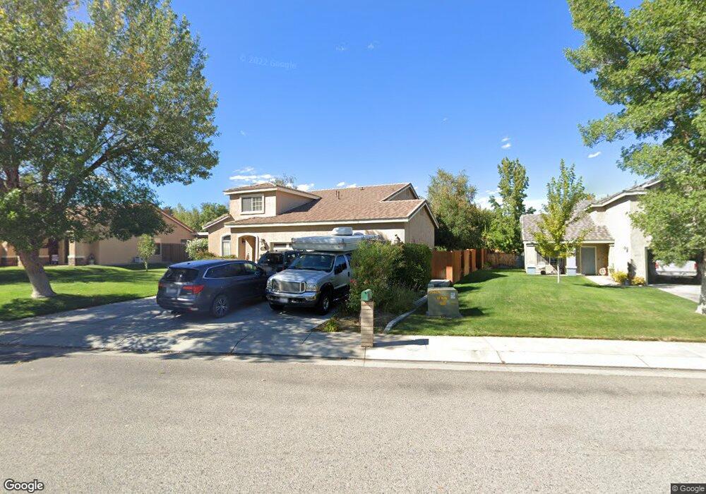
2167 Kiowa Cir Bishop, CA 93514
Estimated Value: $662,000 - $783,000
5
Beds
3
Baths
2,663
Sq Ft
$269/Sq Ft
Est. Value
About This Home
This home is located at 2167 Kiowa Cir, Bishop, CA 93514 and is currently estimated at $715,957, approximately $268 per square foot. 2167 Kiowa Cir is a home located in Inyo County with nearby schools including Bishop Elementary School, Elm Street Elementary School, and Home Street Middle School.
Ownership History
Date
Name
Owned For
Owner Type
Purchase Details
Closed on
Aug 19, 2008
Sold by
Ronci Arthur and Ronci Joann
Bought by
Johnson Brian Scott and Johnson Margo
Current Estimated Value
Home Financials for this Owner
Home Financials are based on the most recent Mortgage that was taken out on this home.
Original Mortgage
$290,500
Outstanding Balance
$192,247
Interest Rate
6.5%
Mortgage Type
Purchase Money Mortgage
Estimated Equity
$523,710
Create a Home Valuation Report for This Property
The Home Valuation Report is an in-depth analysis detailing your home's value as well as a comparison with similar homes in the area
Home Values in the Area
Average Home Value in this Area
Purchase History
| Date | Buyer | Sale Price | Title Company |
|---|---|---|---|
| Johnson Brian Scott | $415,000 | Inyo Mono Title Company |
Source: Public Records
Mortgage History
| Date | Status | Borrower | Loan Amount |
|---|---|---|---|
| Open | Johnson Brian Scott | $290,500 |
Source: Public Records
Tax History Compared to Growth
Tax History
| Year | Tax Paid | Tax Assessment Tax Assessment Total Assessment is a certain percentage of the fair market value that is determined by local assessors to be the total taxable value of land and additions on the property. | Land | Improvement |
|---|---|---|---|---|
| 2025 | $5,495 | $534,403 | $238,227 | $296,176 |
| 2024 | $5,495 | $523,925 | $233,556 | $290,369 |
| 2023 | $5,370 | $513,653 | $228,977 | $284,676 |
| 2022 | $5,349 | $503,583 | $224,488 | $279,095 |
| 2021 | $5,261 | $493,710 | $220,087 | $273,623 |
| 2020 | $5,087 | $488,649 | $217,831 | $270,818 |
| 2019 | $5,087 | $479,068 | $213,560 | $265,508 |
| 2018 | $4,976 | $469,675 | $209,373 | $260,302 |
| 2017 | $4,874 | $460,467 | $205,268 | $255,199 |
| 2016 | $4,818 | $451,440 | $201,244 | $250,196 |
| 2015 | $4,724 | $444,660 | $198,222 | $246,438 |
| 2014 | $4,629 | $435,951 | $194,340 | $241,611 |
Source: Public Records
Map
Nearby Homes
- 2168 Kiowa Cir
- 1805 Shoshone Dr
- 1510 Glenwood Ln Unit 47
- 2234 Brigadoon Ave
- 2227 Darby Ave
- 1495 Argyle Ln
- 1495 Argyle Ln Unit 86
- 2310 Fiora Ave
- 1424 Rocking West Dr
- 2322 Galloway Ave
- 2371 Edinburgh Ave
- 1369 Glenwood Ln
- 1369 Glenwood Ln Unit 48
- 896 Home St
- 543 Sierra St
- 771 N Main St Unit 39
- 198 Mac Iver St Unit 2
- 3115 W Line St
- 3115 W Line St Unit 1
- 223 Wildrose Ln
- 2167 Kiowa Cir Unit 6
- 2175 Kiowa Cir
- 2161 Kiowa Cir
- 1852 Shoshone Dr
- 2181 Kiowa Cir
- 2155 Kiowa Cir
- 1840 Shoshone Dr Unit 37
- 1840 Shoshone Dr
- 2162 Kiowa Cir
- 2174 Kiowa Cir
- 1851 Shoshone Dr Unit 24
- 1851 Shoshone Dr Unit 4
- 1851 Shoshone Dr
- 2149 Kiowa Cir Unit 9
- 2149 Kiowa Cir
- 2156 Kiowa Cir
- 1806 Shoshone Dr
- 1959 Shoshone Dr Unit 22
- 1959 Shoshone Dr
- 1887 Shoshone Dr Unit 23