Estimated Value: $384,000 - $438,862
3
Beds
4
Baths
1,783
Sq Ft
$236/Sq Ft
Est. Value
About This Home
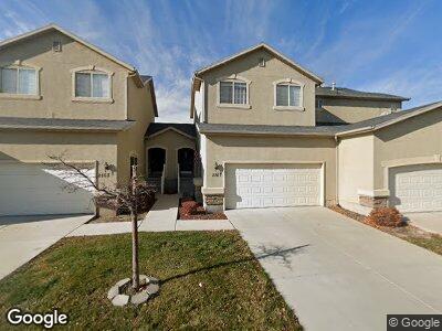
This home is located at 2167 N 2040 W, Lehi, UT 84043 and is currently estimated at $420,716, approximately $235 per square foot. 2167 N 2040 W is a home located in Utah County with nearby schools including Liberty Hills Elementary School, Skyridge High School, and Ascent Academies of Utah - Lehi Campus.
Ownership History
Date
Name
Owned For
Owner Type
Purchase Details
Closed on
Jul 29, 2009
Sold by
Gratzinger Michael and Gratzinger Nicole K
Bought by
Thomas Fernando J and Lara Alba L
Current Estimated Value
Home Financials for this Owner
Home Financials are based on the most recent Mortgage that was taken out on this home.
Original Mortgage
$176,641
Interest Rate
5.3%
Mortgage Type
FHA
Purchase Details
Closed on
Dec 15, 2005
Sold by
Pointe Meadows Townhomes Llc
Bought by
Gratzinger Michael and Gratzinger Nicole K
Home Financials for this Owner
Home Financials are based on the most recent Mortgage that was taken out on this home.
Original Mortgage
$29,987
Interest Rate
6.36%
Mortgage Type
Stand Alone Second
Create a Home Valuation Report for This Property
The Home Valuation Report is an in-depth analysis detailing your home's value as well as a comparison with similar homes in the area
Home Values in the Area
Average Home Value in this Area
Purchase History
| Date | Buyer | Sale Price | Title Company |
|---|---|---|---|
| Thomas Fernando J | -- | First American Union Park | |
| Gratzinger Michael | -- | Cottonwood Title Insurance |
Source: Public Records
Mortgage History
| Date | Status | Borrower | Loan Amount |
|---|---|---|---|
| Open | Thomas Fernando J | $171,000 | |
| Open | Thomas Fernando J | $582,000 | |
| Closed | Thomas Fernando J | $582,000 | |
| Closed | Thomas Fernando J | $162,400 | |
| Closed | Thomas Fernando J | $176,392 | |
| Closed | Thomas Fernando J | $176,641 | |
| Previous Owner | Gratzinger Michael | $151,000 | |
| Previous Owner | Gratzinger Michael | $29,987 | |
| Previous Owner | Gratzinger Michael | $119,948 |
Source: Public Records
Tax History Compared to Growth
Tax History
| Year | Tax Paid | Tax Assessment Tax Assessment Total Assessment is a certain percentage of the fair market value that is determined by local assessors to be the total taxable value of land and additions on the property. | Land | Improvement |
|---|---|---|---|---|
| 2024 | $1,910 | $223,520 | $0 | $0 |
| 2023 | $1,653 | $209,990 | $0 | $0 |
| 2022 | $149 | $211,695 | $0 | $0 |
| 2021 | $1,554 | $289,400 | $43,400 | $246,000 |
| 2020 | $1,451 | $267,100 | $40,100 | $227,000 |
| 2019 | $1,302 | $249,100 | $37,400 | $211,700 |
| 2018 | $1,134 | $205,100 | $30,800 | $174,300 |
| 2017 | $1,081 | $104,005 | $0 | $0 |
| 2016 | $1,165 | $104,005 | $0 | $0 |
| 2015 | $1,169 | $99,000 | $0 | $0 |
| 2014 | $1,078 | $90,750 | $0 | $0 |
Source: Public Records
Map
Nearby Homes
- 1898 W Pointe Meadow Loop
- 2014 N 2090 St W
- 2015 N 2090 St W
- 1972 N 2160 St W
- 1994 N 2160 St W
- 2016 N 2160 St W
- 1992 N 2090 St W
- 1853 W 2250 N
- 1971 N 2090 St W
- 1972 2160 St W
- 2246 W 2000 St N
- 2240 W 2000 St N
- 2280 N 2350 W
- 1051 N 3685 W Unit 250
- 1027 N 3685 W Unit 248
- 1003 N 3685 W Unit 246
- 1993 N 2090 W
- 2121 W 1960 N
- 2772 W 1500 N
- 2077 W 1960 St N
- 2167 N 2040 W
- 2173 N 2040 W
- 2163 N 2040 W
- 2159 N 2040 W
- 2172 N 2080 W
- 2178 N 2080 W
- 2168 N 2080 W
- 2162 N 2080 W
- 2052 W 2180 N Unit 21C
- 2048 W 2180 N
- 2048 W 2180 N Unit 21D
- 2172 N 2040 W
- 2178 N 2040 W
- 2168 N 2040 W
- 2058 W 2180 N
- 2058 W 2180 N Unit 21B
- 2162 N 2040 W
- 2062 W 2180 N
- 2062 W 2180 N Unit 21A
- 2038 W 2180 N