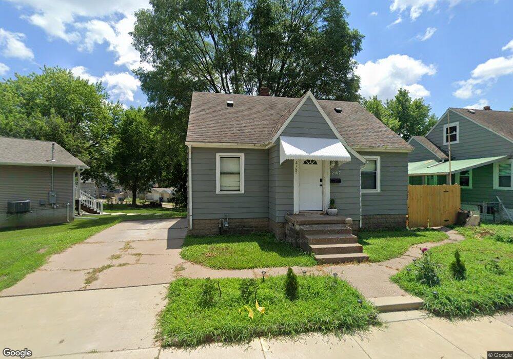
2167 Telegraph Rd Davenport, IA 52804
Fejervary NeighborhoodEstimated Value: $94,000 - $121,000
3
Beds
1
Bath
1,167
Sq Ft
$90/Sq Ft
Est. Value
About This Home
This home is located at 2167 Telegraph Rd, Davenport, IA 52804 and is currently estimated at $105,609, approximately $90 per square foot. 2167 Telegraph Rd is a home located in Scott County with nearby schools including Walnut Hill Elementary School, South Christian Elementary School, and Wilson Elementary School.
Ownership History
Date
Name
Owned For
Owner Type
Purchase Details
Closed on
Oct 18, 2013
Sold by
Gibson Christie
Bought by
Ohp 1 Llc
Current Estimated Value
Purchase Details
Closed on
Feb 20, 2012
Sold by
Ohp I Lc
Bought by
Fersch Lee and Friedrichsen Stephanie
Home Financials for this Owner
Home Financials are based on the most recent Mortgage that was taken out on this home.
Original Mortgage
$57,000
Interest Rate
3.89%
Mortgage Type
Seller Take Back
Purchase Details
Closed on
Apr 25, 2007
Sold by
Serrano Gary F and Serrano Mary M
Bought by
Ohp 1 Lc
Create a Home Valuation Report for This Property
The Home Valuation Report is an in-depth analysis detailing your home's value as well as a comparison with similar homes in the area
Home Values in the Area
Average Home Value in this Area
Purchase History
| Date | Buyer | Sale Price | Title Company |
|---|---|---|---|
| Ohp 1 Llc | -- | None Available | |
| Fersch Lee | $58,500 | None Available | |
| Ohp 1 Lc | -- | None Available |
Source: Public Records
Mortgage History
| Date | Status | Borrower | Loan Amount |
|---|---|---|---|
| Previous Owner | Fersch Lee | $57,000 |
Source: Public Records
Tax History Compared to Growth
Tax History
| Year | Tax Paid | Tax Assessment Tax Assessment Total Assessment is a certain percentage of the fair market value that is determined by local assessors to be the total taxable value of land and additions on the property. | Land | Improvement |
|---|---|---|---|---|
| 2025 | $1,424 | $91,490 | $9,040 | $82,450 |
| 2024 | $1,390 | $79,710 | $9,040 | $70,670 |
| 2023 | $1,256 | $79,710 | $9,040 | $70,670 |
| 2022 | $1,424 | $58,760 | $9,040 | $49,720 |
| 2021 | $1,260 | $58,760 | $9,040 | $49,720 |
| 2020 | $1,712 | $57,660 | $9,040 | $48,620 |
| 2019 | $2,494 | $53,240 | $9,040 | $44,200 |
| 2018 | $1,849 | $53,240 | $9,040 | $44,200 |
| 2017 | $1,210 | $53,240 | $9,040 | $44,200 |
| 2016 | $1,166 | $53,240 | $0 | $0 |
| 2015 | $1,166 | $59,820 | $0 | $0 |
| 2014 | $1,328 | $59,820 | $0 | $0 |
| 2013 | $1,306 | $0 | $0 | $0 |
| 2012 | -- | $57,460 | $7,380 | $50,080 |
Source: Public Records
Map
Nearby Homes