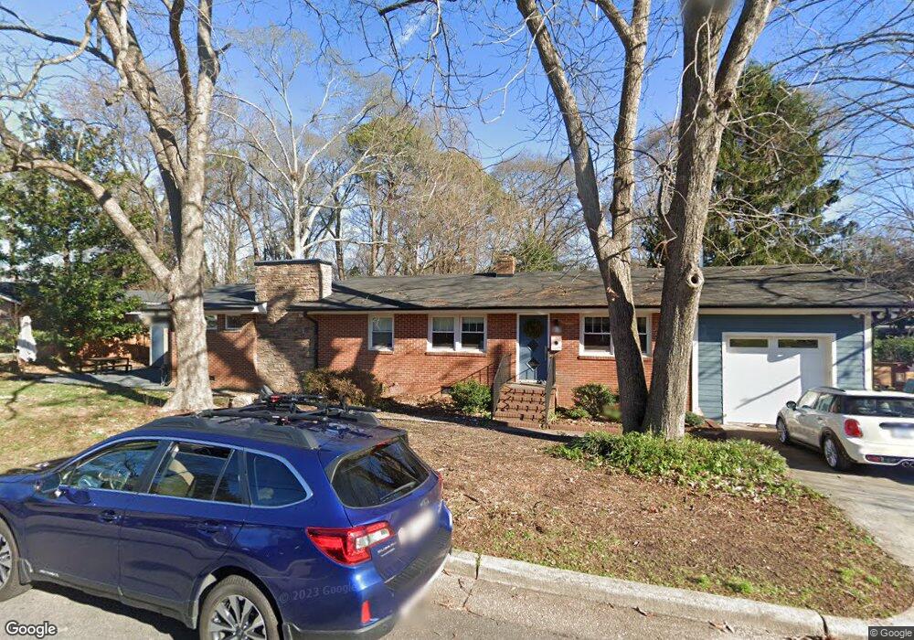
217 Bart St Raleigh, NC 27610
Battery Heights NeighborhoodEstimated Value: $428,000 - $528,000
3
Beds
1
Bath
1,013
Sq Ft
$482/Sq Ft
Est. Value
About This Home
This home is located at 217 Bart St, Raleigh, NC 27610 and is currently estimated at $488,679, approximately $482 per square foot. 217 Bart St is a home located in Wake County with nearby schools including Central Wake High School.
Ownership History
Date
Name
Owned For
Owner Type
Purchase Details
Closed on
Aug 8, 2014
Sold by
Adams C Vincent and Adams Hester Monk
Bought by
Anderson David O and Anderson Kristen D
Current Estimated Value
Home Financials for this Owner
Home Financials are based on the most recent Mortgage that was taken out on this home.
Original Mortgage
$167,400
Outstanding Balance
$125,902
Interest Rate
3.75%
Mortgage Type
Adjustable Rate Mortgage/ARM
Estimated Equity
$362,777
Create a Home Valuation Report for This Property
The Home Valuation Report is an in-depth analysis detailing your home's value as well as a comparison with similar homes in the area
Home Values in the Area
Average Home Value in this Area
Purchase History
| Date | Buyer | Sale Price | Title Company |
|---|---|---|---|
| Anderson David O | $168,000 | None Available |
Source: Public Records
Mortgage History
| Date | Status | Borrower | Loan Amount |
|---|---|---|---|
| Open | Anderson David O | $167,400 |
Source: Public Records
Tax History Compared to Growth
Tax History
| Year | Tax Paid | Tax Assessment Tax Assessment Total Assessment is a certain percentage of the fair market value that is determined by local assessors to be the total taxable value of land and additions on the property. | Land | Improvement |
|---|---|---|---|---|
| 2025 | $4,509 | $514,744 | $210,000 | $304,744 |
| 2024 | $4,491 | $514,744 | $210,000 | $304,744 |
| 2023 | $4,008 | $365,863 | $135,000 | $230,863 |
| 2022 | $3,724 | $365,863 | $135,000 | $230,863 |
| 2021 | $3,580 | $365,863 | $135,000 | $230,863 |
| 2020 | $3,515 | $365,863 | $135,000 | $230,863 |
| 2019 | $2,019 | $172,513 | $77,000 | $95,513 |
| 2018 | $1,905 | $172,513 | $77,000 | $95,513 |
| 2017 | $1,815 | $172,513 | $77,000 | $95,513 |
| 2016 | $1,778 | $172,513 | $77,000 | $95,513 |
| 2015 | $939 | $88,710 | $34,000 | $54,710 |
| 2014 | -- | $88,710 | $34,000 | $54,710 |
Source: Public Records
Map
Nearby Homes
- 1116 E Martin St
- 333 Merrywood Dr
- 1529 Battery Dr
- 200 Lincoln Ct
- 1611 Poole Rd
- 500 Sherrybrook Dr
- 15 Saint Augustine Ave
- 123 Star St
- 923 E Hargett St
- 102 Saint Augustine Ave
- 204 S State St
- 305 Freeman St
- 1501 Beauty Ave
- 1307 E Jones St
- 1317 Pender St
- 1305 E Jones St
- 806 Postell St
- 12 N Tarboro St
- 605 Quarry St
- 801 E Martin St Unit B
- 1305 E Martin St
- 1305 Martin Dr
- 1215 E Martin St
- 1309 E Martin St
- 209 Bart St
- 1213 E Martin St
- 1313 E Martin St
- 207 Bart St
- 208 Bart St
- 1334 Martin Creek Dr
- 205 Bart St
- 206 Bart St
- 1216 E Martin St
- 1317 E Martin St
- 1209 E Martin St
- 204 Bart St
- 1214 E Martin St
- 202 Bart St
- 312 Parrish St
- 1212 E Martin St