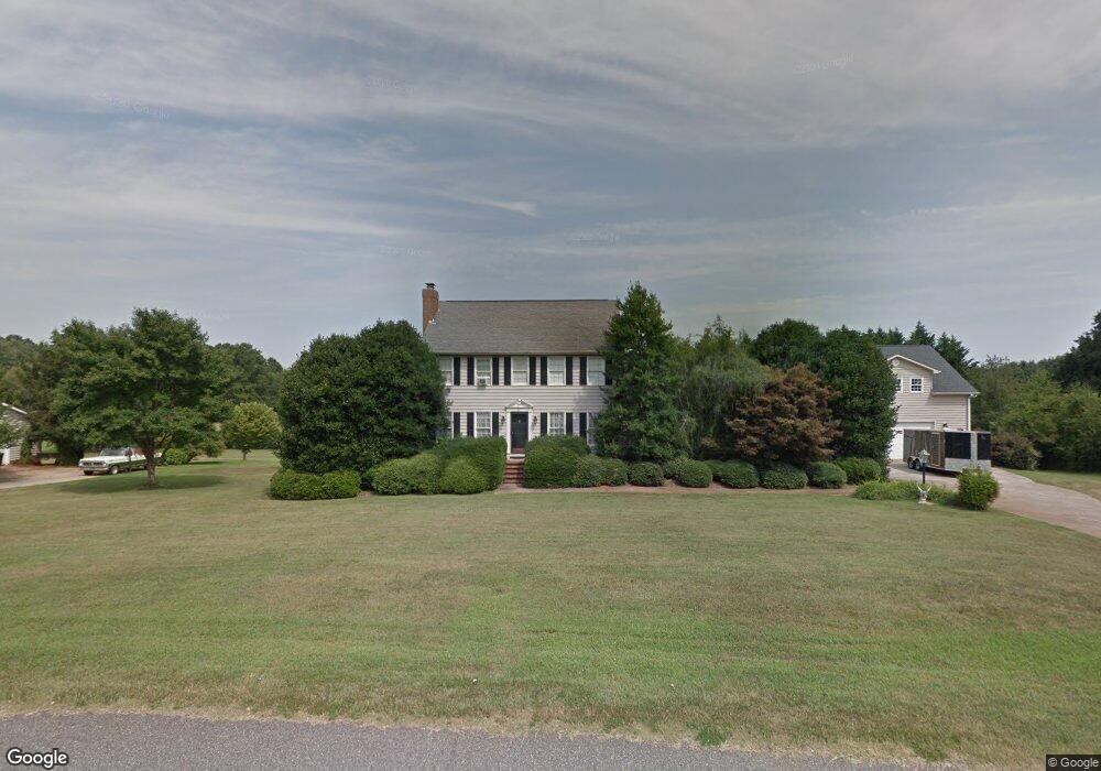
217 Devon Way Anderson, SC 29621
Estimated Value: $489,000 - $529,000
4
Beds
3
Baths
2,100
Sq Ft
$242/Sq Ft
Est. Value
About This Home
This home is located at 217 Devon Way, Anderson, SC 29621 and is currently estimated at $507,165, approximately $241 per square foot. 217 Devon Way is a home located in Anderson County with nearby schools including Midway Elementary School, Glenview Middle School, and T.L. Hanna High School.
Ownership History
Date
Name
Owned For
Owner Type
Purchase Details
Closed on
Apr 23, 2010
Sold by
Bailey Larry D
Bought by
Bailey Brenda M
Current Estimated Value
Purchase Details
Closed on
Apr 15, 2005
Sold by
Cooley James Kenneth
Bought by
Bailey Larry D and Bailey Brenda M
Home Financials for this Owner
Home Financials are based on the most recent Mortgage that was taken out on this home.
Original Mortgage
$193,500
Outstanding Balance
$100,502
Interest Rate
5.88%
Mortgage Type
Purchase Money Mortgage
Estimated Equity
$406,663
Purchase Details
Closed on
Aug 1, 2003
Sold by
Jolly James D
Bought by
Cooley James K
Create a Home Valuation Report for This Property
The Home Valuation Report is an in-depth analysis detailing your home's value as well as a comparison with similar homes in the area
Home Values in the Area
Average Home Value in this Area
Purchase History
| Date | Buyer | Sale Price | Title Company |
|---|---|---|---|
| Bailey Brenda M | -- | -- | |
| Bailey Larry D | $215,000 | -- | |
| Cooley James K | $187,625 | -- | |
| Reno William T | $180,000 | -- |
Source: Public Records
Mortgage History
| Date | Status | Borrower | Loan Amount |
|---|---|---|---|
| Open | Bailey Larry D | $193,500 |
Source: Public Records
Tax History
| Year | Tax Paid | Tax Assessment Tax Assessment Total Assessment is a certain percentage of the fair market value that is determined by local assessors to be the total taxable value of land and additions on the property. | Land | Improvement |
|---|---|---|---|---|
| 2024 | $1,461 | $13,670 | $1,410 | $12,260 |
| 2023 | $1,472 | $13,670 | $1,410 | $12,260 |
| 2022 | $1,441 | $13,670 | $1,410 | $12,260 |
| 2021 | $1,283 | $11,040 | $1,000 | $10,040 |
| 2020 | $1,272 | $11,040 | $1,000 | $10,040 |
| 2019 | $1,272 | $11,040 | $1,000 | $10,040 |
| 2018 | $1,294 | $11,040 | $1,000 | $10,040 |
| 2017 | -- | $11,040 | $1,000 | $10,040 |
| 2016 | $1,161 | $10,970 | $880 | $10,090 |
| 2015 | $1,188 | $10,970 | $880 | $10,090 |
| 2014 | $1,183 | $10,970 | $880 | $10,090 |
Source: Public Records
Map
Nearby Homes
- 406 Hopewell Ridge
- 109 Limelight Dr
- 1001 White Oak Dr
- 1420 White Oak Dr
- 139 Rivendell Dr
- 105 Bree Dr
- 123 Silo Ridge Dr
- 116 Silo Ridge Dr
- 121 Silo Ridge Dr
- 114 Silo Ridge Dr
- 119 Silo Ridge Dr
- 117 Silo Ridge Dr
- 270 Silo Ridge Dr
- 129 Silo Ridge Dr
- 276 Silo Ridge Dr
- 288 Silo Ridge Dr
- 284 Silo Ridge Dr
- 131 Silo Ridge Dr
- 264 Silo Ridge Dr
- 604 Hopewell Ridge
- 215 Devon Way
- 219 Devon Way Unit ANDERSON
- 219 Devon Way
- 606 Hopewell Ridge
- 222 Devon Way
- 602 Hopewell Ridge
- 224 Devon Way
- 220 Devon Way
- 103 Wiltshire Ct
- 213 Devon Way
- 213 Devon Way
- 211 Devon Way
- 300 Devon Way
- 218 Devon Way
- 600 Hopewell Ridge
- 301 Devon Way
- 608 Hopewell Ridge
- 305 Surrey Ln
- 105 Wiltshire Ct
Your Personal Tour Guide
Ask me questions while you tour the home.