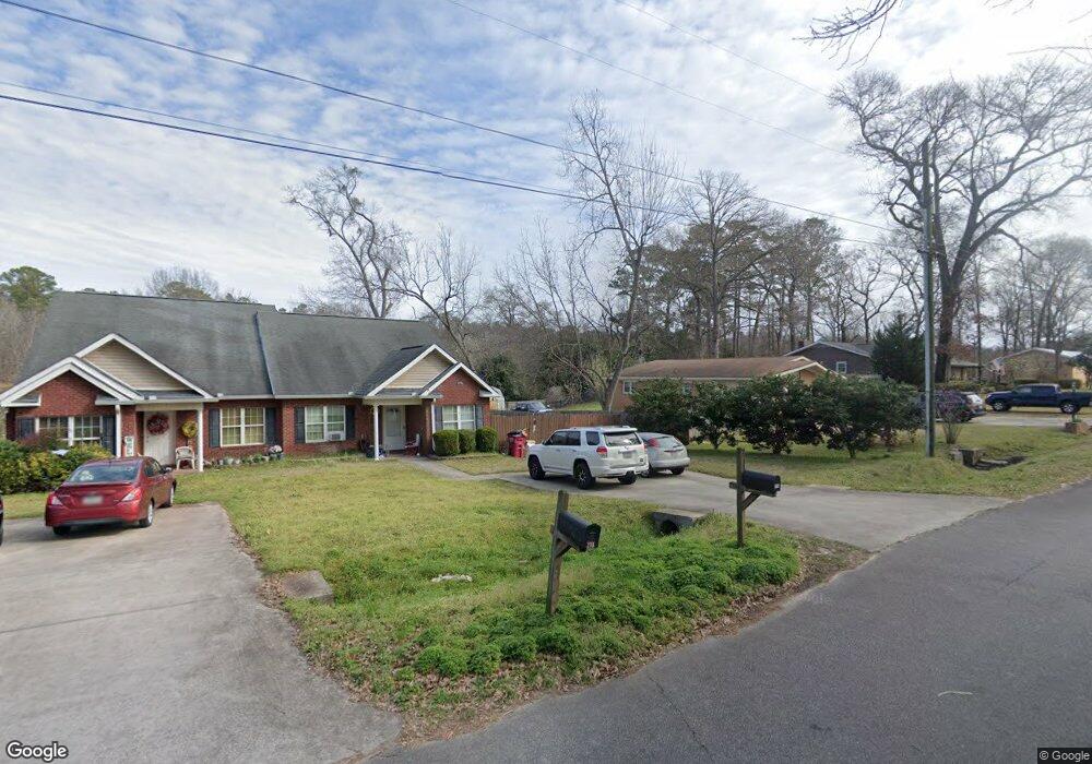
217 E Thomson Dr Centerville, GA 31028
Estimated Value: $167,000 - $460,000
2
Beds
2
Baths
1,248
Sq Ft
$225/Sq Ft
Est. Value
About This Home
This home is located at 217 E Thomson Dr, Centerville, GA 31028 and is currently estimated at $280,989, approximately $225 per square foot. 217 E Thomson Dr is a home located in Houston County with nearby schools including Centerville Elementary School, Thomson Middle School, and Northside High School.
Ownership History
Date
Name
Owned For
Owner Type
Purchase Details
Closed on
Oct 30, 2009
Sold by
Newell Blair F and Anderson Blair F
Bought by
Jsg Development Llc
Current Estimated Value
Purchase Details
Closed on
May 30, 2006
Sold by
Jsg Development Llc
Bought by
Anderson Blair F
Home Financials for this Owner
Home Financials are based on the most recent Mortgage that was taken out on this home.
Original Mortgage
$73,600
Interest Rate
6.51%
Mortgage Type
New Conventional
Purchase Details
Closed on
Mar 6, 1998
Sold by
Barfield Ruth S and Barfield George W
Bought by
Barfield Charlotte A
Purchase Details
Closed on
Sep 9, 1983
Sold by
Barfield Ruth S
Bought by
Barfield Ruth S and Barfield George W
Purchase Details
Closed on
Aug 17, 1977
Sold by
Rosenburg James Estate
Bought by
Barfield Ruth S
Create a Home Valuation Report for This Property
The Home Valuation Report is an in-depth analysis detailing your home's value as well as a comparison with similar homes in the area
Home Values in the Area
Average Home Value in this Area
Purchase History
| Date | Buyer | Sale Price | Title Company |
|---|---|---|---|
| Jsg Development Llc | -- | None Available | |
| Anderson Blair F | $92,000 | None Available | |
| Barfield Charlotte A | -- | -- | |
| Barfield Ruth S | -- | -- | |
| Barfield Ruth S | -- | -- |
Source: Public Records
Mortgage History
| Date | Status | Borrower | Loan Amount |
|---|---|---|---|
| Previous Owner | Anderson Blair F | $73,600 |
Source: Public Records
Tax History
| Year | Tax Paid | Tax Assessment Tax Assessment Total Assessment is a certain percentage of the fair market value that is determined by local assessors to be the total taxable value of land and additions on the property. | Land | Improvement |
|---|---|---|---|---|
| 2024 | $1,827 | $52,680 | $3,400 | $49,280 |
| 2023 | $1,512 | $43,280 | $3,400 | $39,880 |
| 2022 | $899 | $39,080 | $3,000 | $36,080 |
| 2021 | $819 | $35,440 | $3,000 | $32,440 |
| 2020 | $766 | $32,960 | $3,000 | $29,960 |
| 2019 | $766 | $32,960 | $3,000 | $29,960 |
| 2018 | $766 | $32,960 | $3,000 | $29,960 |
| 2017 | $766 | $32,960 | $3,000 | $29,960 |
| 2016 | $768 | $32,960 | $3,000 | $29,960 |
| 2015 | $769 | $32,960 | $3,000 | $29,960 |
| 2014 | -- | $32,960 | $3,000 | $29,960 |
| 2013 | -- | $32,960 | $3,000 | $29,960 |
Source: Public Records
Map
Nearby Homes
- 110 Lee St
- 102 Lee St Unit 117 Wilson Drive
- 102 Lee St
- 708 N Houston Lake Blvd
- 111 Shamrock Dr
- 107 Miller Ct
- 400 S Cambridge Dr
- 214 Mcvey Trail
- 109 Calvin Ct
- 222 Ridgewood Dr
- 114 Collins Estate Ave
- 105 Parker Ln
- 204 S Cambridge Dr
- 118 Ridgewood Dr
- 200 Collins Estate Ave
- 100 Jamestown Ct
- 132 Montrose Ln
- 305 Brantley Rd Unit 14
- 305 Brantley Rd Unit 37
- 305 Brantley Rd Unit 6
- 217B E Thomson Dr
- E Thomas Dr Unit B
- 221 E Thomson Dr
- 215 E Thomson Dr
- 223 E Thomson Dr
- 213 E Thomson Dr
- 221 Mason Dr
- 211 E Thomson Dr
- 225 E Thomson Dr
- 225 E Thomson Dr Unit 112
- 210 E Thomson Dr
- 219 Mason Dr
- 217 Mason Dr
- 218 Mason Dr
- 124 Brantley Rd
- 215 Mason Dr
- 428 Davis Dr
- 202A Brantley Rd
- 114 Lee St
- 216 Mason Dr
Your Personal Tour Guide
Ask me questions while you tour the home.